Good Thursday, folks. Chilly winds continue to push into the region today as winter slowly starts to wage a comeback. This starts with the chance for a rain or snow shower tonight, with a better chance for some rain and snow with a weekend system.
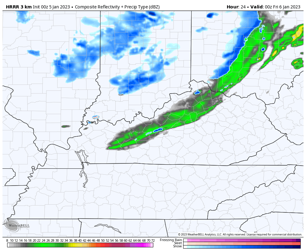
An upper level system moves into the Ohio Valley later today into tonight and may bring a few rain and snow showers. The best chance is across the north and east through Friday morning. The Future Radar from the HRRR continues to be the most aggressive with the action. This animation starts at 7pm this evening and goes through early Friday afternoon…
The system rolling in for the weekend arrives late Friday night and Saturday morning. This may bring a swath of some light snow into the area, but the models disagree with that. Here’s a look at where the individual models have the light snow…
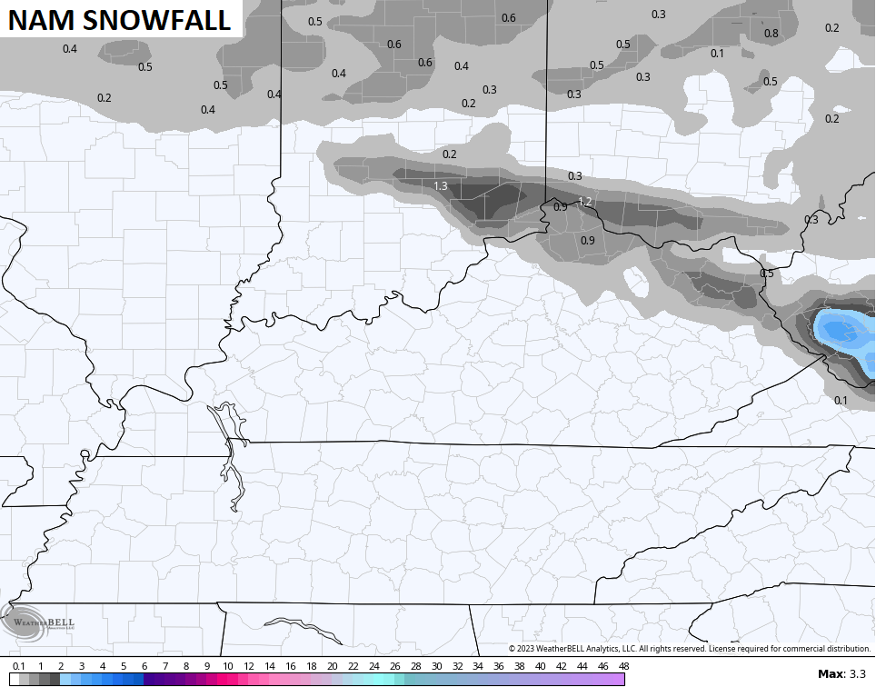
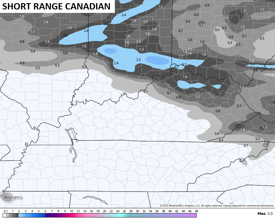
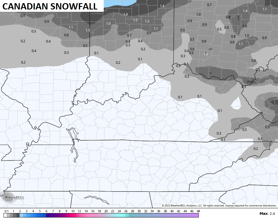
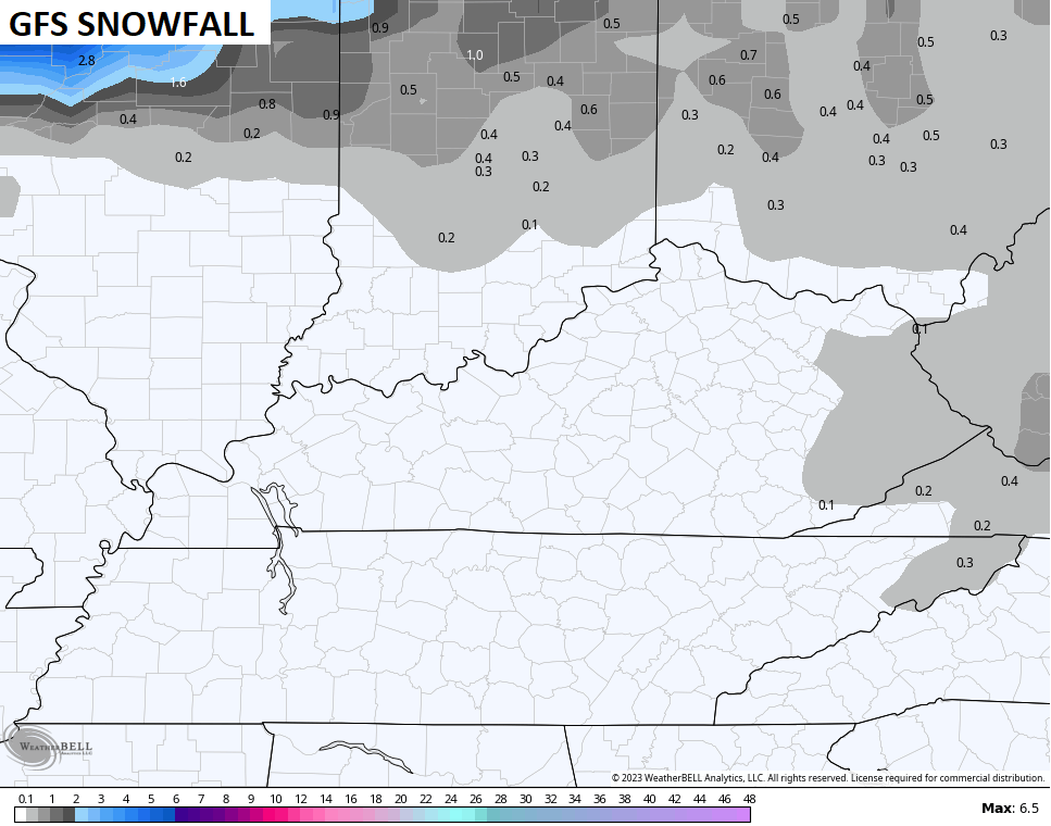
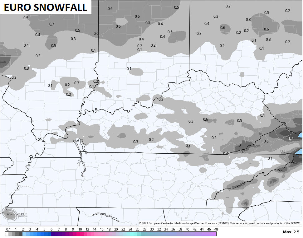
As you can see, we have quite the spread in there.
Whatever snow we get should go over to rain with showers continuing on and off into Sunday.
The overall pattern has the look of one that will continue to send systems across the country for the foreseeable future. Troughs will essentially roll out of the west like bowling balls across the country…
These can easily crank into hefty storm systems for our region. As the pattern goes back to colder, don’t be surprised if we see some winter storm threats coming for the middle and end of January.
I’ll be back with your normal updates later today. Have a great day and take care.

In his most recent blog post, Dr. Judah Cohen believes that stratospheric warming could trigger a visit by the Polar Vortex later this month, but in the same post he states that La Niña will persist into the Fall. This goes against the most recent ENSO report, which forecasts a 71% chance for ENSO – Neutral conditions by Spring. I’ve asked Dr. Cohen whether some new information is behind his La Niña prediction.
https://www.aer.com/science-research/climate-weather/arctic-oscillation/