Good Friday to one and all. We have a few flurries flying this morning in parts of the state, but the focus is on another weak system for the weekend. This one may also bring some flakes into the area early Saturday. From there, it’s more about showers than anything else.
Let’s begin with the flake chance out there this morning. The best opportunity to see some flurries is across the north and east. This comes from our upper level system slowly pulling away to the northeast.
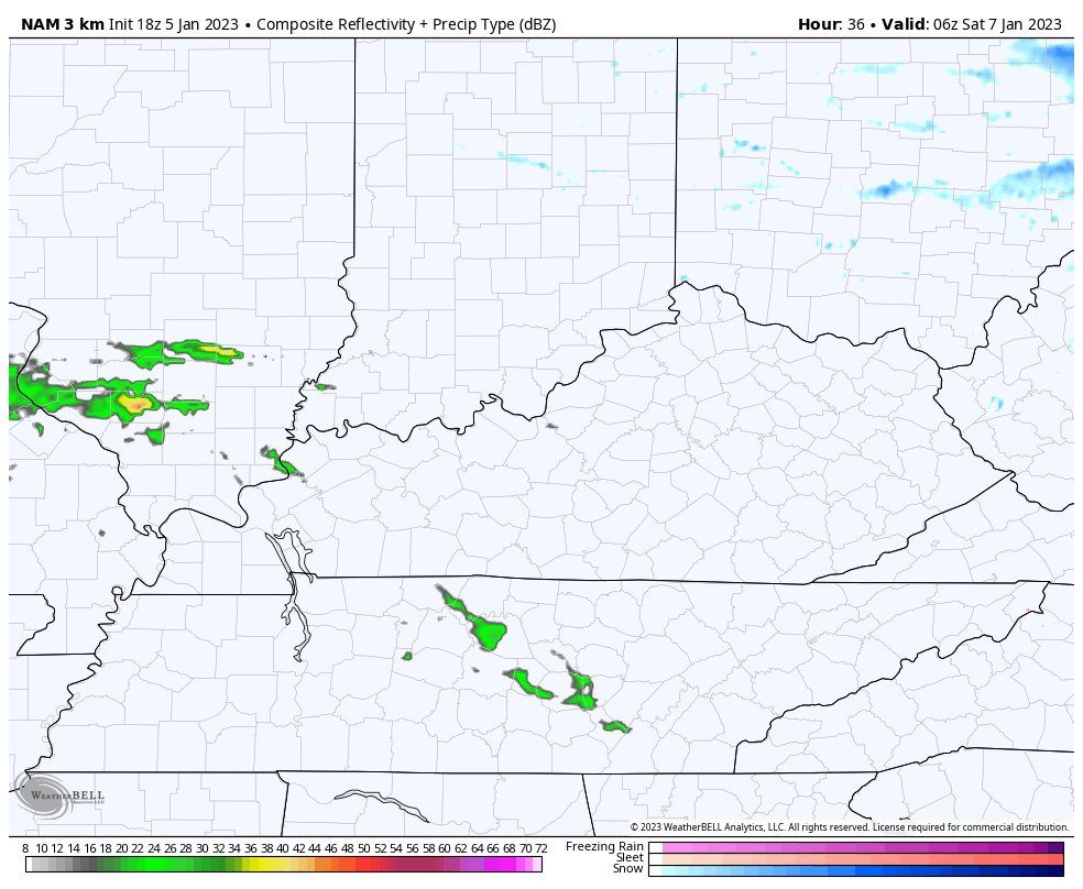
Here are your radars…

Clouds will slowly break from southwest to northeast this afternoon. Temps hit 40-45 with some sun and hang in the upper 30s for areas hanging onto the clouds.
Clouds will increase again tonight ahead of a system moving in here for Saturday. This has some very light precipitation with it and the best chance is across the southern half of the state. This may produce some light snow or a bit of a mix, but shouldn’t be a big deal.
That will be followed up by another system moving in with light rain on Sunday. That one may start with a touch of frozen in the north. Here’s the future radar from the Hi Res NAM that starts around 3am Saturday and goes through 7am Sunday…
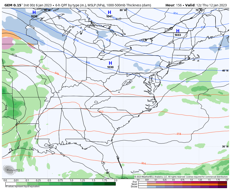
There’s a similar weak system showing up on Tuesday before we see the chance for a bigger eastern US storm by the end of the week into the weekend. There’s not a ton of cold air available for this storm to tap and the models will have a hard time pinpointing where this big storm rolls and where it cuts off. Here’s a snapshot of what the models are seeing right now…
CANADIAN
GFS
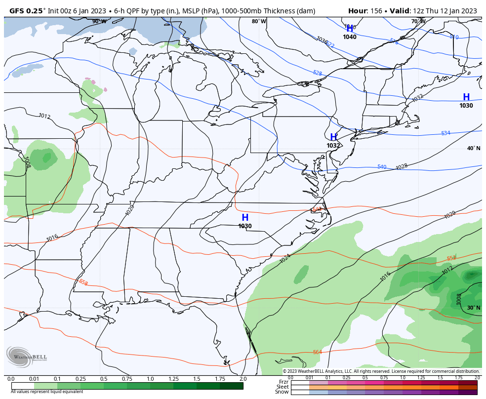
You can clearly see how there’s a monster storm brewing for the east, but what impact it can have on our weather is days away from being known. If we had some colder air involved in the pattern, I would be much more excited about this potential. That said, it’s still early.
I will update things later today. Have a good one and take care.

KWC NBA central get on nets -4 before it goes up. song anything CCR
Cold rain appears to be the highlight for the next coming days.
Besides the cold spell around Christmas winter has been a no show..Packed up and left..Headed west..Don’t see no blues on maps anywhere including Canada..Ready for spring anyone??
Thanks Chris, Winter will come back, later in the month. Our biggest Snows usually occur in late February and March. We shall see.
In this week’s blog post, climatologist Dr. Judah Cohen states that a Polar Vortex could be triggered by stratospheric warming, during the latter half of January. In the same post he states that La Niña will persist into the Fall, which is contrary to the most recent ENSO report, which forecasts a 71% chance for ENSO – Neutral conditions by Spring. I’d be curious to know whether some new information backs up his La Niña prediction.
https://www.aer.com/science-research/climate-weather/arctic-oscillation/