Good afternoon, everyone. It’s a seasonably cold day across the Commonwealth as we watch a couple of systems for the weekend. As this happens, I’m watching the potential for a much bigger storm system later next week into the following weekend.
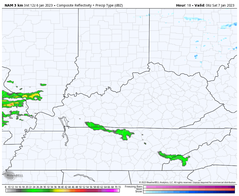
The system moving in on Saturday mainly impacts the southern half of the state and it may begin with a period of light snow. This isn’t a big deal, but it’s worth noting because it’s been a while. Here’s the Future Radar from the Hi Res NAM from 1am -1pm Saturday…
The next round arrives late Saturday night and Sunday morning. This may be in frozen form across the north at the beginning while the rest of the region sees a few chilly showers…
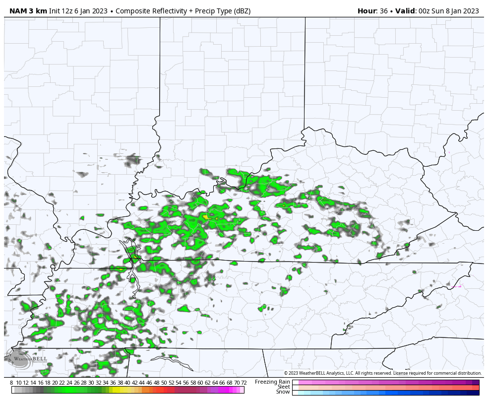
That should be quite the temp spread from north to south as well. Temps stay in the 30s across the north with a spike to 50 in the south.
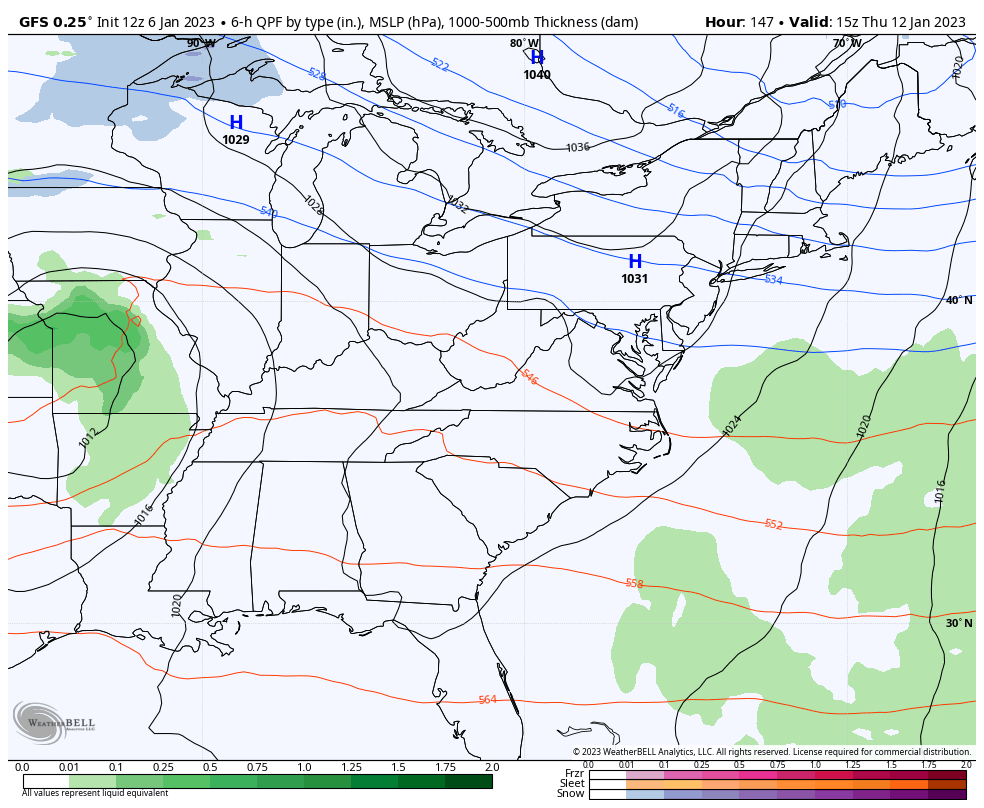
Another light system moves in on Tuesday before we turn our attention toward a big system arriving by Thursday and Friday. This system is likely to cut off from the main flow and should develop into a major storm system in the eastern US. The signal on this is strong, but how much cold air will be available?
The latest operational models are showing the potential for more cold air to get into our storm…
GFS
The Canadian…
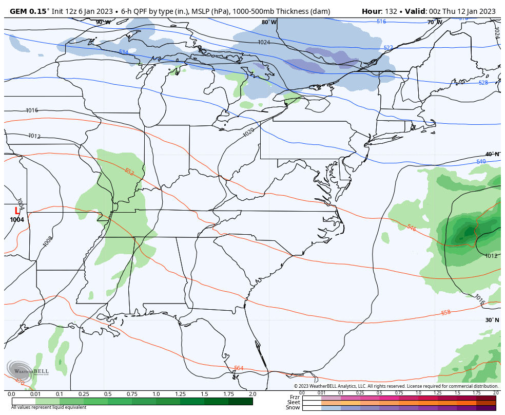
Obviously, we will see lots of changes on the models in the coming days, but the overall signal is stout!
I’ll have another update on that later today. Have a good one and take care.

where are the weather weenies!!!!!!!!!!!!!!!!!! hard livin by whitley.
Hope the cold air catches up or it looks like a miss (suprise suprise) for WKT