Good evening, everyone. The system for the weekend continues to look fairly week but may have a touch of winter with it. Winter weather lovers have something to track with a much stronger storm later next week.
The weekend starts with a touch of light rain and some light snows across the southern half of the state Saturday morning. That’s not much and most of the area appears to be in pretty good shape for Saturday.
A second surge of light precipitation moves in Saturday night and early Sunday. The models are now hinting at a touch of freezing rain to start things out across the north. Here’s a look at several models for early Sunday…
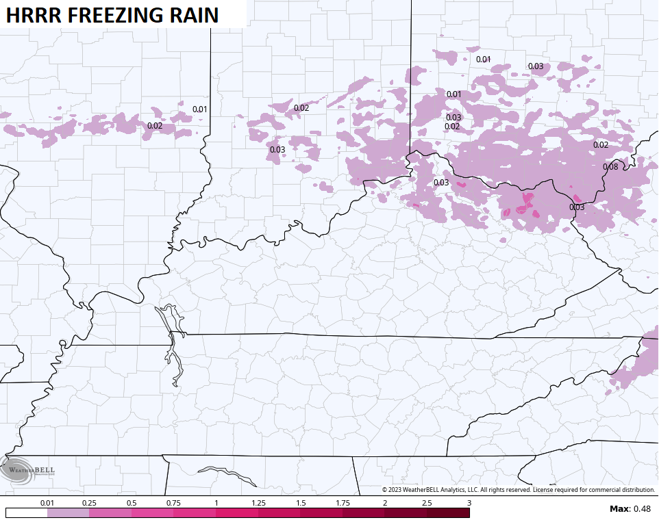
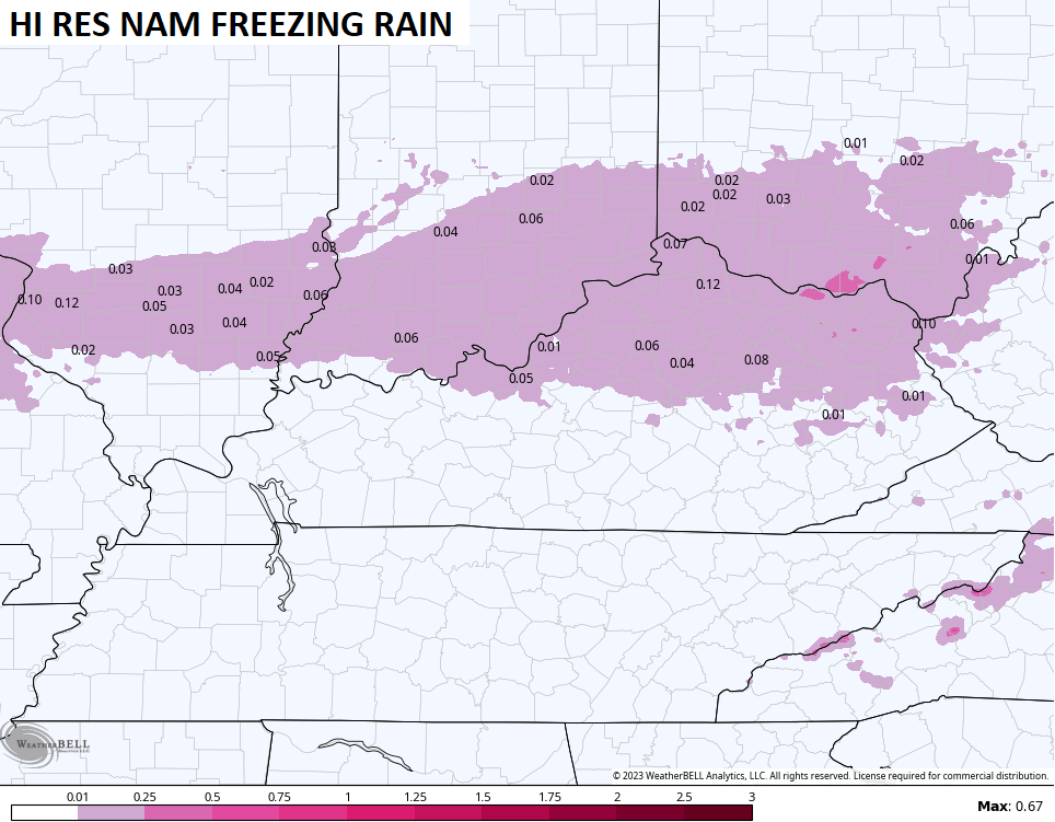
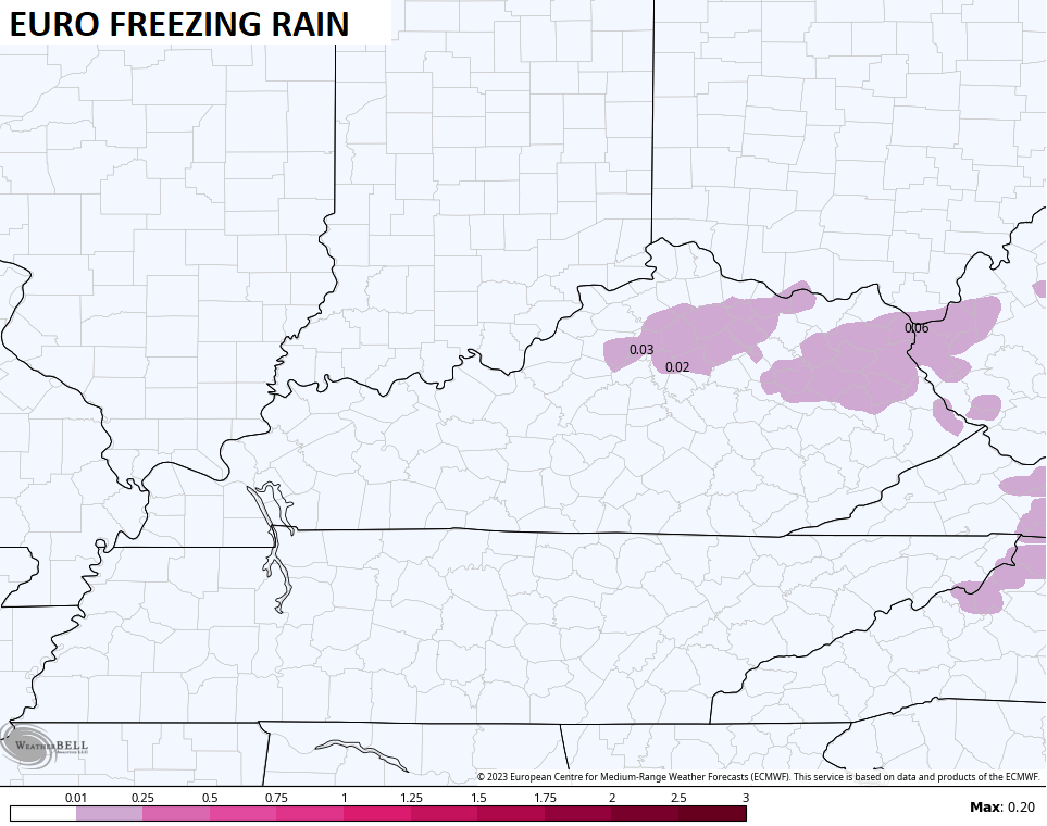
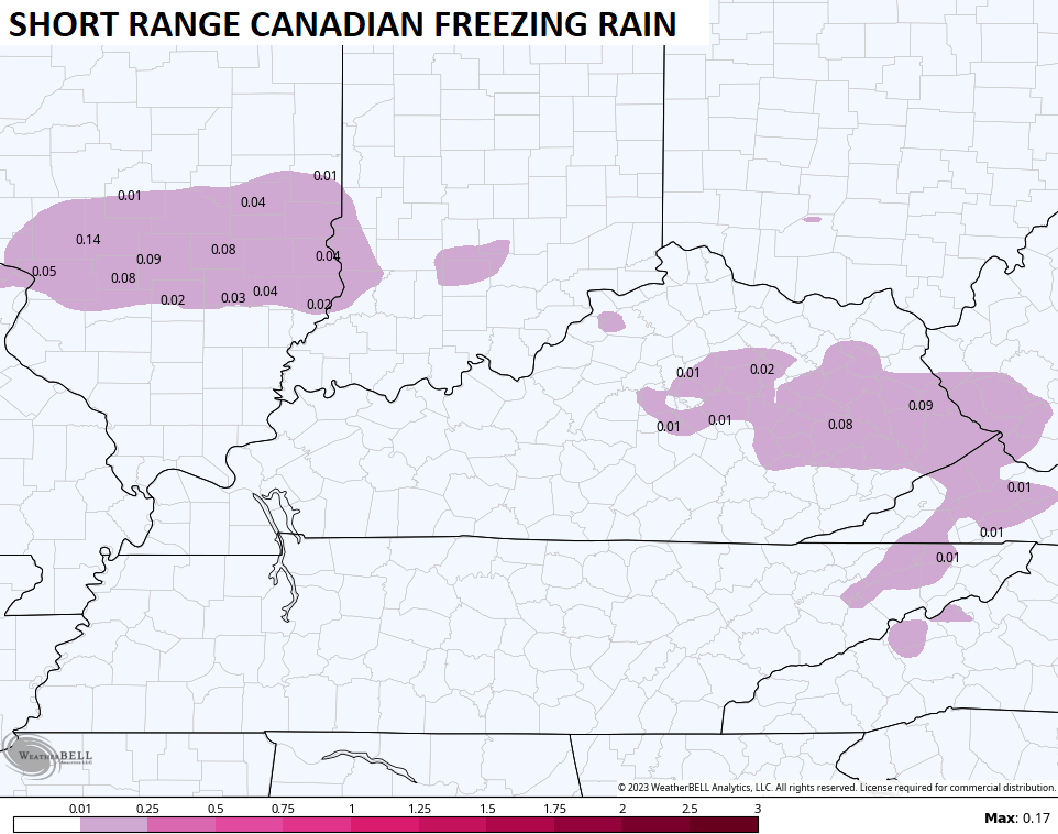
I suspect the chance for freezing rain is dependent on some clearing Saturday evening that would allow temps to drop toward freezing or a bit below right before some light showers move in. Remember, it doesn’t take much freezing rain to slicken up a road. That’s something we will continue to watch.
The models continue to point toward a big eastern US storm late next week into the weekend. This is part of the pattern I pointed toward as sending storms our way from the west with some trying really blow up near us.
The theme of the models for rain and snow to impact us starting late Thursday into the start of the weekend.
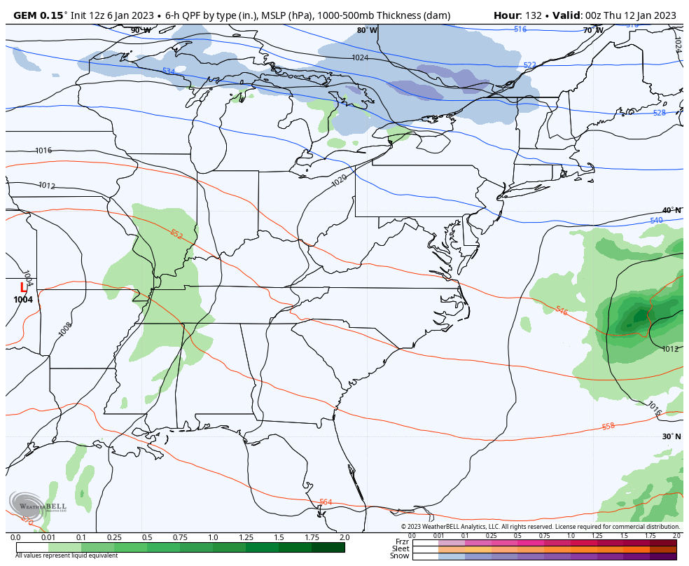
Earlier, I posted the wrong run of the Canadian. Here’s the latest run…
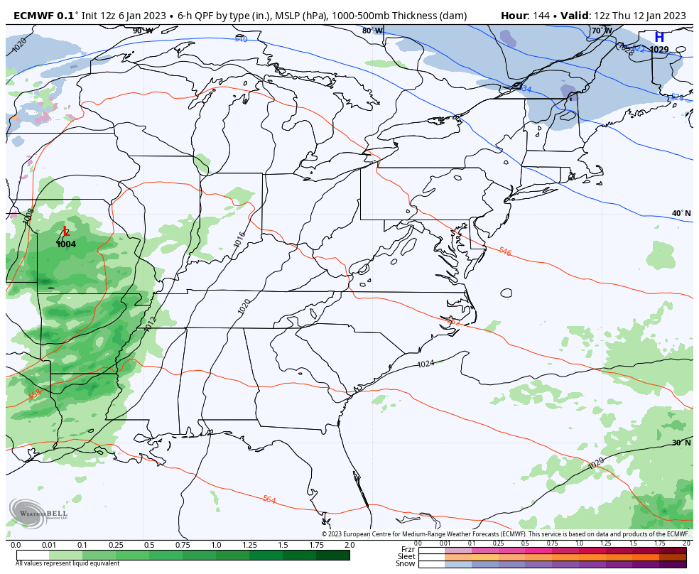
The EURO Has a similar setup, but is weaker…
The GFS has a nice setup similar to the Canadian…
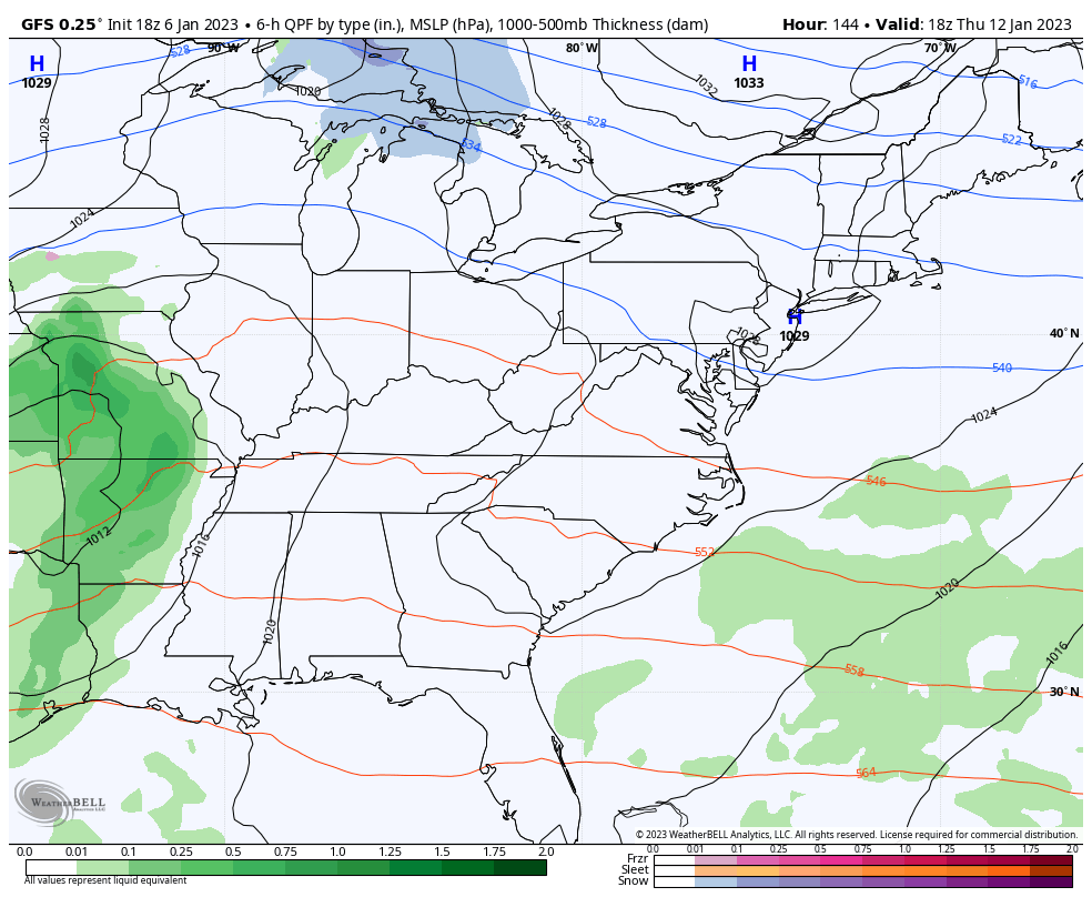
Notice how all the models are blowing up multiple lows and aren’t sure which to key on. That’s because we are likely to see a major cutoff upper level low spinning across the region during this time.
At least we have something to track. Right? 😁
I’ll see you guys later tonight. Have a good one and take care.
