Good afternoon, everyone. Our weak weather system continues to chug toward the region and will bring some light stuff with it tonight and Sunday. This means a little rain and some frozen stuff will move in here. We also continue to track a much bigger system later in the week.
This initial system doesn’t have much moisture with it, but will have enough for some light showers that may even be in frozen form in the north. That’s the area that has a better chance of seeing a few flakes during the afternoon and evening, as well.
The Future Radar from the Hi Res NAM starts at 7am Sunday and goes through 1am Sunday…
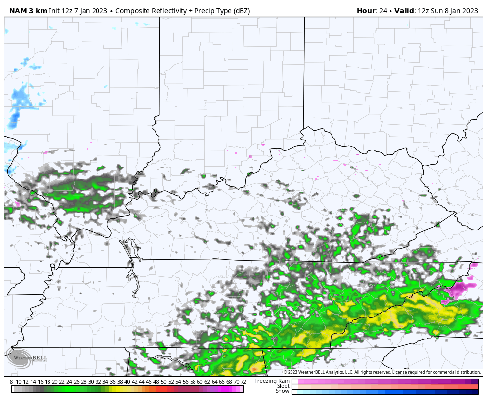
Temps do trend down from northwest to southeast behind that system on Sunday with a colder look for Monday.
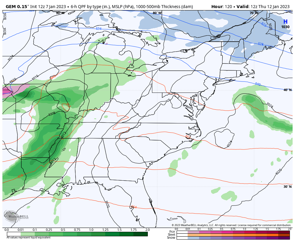
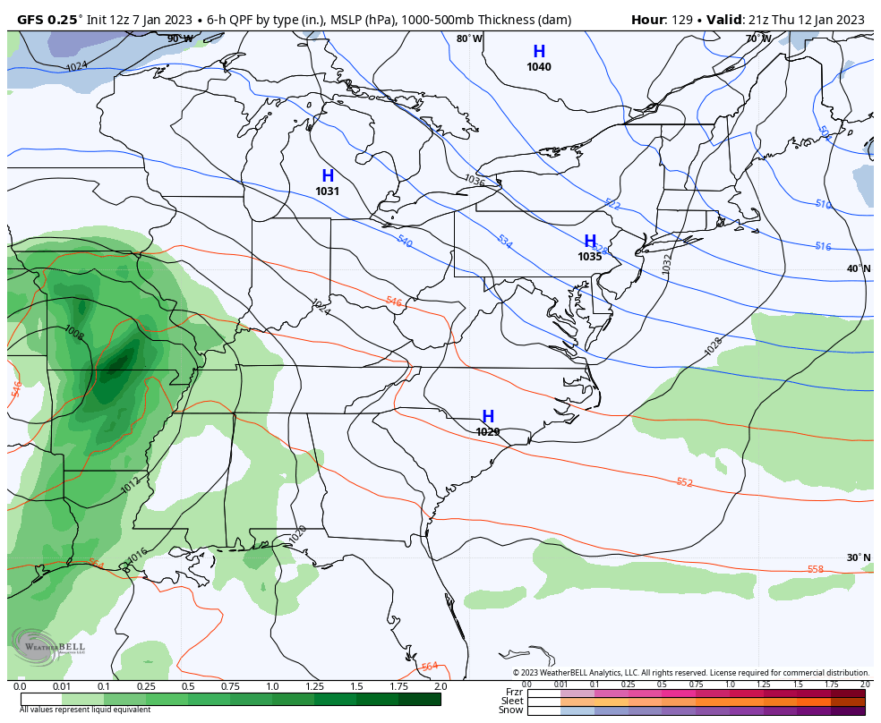
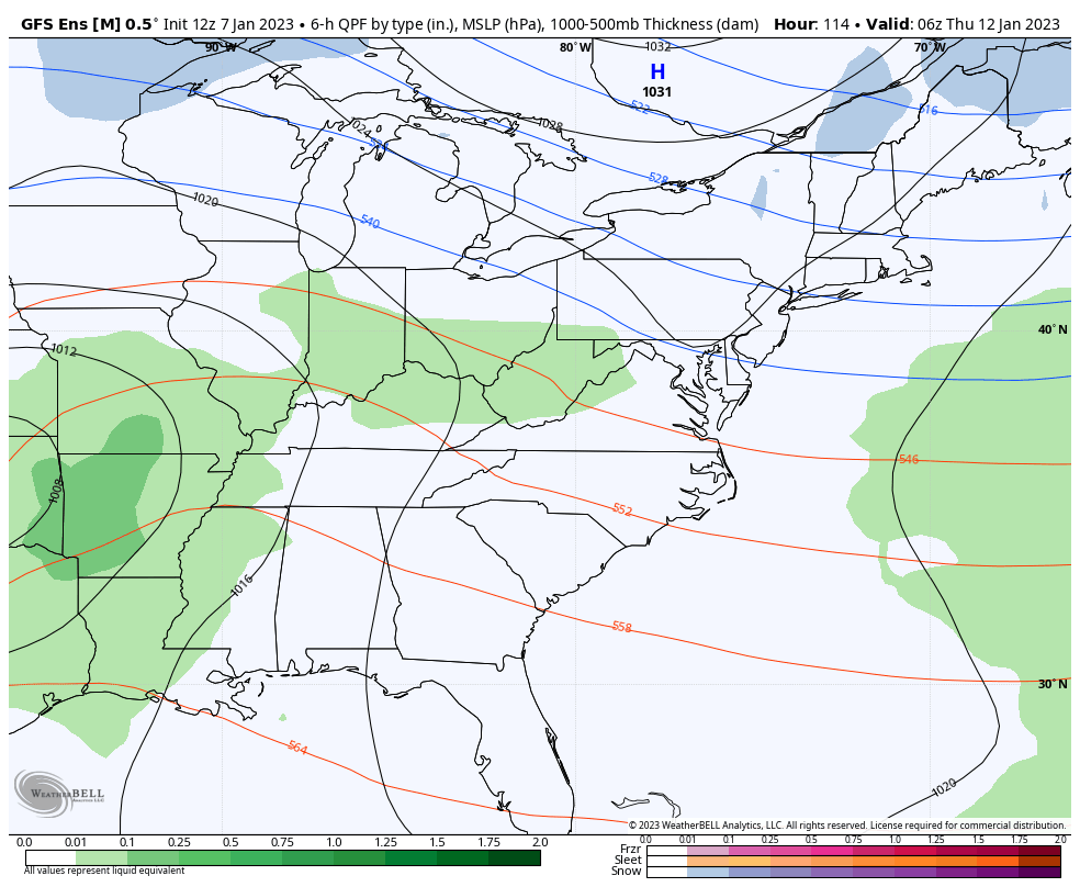
The late week setup is still one to watch. We have a huge upper level low spinning into the eastern half of the country. This will spawn a big storm system that will impact just about the entire eastern part of the country.
The exact impact it has on our weather is still a work in progress and will be for a while longer.
All the models show a big time storm, but vary on where to put it…
CANADIAN
GFS
Here’s the blend of what the 21 members of the GFS Ensembles look like…
I’ll see you guys back here for the evening update.
Make it a good one and take care.

Looks like mainly rain and a little snow on the back end. Normal KY winter weather
Don’t need a weather model to know how the storm next weekend will perform. LOL
are we winning any money on my bet against kentucky, can we hire woman beater beard or the guy that beating us badly today. we dont have talent even close to what alabama has. song allan jackson between the devil and me.