Good Sunday, everyone. The first weekend of the new year is wrapping up with some light stuff falling across parts of central and eastern Kentucky. I’ll take a look at that, the chances for a bigger storm later next week and where this pattern is going for the rest of winter.
Let’s talk about today before looking ahead. We have some light rain and a touch of a light mix developing. As mentioned, the best chance of a mix and some flakes is across the north. As colder air comes in behind our departing low, a few flakes may fly all the way into eastern Kentucky this evening. There’s even the outside chance for a little light sticking snow in the north.
Here are your radars to start things out…

The storm system coming in later in the week continues to be a work in progress as the models try to get a better handle on all the energy and how much of a phased storm we can get. There’s quite a bit of upper level energy trying to cut off…
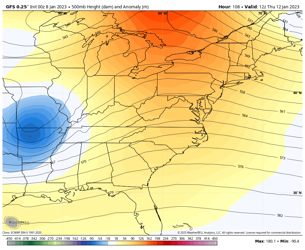
How strong is that upper low? What’s the exact path of it? Just how slow will it roll? Those are the questions to be answered over the next several days. All of those answers will decide on how things play out at the surface where we live.
What’s likely to happen is that one surface low works into the Ohio Valley as another low pops to the east of us.
That’s why we get a different look with each model run. The latest GFS looks like this…
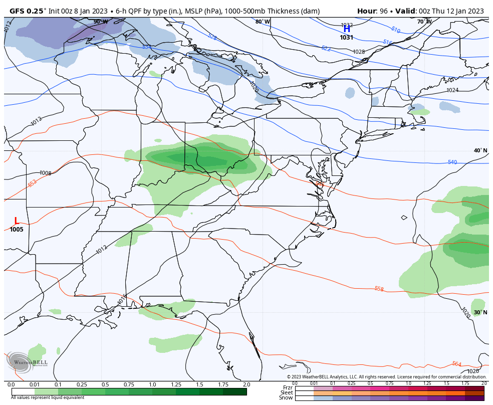
That’s a colder look than earlier runs and produces some nice wraparound and lake enhanced snows around here.
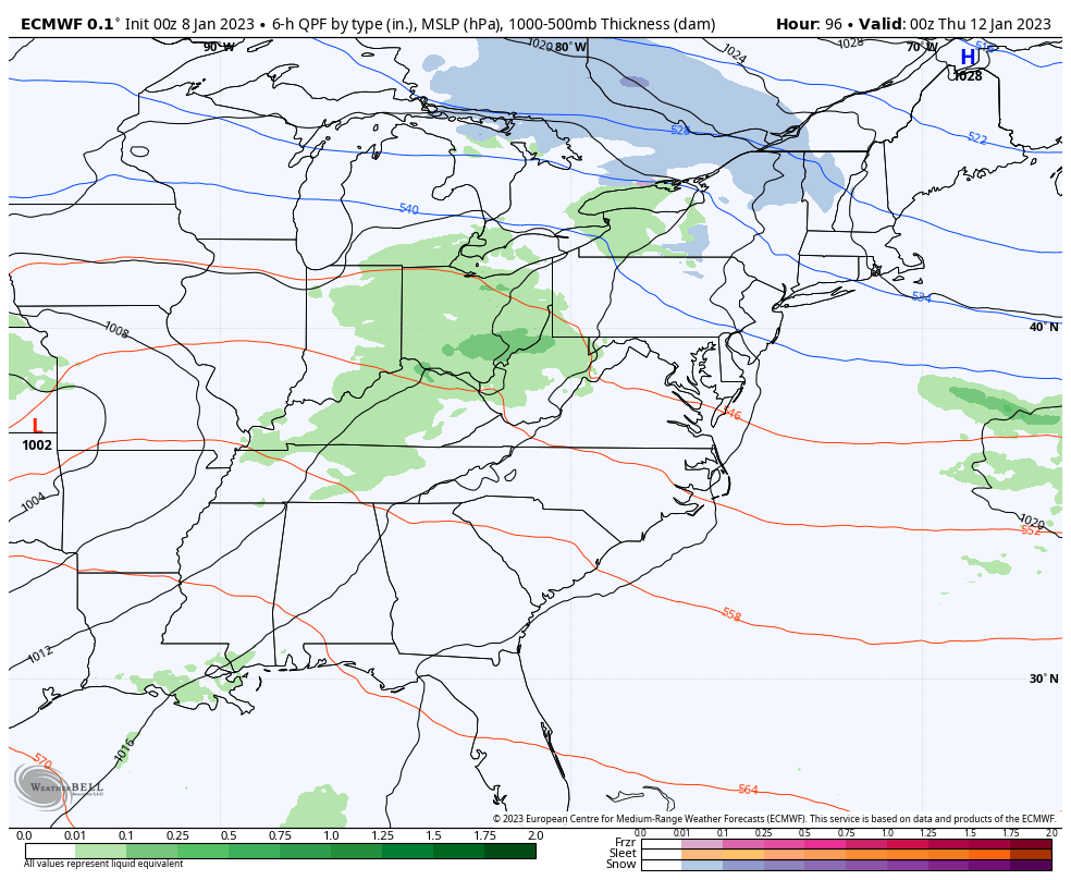
The EURO has a similar idea…
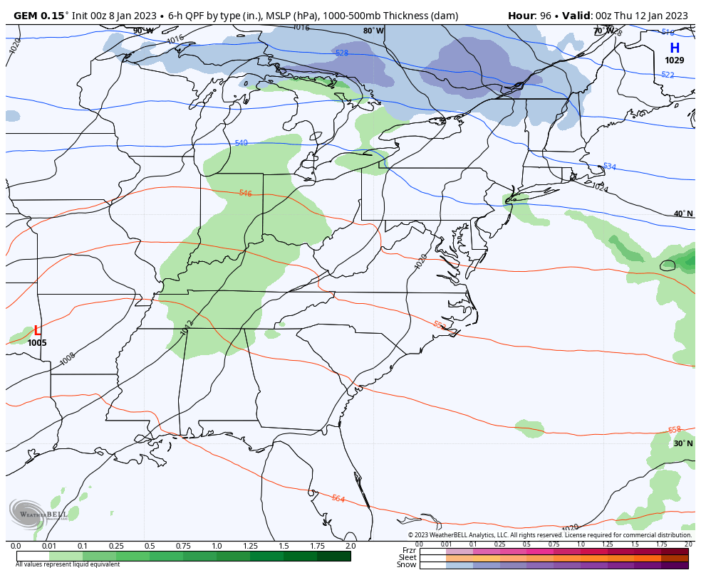
The Canadian is a flatter and more progressive solution that doesn’t like the wraparound snow potential as much…
Looking ahead, I highlighted the second week of January when winter should begin to show back up. Technically, that’s true with some cold to start the week and that system later in the week, but the real change to winter appears to be for the following week.
The European Ensembles are going all in on a pattern reversal with a ridge going up in the west and that trough finally getting established in the east…
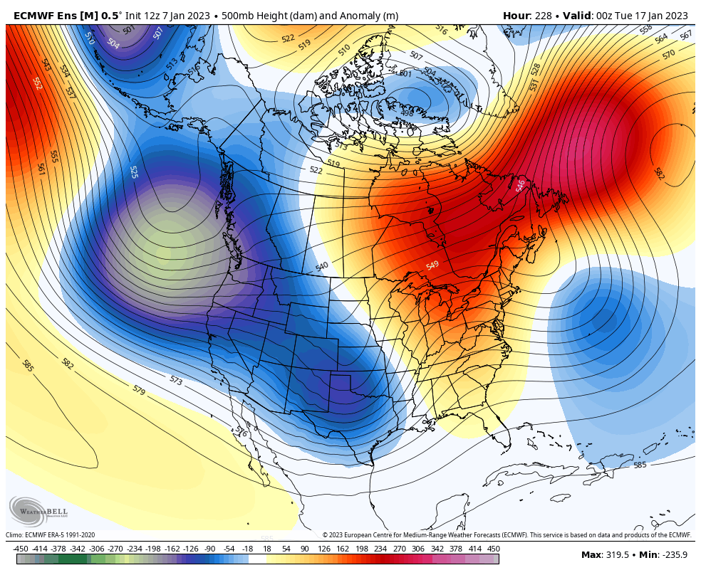
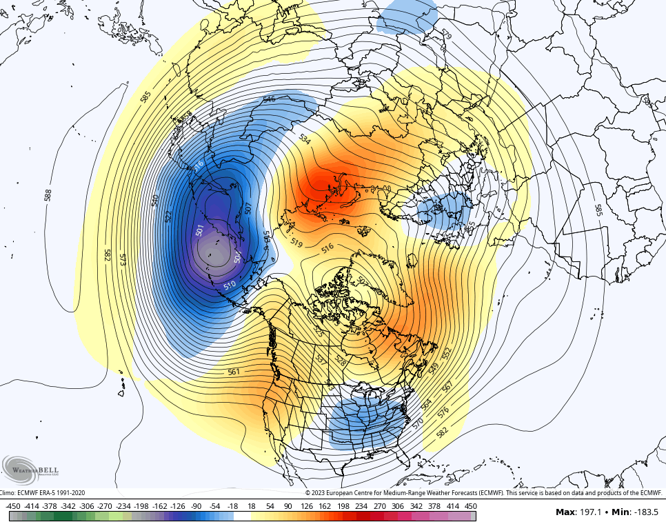
If we look at the overall view of the northern hemisphere, we can see the blocks going up to the north…
EURO ENSEMBLES
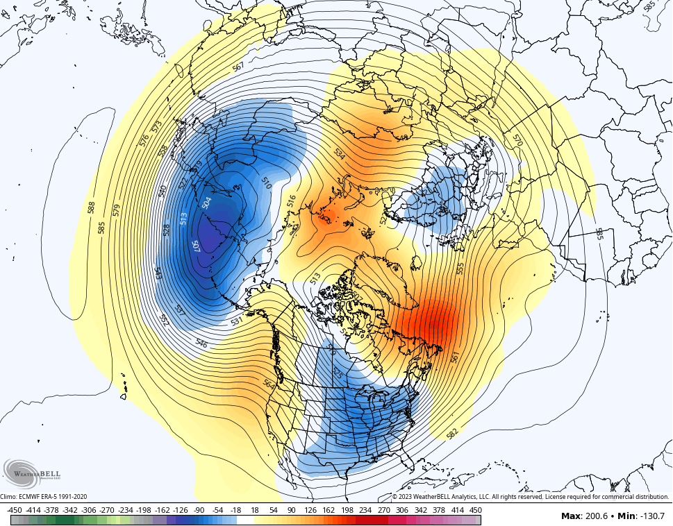
CANADIAN ENSEMBLES
The more I look at the setup ahead, the more I think my winter forecast is going to be wrong. I was going for the earlier start than normal to spring. The upcoming pattern has more of a late winter vibe from February 2021.
My winter analogs had the past two winters on the list. So far, the first part of winter has been a battle between the two. Both featured some second half of winter fun and games. Obviously, no one wants a repeat of what February of 2021 brought and I’m not saying that’s ahead. I’m saying the setup for a prolonged period of winter weather that lasts into early spring is showing up.
You guys know me, by the middle of February I go into #teamspring mode. 🌷😎 Of course, Mother Nature gives no cares to my mode or my mood.
I’ll have your normal updates later today. Make it a good one and take care.

More and more, it’s looking like we’re in a front-loaded, La Niña influenced Winter, the Polar Vortex remains strong, which is locking up much of the coldest air way to the north. If we do get an intrusion of Canadian air, my fear is that we could see an outbreak of severe weather, and chances are good that our normal severe weather season, which usually takes place from early April to mid-May could possibly start as much as a month earlier. And it’s a safe bet that the frequency of severe weather events will continue to show an uptick, especially in Western Kentucky.
https://news.yahoo.com/tornado-alley-shifting-east-164650651.html?guce_referrer=aHR0cHM6Ly93d3cuZ29vZ2xlLmNvbS8&guce_referrer_sig=AQAAANqmv8E1bD0bhk3aQwACZ_XtBCAEQ9HeKtIxYCVlChU4BilkOLxusOILSgZfbPHlaz1iLBgXeCletVartjvfifEoLIjg4gsY-dHzvBcMcvzjmVc3_yoAV9HMLknjk3RY4-Q4_LaVstYvmb4aw7R0ACE5934c-ULVkWB-uCrvqdx7
February ice storm. Is that what Chris is referring to?
Looks like WKY will miss out on this sys but we still get the rain train. Ugh