Good afternoon, folks. A little bit of light snow will develop and push across the region through tonight. This may put down some light accumulations for some. Looking into next week, a bigger storm is on the way with rain and snow.
Let’s start with the current system and the chance for light snow. The greatest chance is across northern Kentucky, but flakes will likely fly all the way into eastern Kentucky through Monday morning.
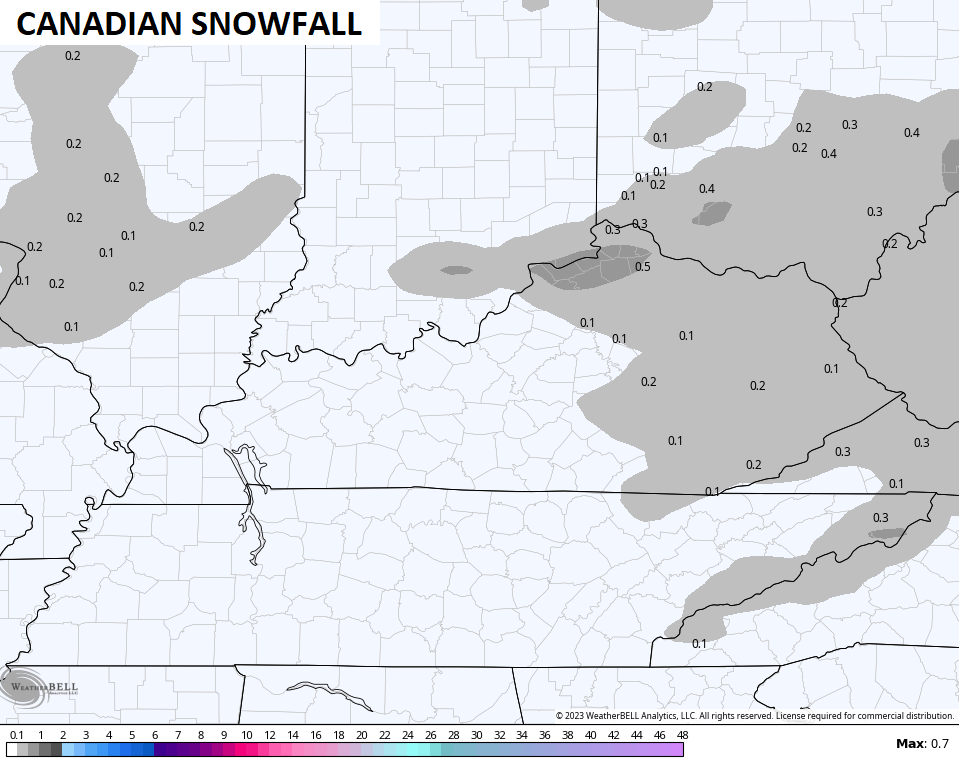
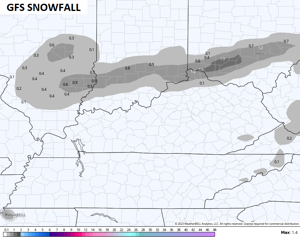
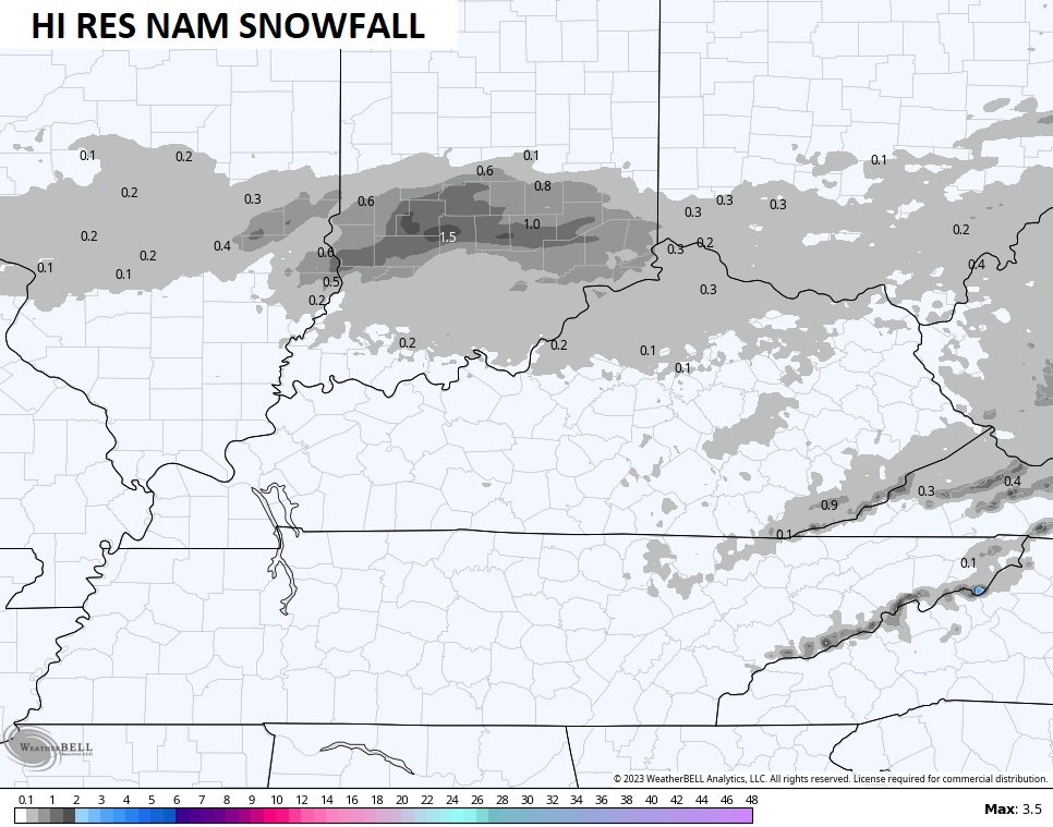
Light accumulations will be possible, especially in the north. Here’s a look at some of the model forecasts…
Monday is a cold day with temps in the 30s.
Tuesday looks to be near normal with highs in the 40s.
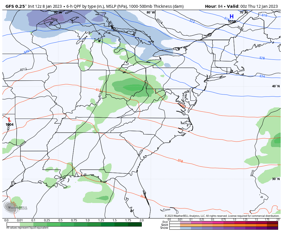
Clouds thicken Wednesday as showers develop ahead of our big storm system rolling into the Ohio Valley. A lot of how this works out depends on how this big upper level system plays out…
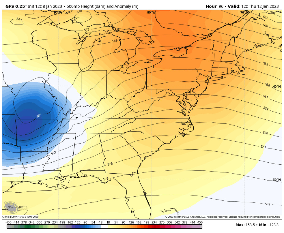
We should get low pressure to work into the Ohio Valley on Thursday with mainly rain, except on the northwest side of it. As this wraps up and lifts to the north/northeast by Friday, it will pull down colder air that should be able to give us a period of snow, or just some snow showers.
Here’s the GFS…
And the Canadian…
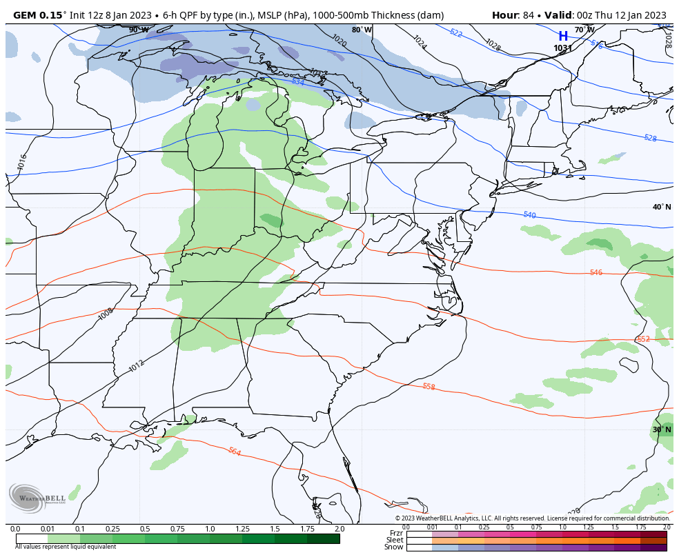
That’s a much flatter solution, but still kicks up some snow showers behind it.
I will have another update later today, until then, let’s track the flakes in from the northwest…

Make it a great Sunday and take care.

let her cry hootie.