Good evening, folks. We have some light rain and light snow impacting parts of the state this evening and some of us may even see a very light accumulation. As we look into the week ahead, it’s all about a big storm system for the end of the week.
The stuff out there this evening has a greater concentration across the north, but flakes will likely fly all the way into southeastern Kentucky overnight and early Monday. This isn’t much of anything, but some coatings can’t be ruled out. Here are your radars for the evening…

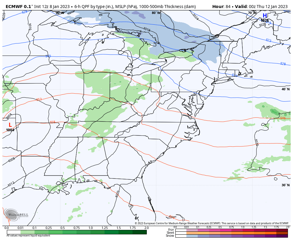
Nothing has changed with the late week storm system. One low moves into the region with rain on Thursday as another low pops along the east coast. Colder winds wrap in quickly Thursday night and Friday with a period of light snow or snow showers a good bet.
Here’s the latest EURO for this system…
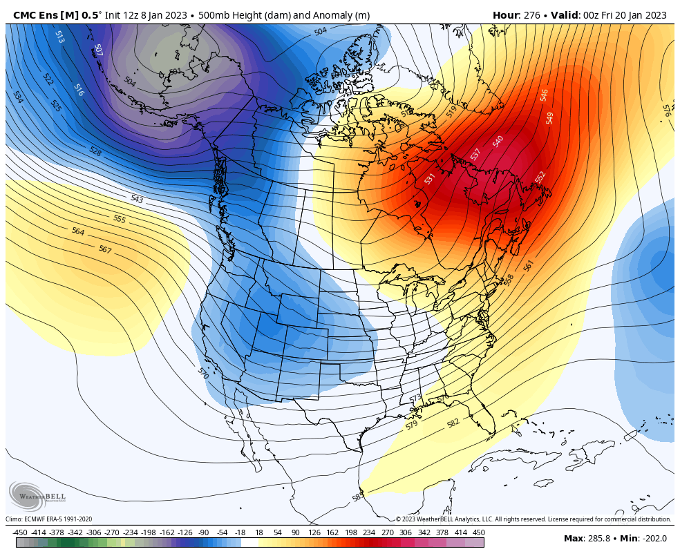
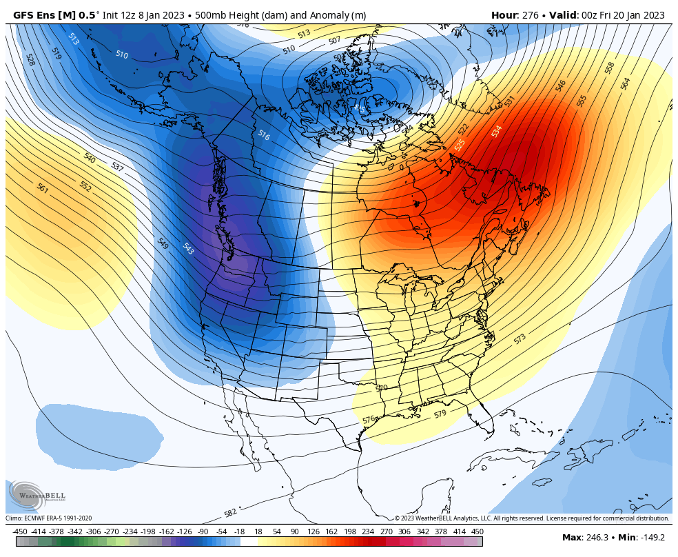
We are finally seeing ALL Ensembles agreeing on a major pattern change with the west seeing a big ridge going up, allowing for a deep trough into the eastern half of the country…
Candian Ensembles
GFS Ensembles
That’s the late winter of 2020/21 vibe.
Enjoy the rest of your evening and take care.

love the look at those ensembles, hoping this isn’t going to be another can kicking