Good Monday, everybody. Here’s hoping you guys had a wonderful weekend. The new week is starting out on a seasonably cold note as we watch a big storm system set to target the region later this week. Rain and some snow are likely to accompany this system.
Speaking of some snow, very light snow or flurries continues early this morning into parts of the east. This isn’t doing much of anything, but it’s a reminder the calendar does say January. Here are your radars to follow any of those flakes…

Temps out there today are generally in the 30s with clouds hanging tough for many.
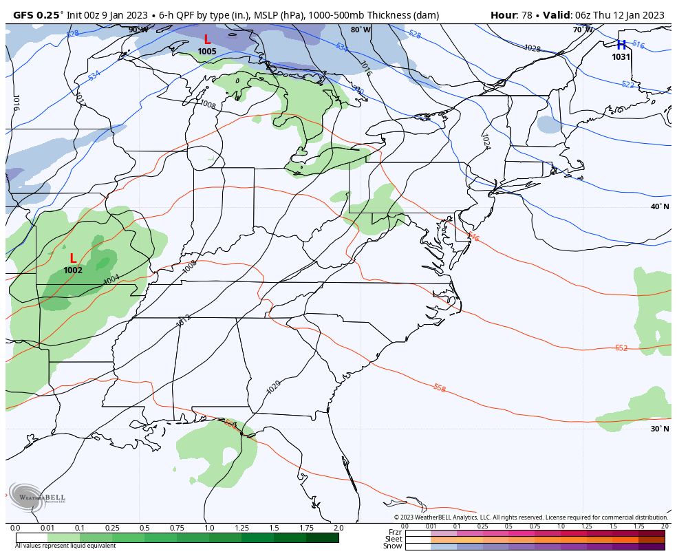
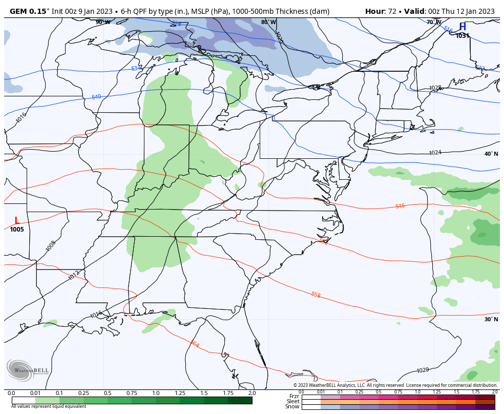
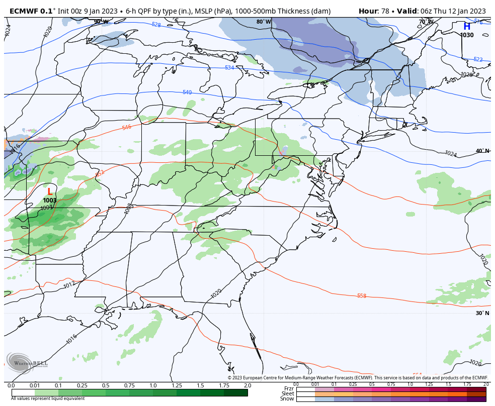
Our late week storm will likely feature one low working into the Ohio Valley on Thursday. That means rain will become widespread and those drops will actually move in later Wednesday. By the time we get into Friday, our low is quickly wrapping up just to our northeast. At the same time, another low tries to pop along the east coast.
All of that would mean colder air gets pulled in here Thursday night and Friday with a period of light snow or snow showers. This looks like the first northwest wind flow of the winter and those usually deliver light snowfalls to central and eastern Kentucky.
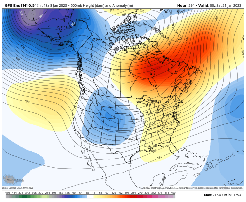
Here’s the GFS…
The Canadian…
And the EURO…
We are about to see a total pattern reversal across North America. The west is currently getting bombarded by major storms rolling in off the Pacific while the east has been basking in a super mild start to the year.
How about we flip the west to a big ridge and warm, and bring a deep trough and winter into the east? Watch the switch take place on the EURO Ensembles…
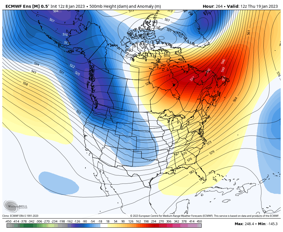
The GFS Ensembles also show the flip…
Your normal updates will be online later today. Make it a magnificent Monday and take care.

So far January has been quite, but that may changes here later this month.
When you got rain and thunderstorms forecast middle of week this isn’t typical January weather. Ugh
lets end KWC bowl season with under 63.5 as i type. even flow pearl J
TCU/Georgia is definitely going to be a high-scoring game… it will go well over the 63.5.
Patches of warmer water are beginning to show up off the coast of equatorial South America, which may signal a shift from our 3-year long La Niña, into ENSO Neutral conditions. The changes will come about slowly, so it’s probably too late to influence our Winter weather, but we could see a benefit in the Spring, as ENSO Neutral conditions usually favor normal to slightly below normal instances of severe weather.
https://www.ospo.noaa.gov/Products/ocean/sst/anomaly/
So far this season, Chicago has had a measly 4.5 inches of snow. Heck, some of you guys in Kentucky have gotten at least that much.
In January, the Chicago area is averaging a remarkable nine degrees per day above normal, and we have not had a temperature under 24 degrees. This morning, at 24 degrees, was the coldest of the month.
Looks like that much colder pattern is going to take its sweet time getting here.