Good afternoon, folks. It’s a cloudy and cold start to the week as we continue to track a system on the way for the end of the week. That’s a rain and light snow maker for much of our part of the world.
Here’s a quick breakdown of what we may be looking at:
- Low pressure works into the Ohio Valley on Thursday. This brings widespread rain along for the ride. There’s even the chance for thunder with temps spiking to 60.
- This low then wraps up as it lifts to the north and northeast, dragging a cold front across Kentucky.
- Periods of light snow develop behind this on Friday as a strong northwest flow sets up. That would continue into early Saturday.
- Can we get another low to develop along the front as it hits the Appalachian Mountains on Friday?
- These setups are usually good for light accumulating snows in central and eastern Kentucky, especially.
- That nothwest flow can sometimes overachieve, especially in the east.
- We have to keep in mind the Great Lakes are ice free and open for business. A cold northwest wind coming down the length of Lake Michigan can do some work if it’s aimed at Kentucky.
The latest Canadian Model is seeing the second low idea…
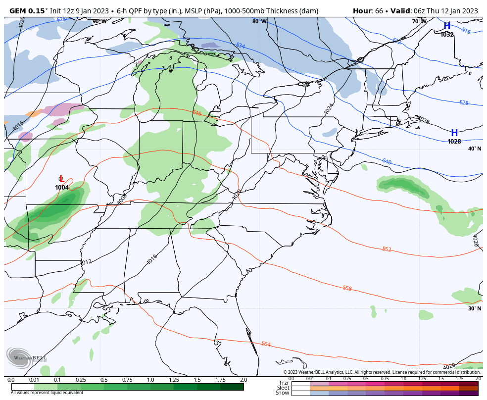
The
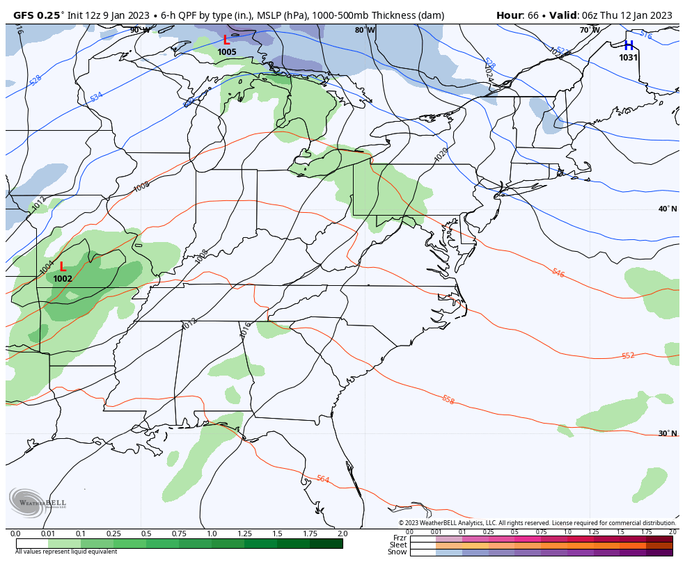
GFS is more progressive, but still shows the widespread light snows developing on that northwest flow…
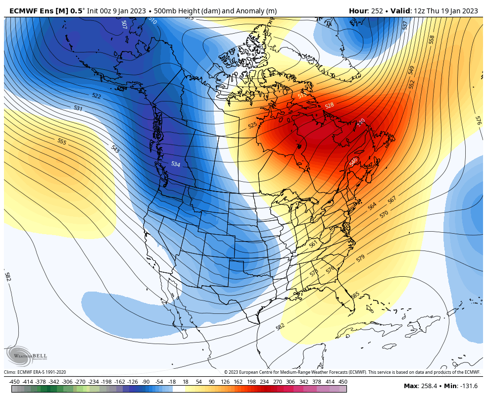
The Ensembles continue to point toward a total pattern flip developing later next week…
I will update things on WKYT-TV starting at 4pm and on KWC later this evening.
Make it a good one and take care.
