Good Tuesday, folks. It’s another pretty nice weather day taking place, but we have some big changes rolling in for the west of the week. Spring and winter collide with a big storm system impacting us Thursday into Friday.
Let’s get straight to the updated breakdown of the system coming at us:
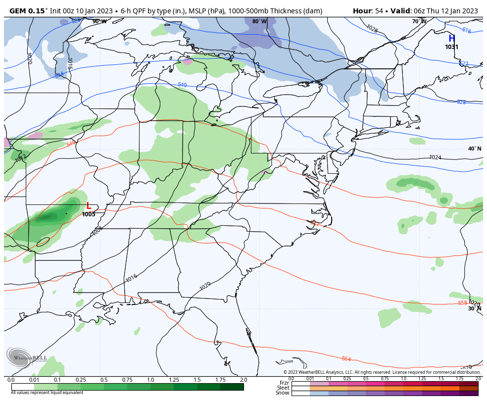
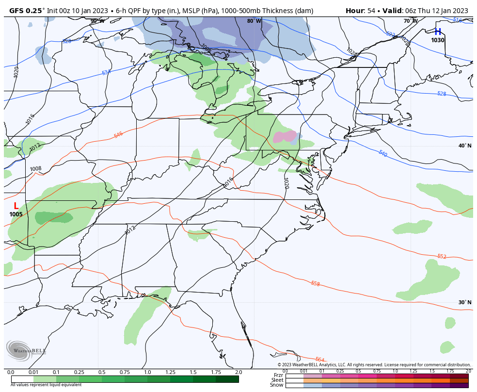
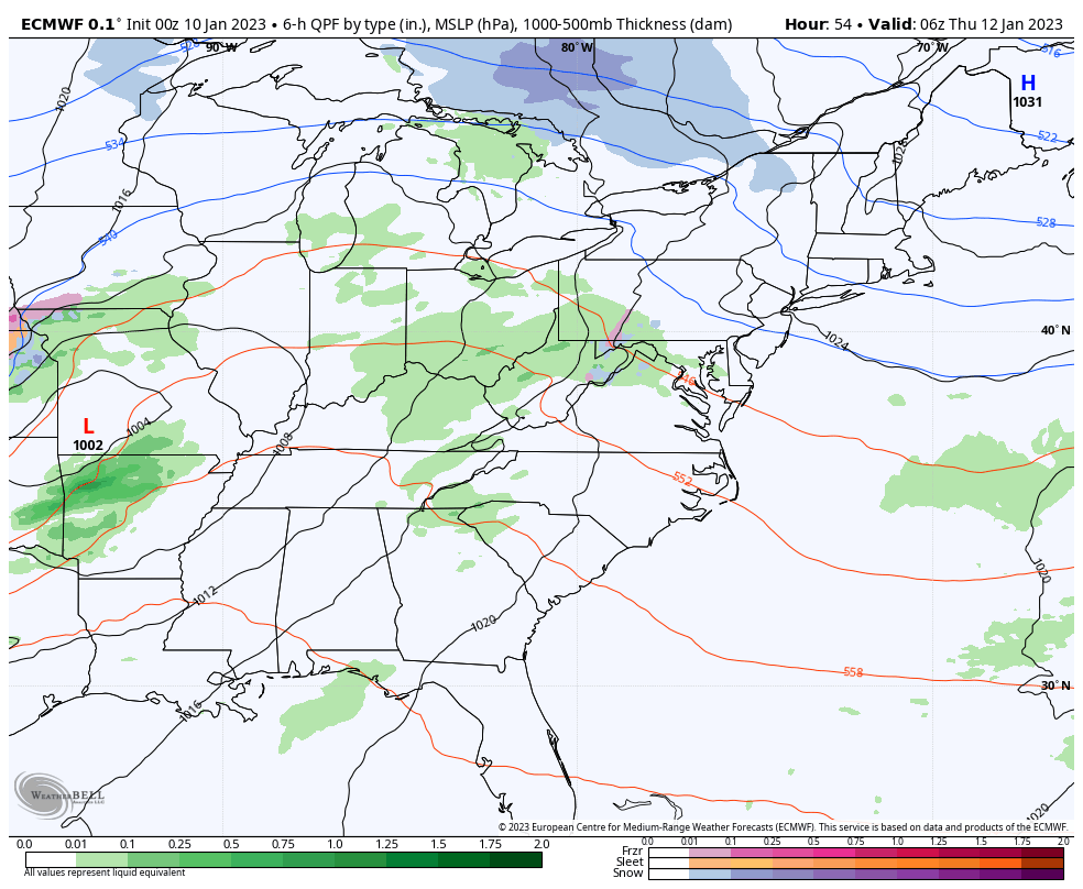
- Low pressure works into the Ohio Valley on Thursday. This brings widespread rain along for the ride. There’s even the chance for thunder with temps spiking to 60.
- This low then wraps up as it lifts to the north and northeast, dragging a cold front across Kentucky.
- Periods of light snow develop behind this on Friday as a strong northwest flow sets up. That would continue into early Saturday.
- Another low is going to develop to our east by Friday afternoon and evening. If we can slow this down, we have a better snow threat around here.
- The setup coming at us is usually good for light accumulating snows in central and eastern Kentucky. Light being the key word as of now.
- That northwest flow can sometimes overachieve, especially in the east and southeast.
- We have to keep in mind the Great Lakes are ice free and open for business. A cold northwest wind coming down the length of Lake Michigan can do some work if it’s aimed at Kentucky.
The models continue to change a bit from run to run, but show the light snow kicking in for Friday and Friday night…
CANADIAN
GFS
EURO
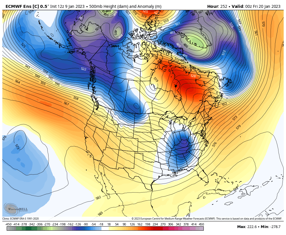
The longer range pattern continues to give me the same vibe from 2 years ago around this time as a deep trough gets established in the east starting late next week…
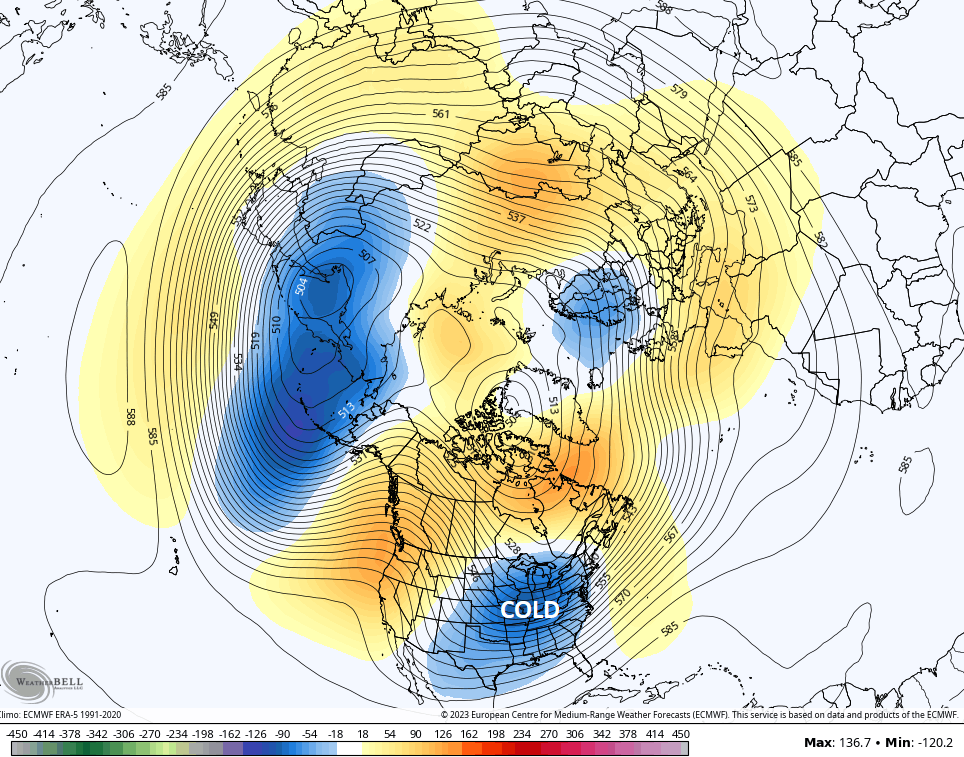
That’s the average of the 61 member EURO Ensembles, so that’s quite the strong signal.
If we look at the lone run of the control run of the Euro Ensembles, we see how deep these troughs may actually look…
That’s a good look for cold and snow lovers around here. We aren’t done with harsh winter weather, folks.
I will have your normal updates coming later today. Have a good one and take care.

Light snow & a warm ground=s “festive flakes”
Whenever we talk about “wrap-around snows” or “festive flakes”, you can almost guarantee that Western and South-Central will see little if any action. The hills to the north of us tend to ring out the moisture, leaving us with a flake or two, and not much else.
With La Niña planning to stick around through Winter into Spring, I’m ready to put on +my severe weather hat, since La Niña tends to amp up severe systems. Buckle up.