Good afternoon, everybody. Milder winds continue to take over across the area over the next several days. These winds are ahead of a storm system set to bring the chance for strong storms and light snow, all within a few hours.
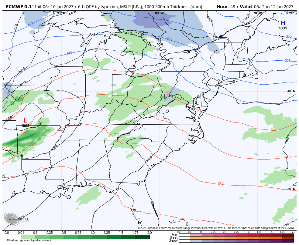
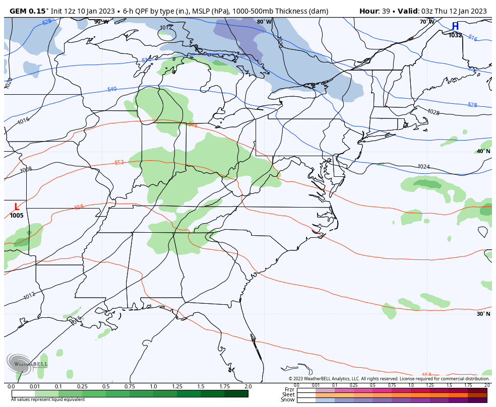
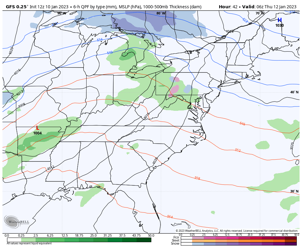
With the track of the low right going from western Kentucky into Indiana and Ohio, it will put us in the warm sector for a few hours on Thursday. That opens us up to the potential for a few strong storms going up.
The Storm Prediction Center has much of the state in the Marginal Risk for severe storms…

Damaging wind is the primary threat with any storm that goes up. Winds will likely be very gusty, with or without thunderstorms.
Colder winds will then settle in on a strong northwest flow Thursday night through Friday night. That causes fairly widespread light snow and snow showers to go up as some moisture from Lake Michigan gets into the mix.
Light accumulations are likely Friday and Friday night, with the southeast doing much better than the rest of the state.
The models are all in decent agreement in how they handle this scenario…
EURO
CANADIAN
GFS
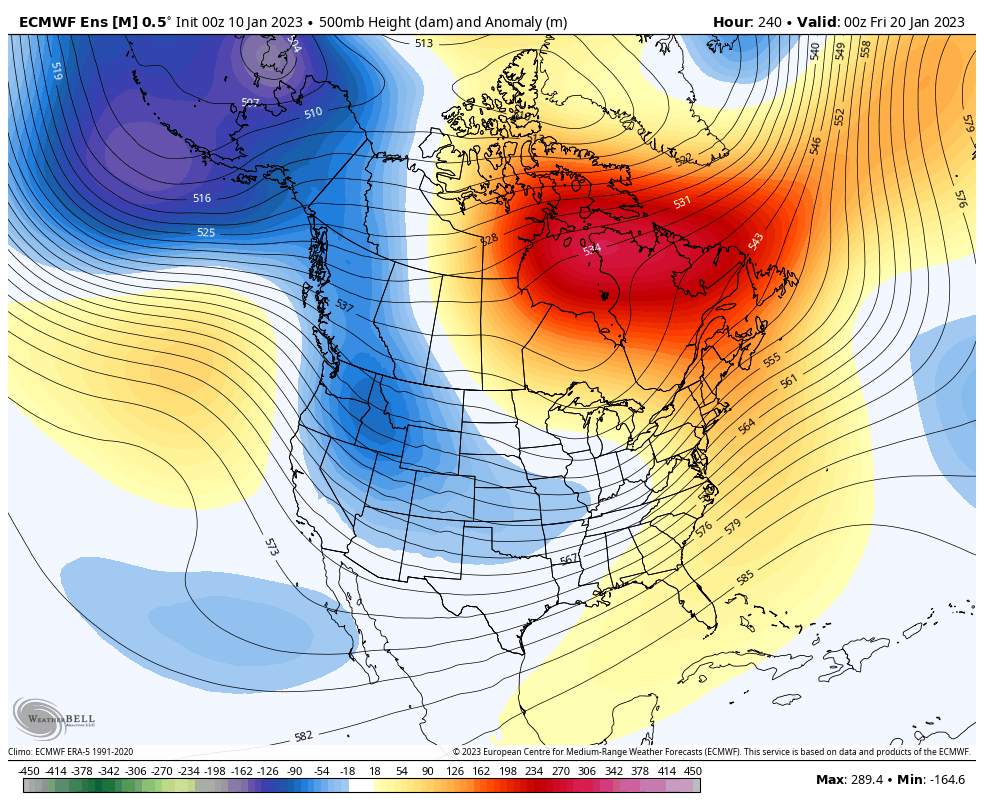
There are no changes to the longer range with a deep trough getting established in the east later next week and likely locking in for the rest of the month and into February…
I’ll see you on WKYT-TV starting at 4pm and I’ll be back with another KWC update this evening. Make it a good one and take care.
