Good evening, friends. Clouds are starting to stream in from the west as our late week storm system gets ready to impact the region. Strong storms and light snow are on the weather menu for the second half of the week.
Those clouds will spit out a few showers on Wednesday, but that looks fairly scattered.
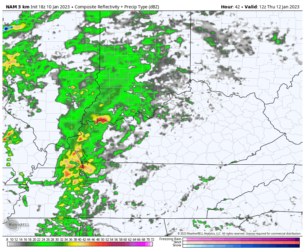
The threat for strong to severe storms is still with us for Thursday. The SPC doesn’t update the Day 3 Severe Weather Outlook, so it’s the same as earlier…

The Future Radar from the Hi Res NAM shows
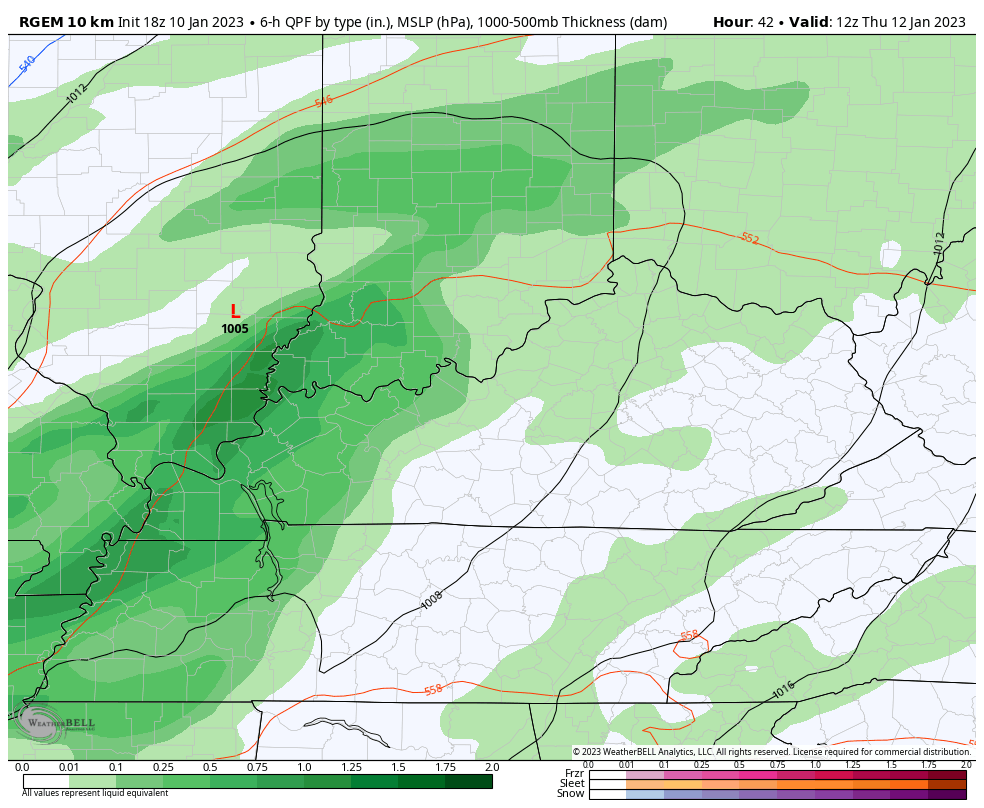
A change to light snow takes place from the northwest Thursday night with periods of light snow taking shape for Friday into Friday night. The flow from the northwest picks up moisture from Lake Michigan and gives us that extra boost for some light accumulations for central and eastern Kentucky. The southeast will have the best chance for picking up on a few inches.
You can see this northwest connection showing up on the Short Range Canadian…
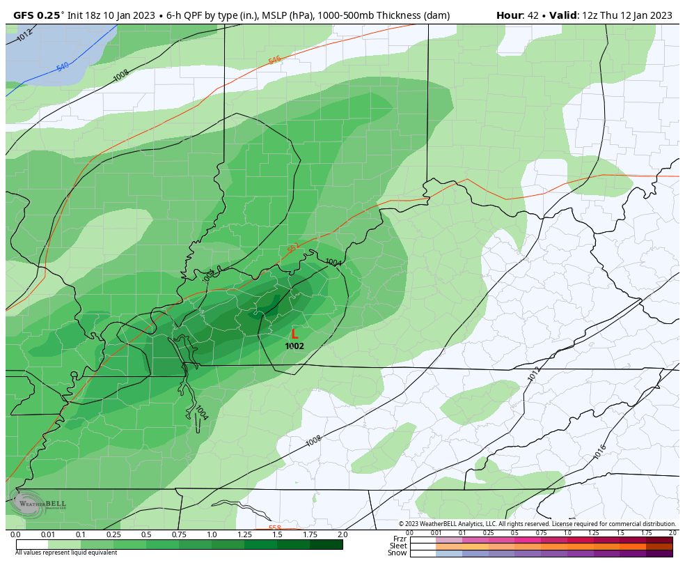
The GFS is picking up on more of this now…
Temps rebound quickly after the flakes stop flying Saturday morning and we should be mild again by early next week. This is ahead of that major pattern change showing up later next week into the following week.
Check out the colder than normal air dropping in and targeting out region…
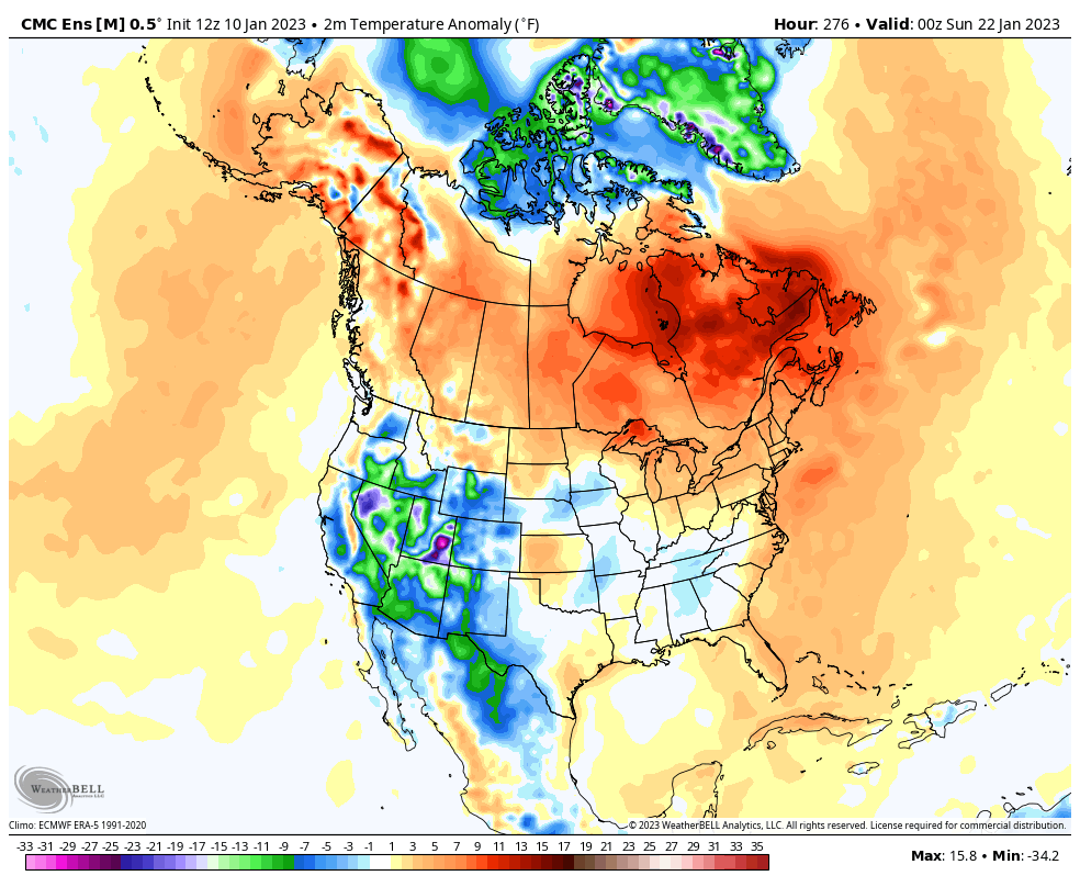
That could be repetitive pattern that carries us into February.
Enjoy the evening and take care.

I’m more worry what our weather going to be down the road that what our cats going to do s