Good Wednesday, everyone. A few showers and storms will try to go up today and that’s ahead of a bigger storm threat for Thursday. Some of those storms may be strong before we see periods of light snow taking over by Thursday night and Friday.
Temps out there today are in the 50s with clouds and a few showers. This isn’t all day rain at all but grab the umbrella to be on the safe side. The threat for a few storms is there in the west and the Storm Prediction Center even shows a low-end risk for severe storms in the far west…

That threat focuses farther east on Thursday and impacts much of the rest of the state…

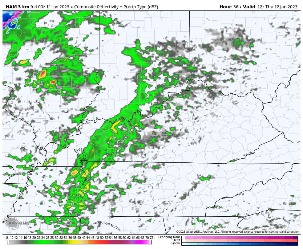
The Future radar from the Hi Res NAM shows the rounds of storms followed by some flakes flying a few hours later. This animation goes from 7am Thursday through Midnight Friday…
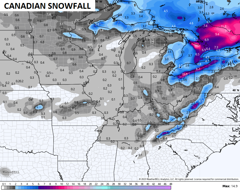
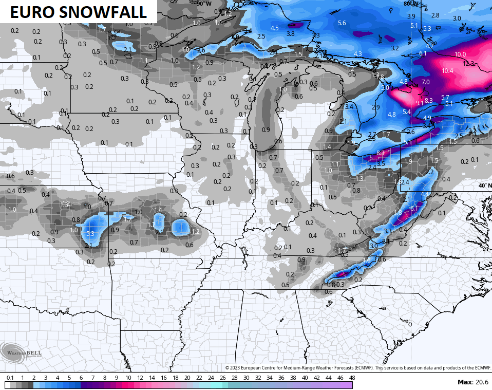
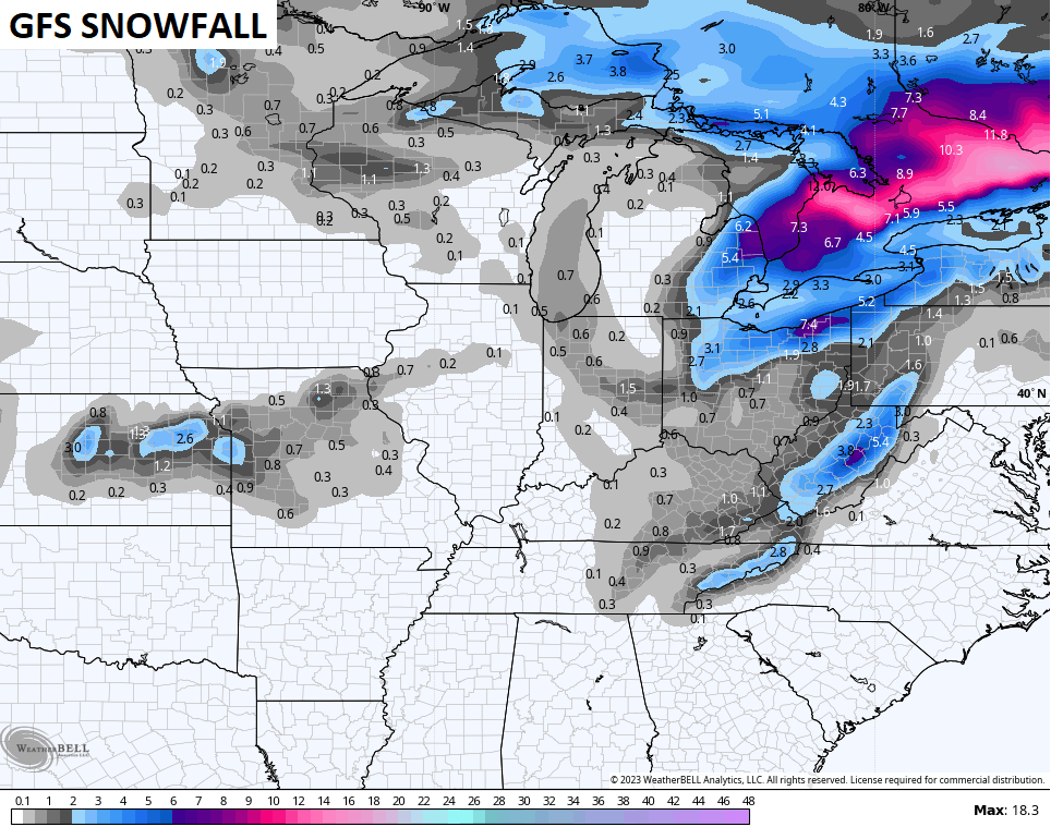
Light snow and periods of snow showers develop Thursday night and continue through Friday night. The greatest concentration is across central and eastern Kentucky and this is where some light accumulations are a good bet. This is especially true for southeastern Kentucky and where a direct plume of moisture from Lake Michigan sets up.
You can see this plume showing up on the snowfall maps from the models…
Once this blows through, temps rebound to well above normal levels early next week, but this won’t last. I continue to beat the drum about a major pattern change taking place next week as the western US goes calm and warm while the eastern half of the country goes toward cold and snowy.
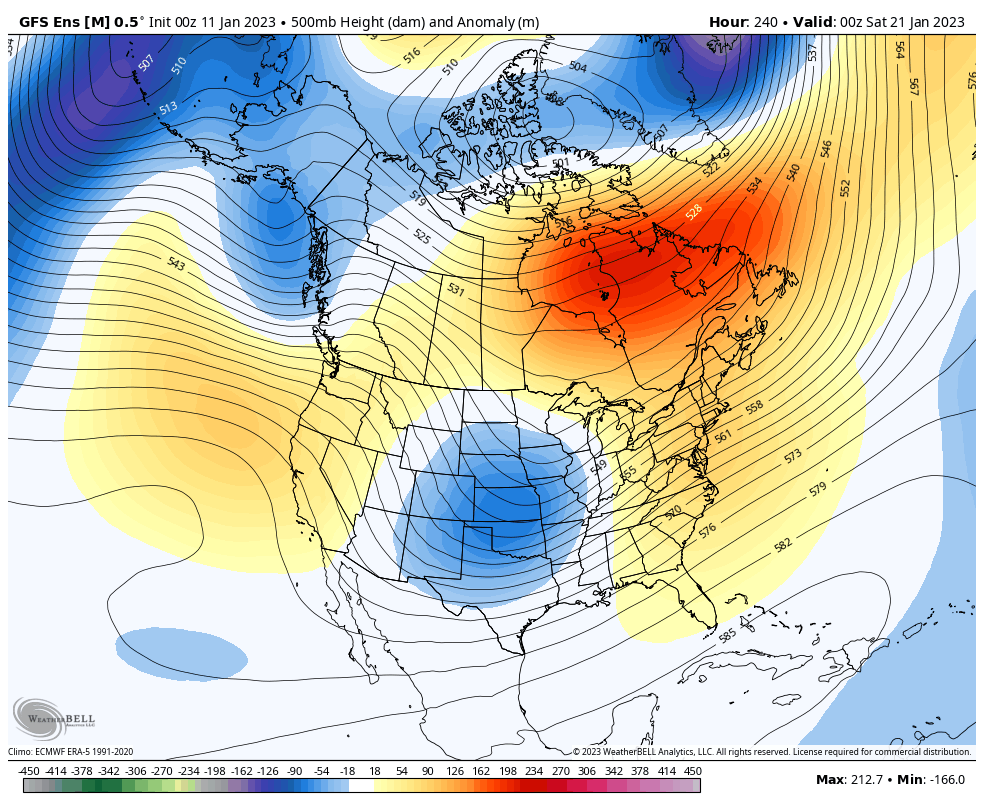
The signal from the Ensembles is growing stronger…
GFS ENSEMBLES
CANADIAN ENSEMBLES
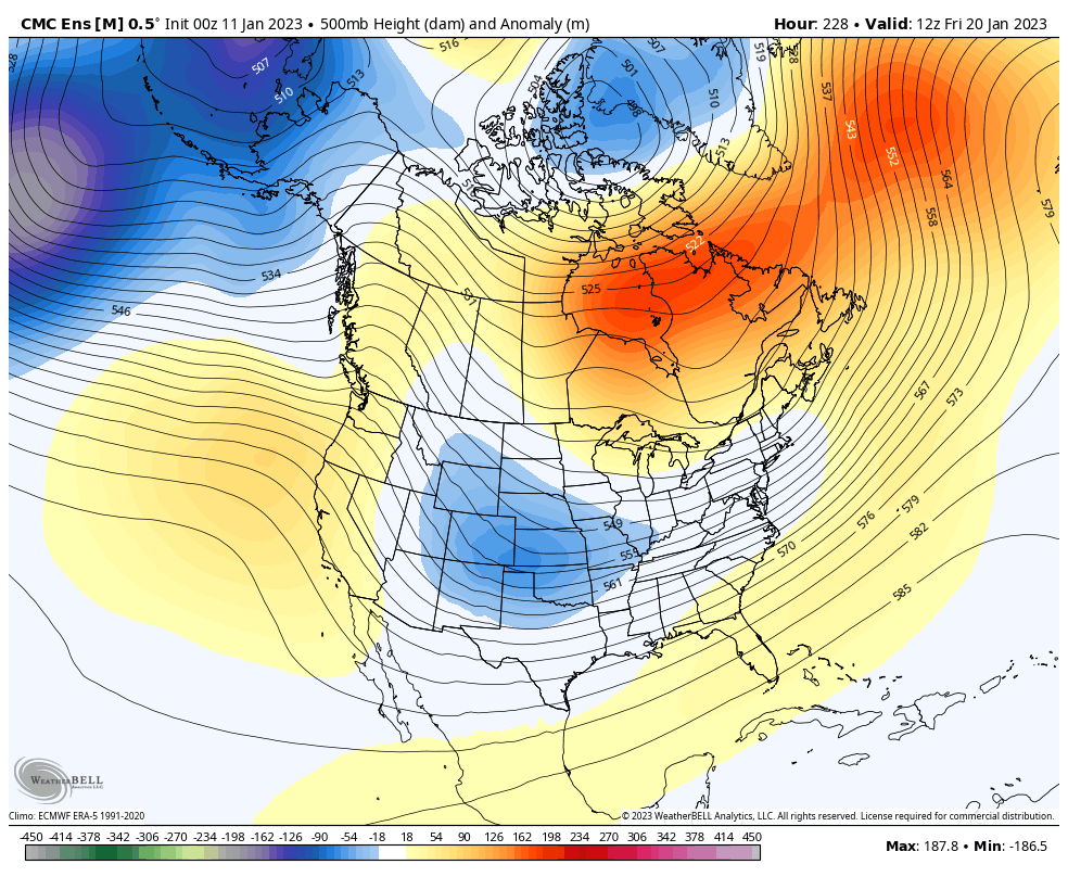
That February 2021 vibe is real!
Your normal updates will be on later today. Until then, I have you set to track the scattered showers going up across the central and east, and the threat for storms in the west…

Current watches

Possible Watch Areas

Have a great day and take care.
