Good afternoon, everyone. We have a big storm system set to rumble across the region, bringing the threat for severe storms and snow. If you know anything about Kentucky weather, nothing about that sentence seems out of the ordinary.
Scattered showers are out there today with scattered being the key word.
I’m watching western Kentucky for storms to go up later today into this evening and some of those may be strong or even severe. The Storm Prediction Center continues with a low-end risk for severe storms in the far west during this time…

That threat expands to include most of Kentucky for Thursday…T

The Thursday setup looks to feature a squall line of storms moving through during the middle of the day, with the chance for a few severe storms to flare behind it ahead of the front. Damaging winds are the main threat, but large hail and a quick tornado spin up can’t be ruled out.
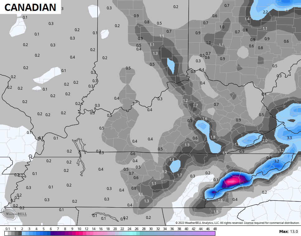
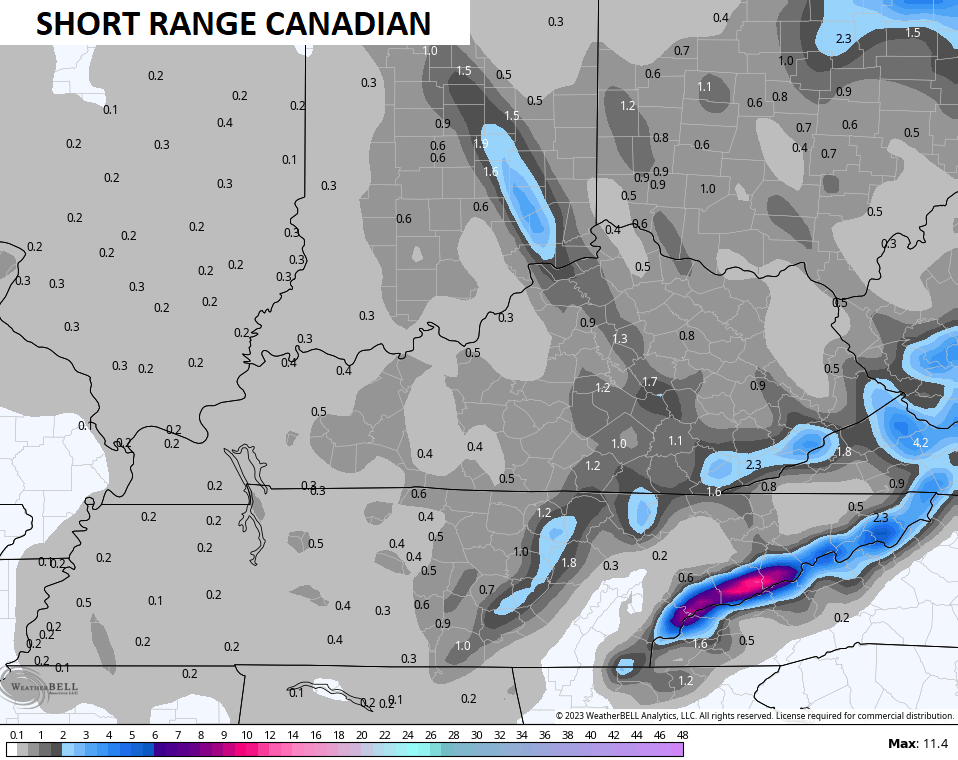
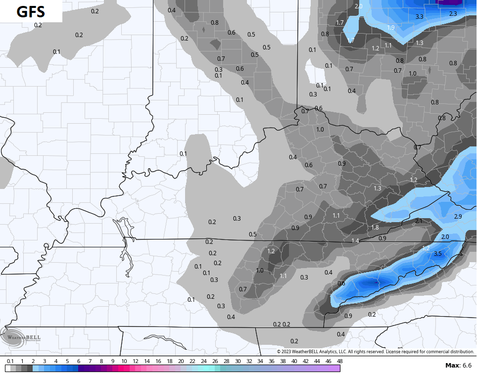
Much colder winds then settle in with the increasing likelihood of light accumulating snow Friday and Friday night. I will likely do a First Call for Snowfall later today on WKYT-TV and here on KWC.
This isn’t a lot, but you can clearly see the Lake Michigan connection on the models snowfall maps…
Until the next update, here are your storm tracking toys for the day…

Current watches

Possible Watch Areas

Have a wonderful Wednesday and take care.

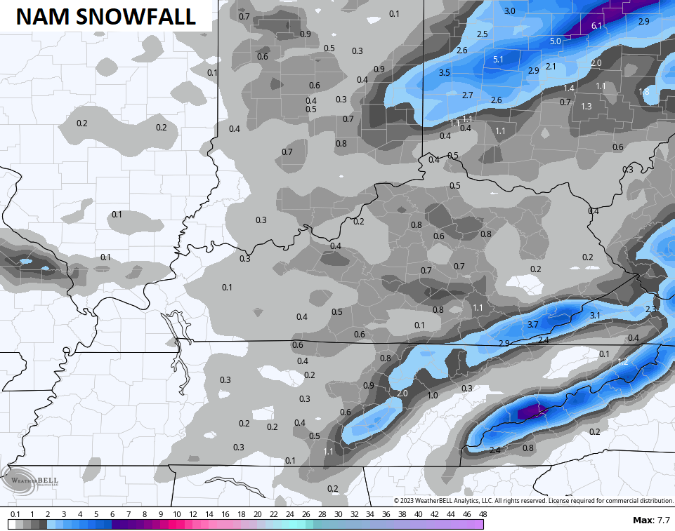
Lake effect snow & future Clipper’s normal winter pattern.
Western and South Central Kentucky will likely miss the flake action, as usual
you know why though… because you’re too far west for the northwest flow off the lakes. Now, if it were a due north flow instead of northwest, it might hit your area…. but has that even ever happened? LOL
We’ll receive a major Snow someday. Hopefully in February or March this Winter ? In the meantime, enjoy the mild and somewhat wet weather that La Nina normally brings to the Ohio Valley.
I read that Mammoth Lakes, California has received 28 feet of Snow in the last few days. Now that’s what I call a real Snowstorm. Wow !!!