Good Thursday to one and all. Strong to a few severe storms are rolling across the state today as a potent storm system works into the Ohio Valley. Once the storms blow through, a light accumulation of snow takes center stage for Friday.
Let’s start with the storms before we get to the winter weather.
A few rounds of strong storms will be noted from this morning into the middle of the afternoon. A few of those may be severe with damaging wind the primary player. There’s a low end threat for a few of the storms to spin a little.
Here is today’s Severe Weather Outlook from the Storm Prediction Center…

I’ll have your tracking tools in a bit.
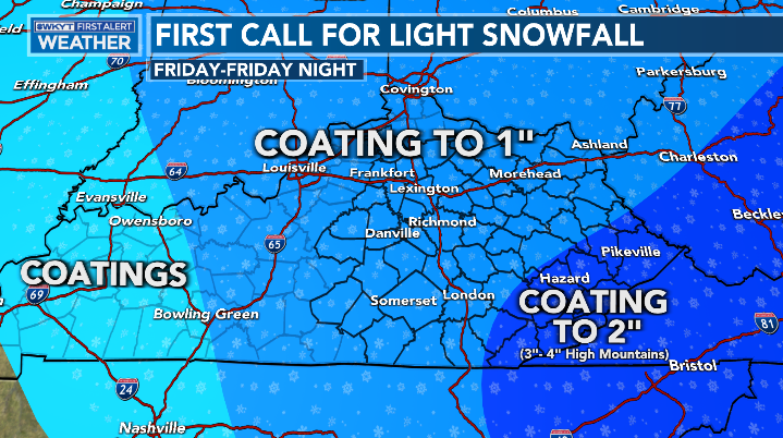
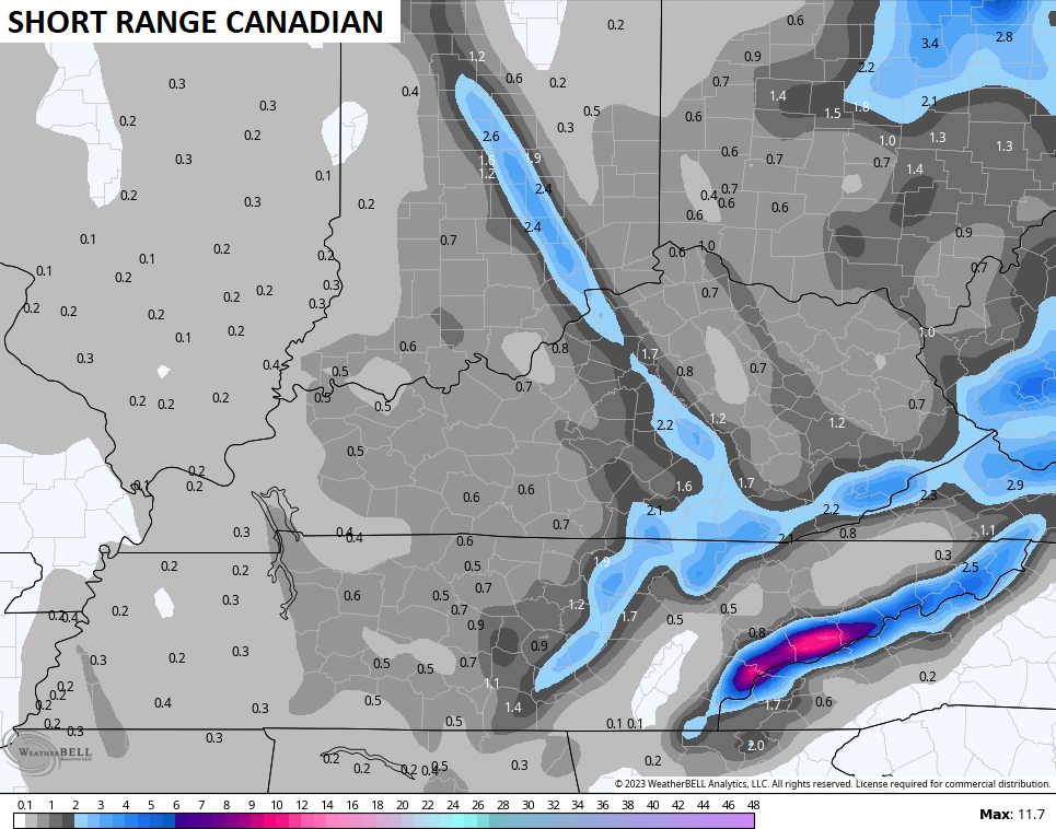
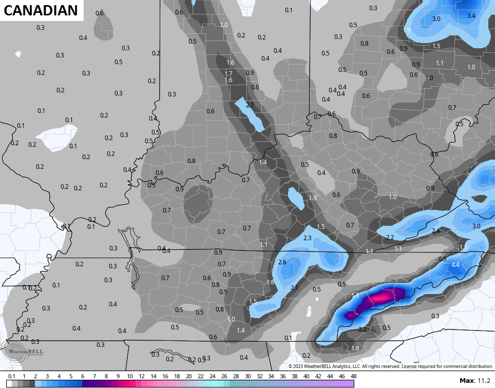
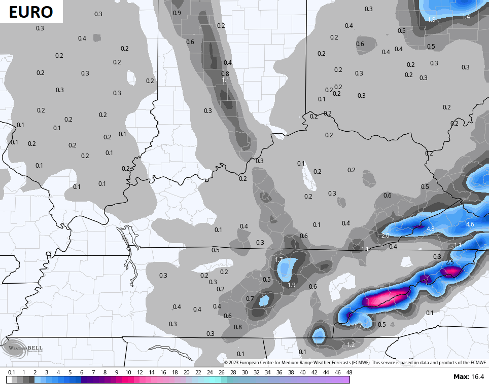
A cold northwest wind kicks on tonight through Friday night with periods of light snow and snow showers likely. Light accumulations are a good bet for much of central and eastern Kentucky, with the far southeast seeing the potential for a few inches or a little more. My snowfall map from yesterday still stands…
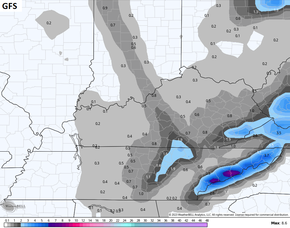
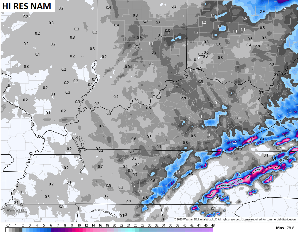
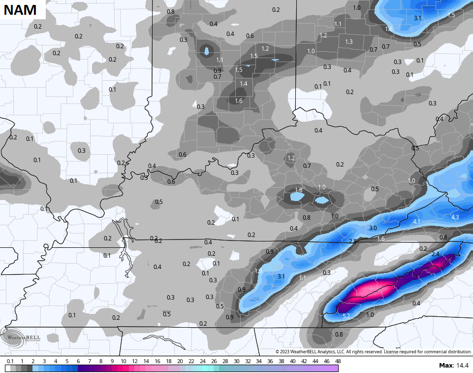
The Lake Michigan connection will be interesting to watch. There could be a band of overachieving light snow wherever that sets up. You can actually see the Lake Michigan impact showing up on the models…
I will have KWC updates through the day, but I leave you with your early Thursday storm tracking toys…

Current watches

Possible Watch Areas

Have a wonderful Thursday and take care.

im no stranger to the rain/ whitley.
pretty sad that jim having do everything himself, then wlex has 3 in studio. and wtvq has 2. spend some money wkyt and get this men some help. where is bow tie at.
these men
poor ole jim has done a great job
im a one armed cripple and i take a job working the computer for jim. the blog aint what it used to be, . this place 15 years ago be hopping.