Good Monday, everyone. On this day we honor the legacy of Dr. Martin Luther King Jr, we are tracking the first in a series of storm systems into Kentucky. This busy pattern likely means a lot of precipitation over the next few weeks and I do expect some of it to be in winter form.
Let’s kick things off with what’s cranking out there today. Clouds are thickening from west to east with showers working into the west. These will overspread the state this evening with a rumble of thunder trying to get into the mix. This is a quick hitting system that should exit the state early Tuesday.
Here are your radars to track the drops into town…

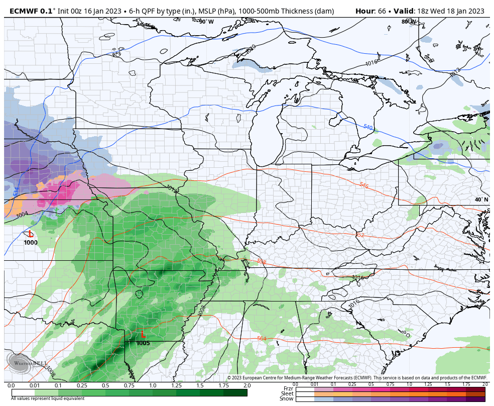
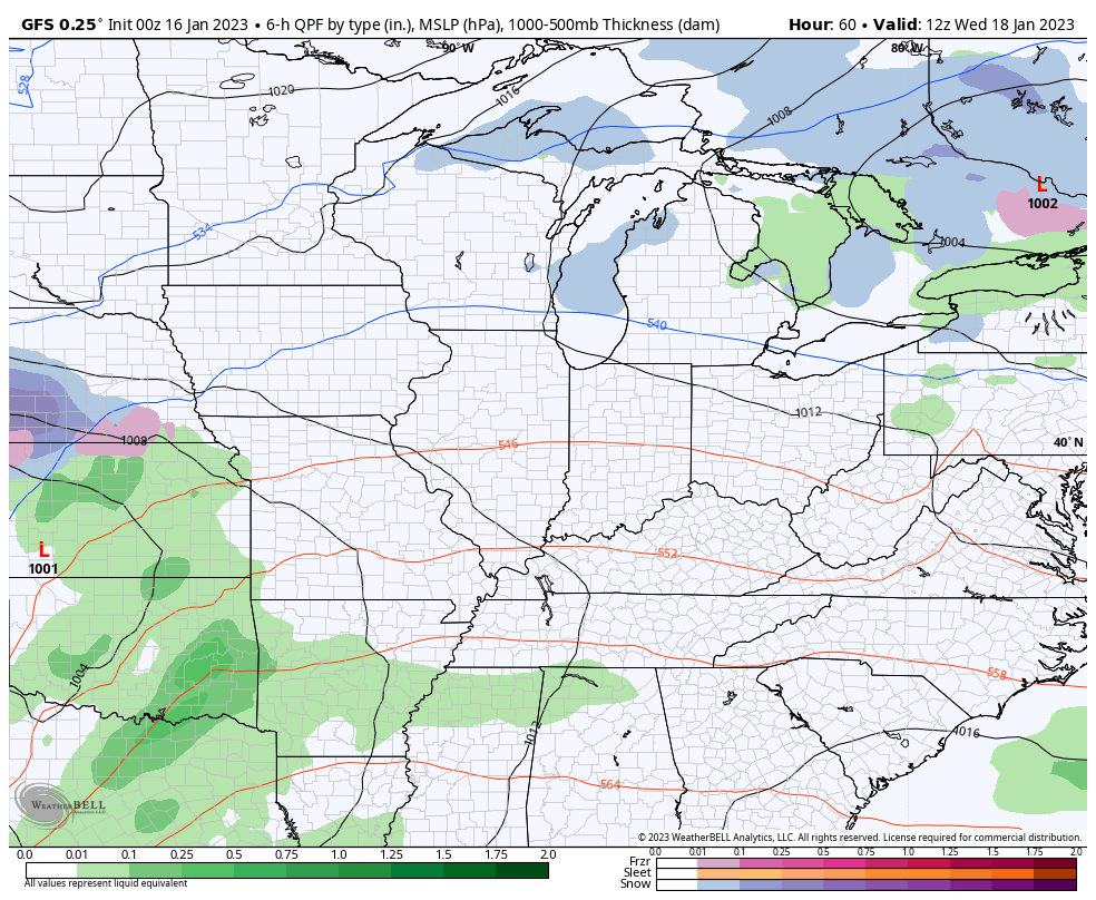
Temps behind this system actually come up for Tuesday and Wednesday as we await the arrival of the next storm system. This one is a little stronger and should bring more widespread rain and a few thunderstorms in here from late Wednesday through Thursday. That will be followed up by another system over the weekend and early next week. This one may be farther south and give us a better shot at some winter weather.
Here’s how the EURO sees these two systems…
The GFS is trending toward some winter with this second system…
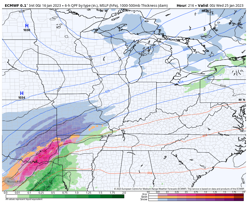
The active pattern continues after this and the EURO continues to show winter threats…
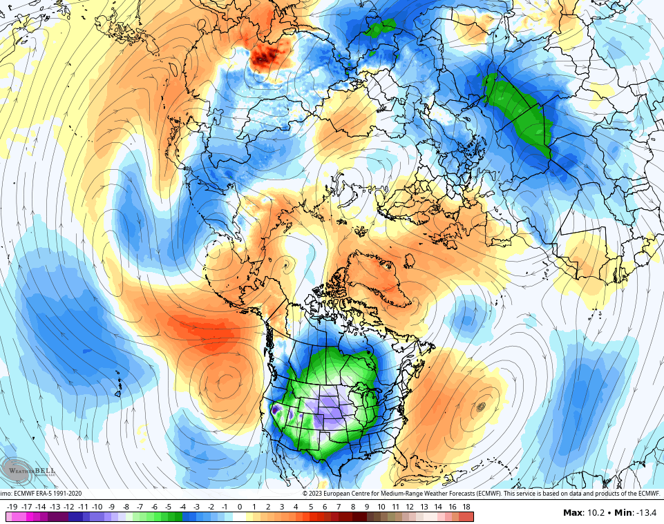
The EURO Ensembles continue to put the coldest air relative to normal in the northern hemisphere into the United States…
Again. this is something we’ve seen happen toward the end of each month since September. It’s one heck of a weather cycle we are rolling with at the moment.
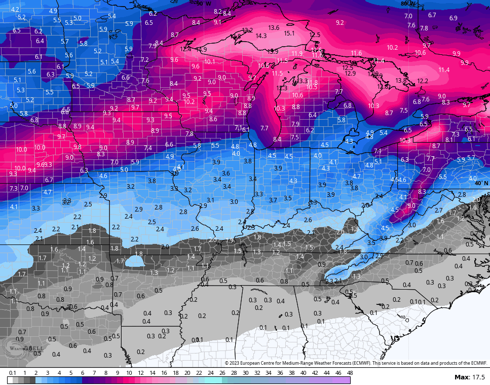
With the active storm track continuing, I do expect snow and ice systems to threaten the region starting next week and into the following week. The EURO Ensembles are made up of 51 individual runs and the aveage of those runs are seeing the snow chances here…
Hang in there winter weather fans!! I’m talking to myself on that one, but we are quickly approaching the time of year when your friendly weatherdude joins #TeamSpring. 🌷😎
I’ve got updates coming your way later today. Make it a great Monday and take care.
