Good afternoon, everyone. Rain and a few thunderstorms continue to roll across the region as another system zips in. Several more are on the way this week into next week as winter weather tries to show up with a few of them.
Today’s showers and storms are pressing from west to east across the Commonwealth. This isn’t a ton of rain, but some of us may pick up close to a half inch or so by the time this wraps up early Tuesday. Here are your radars…

The next system moves in with rain and some storms late Wednesday and Thursday. Colder air coming in behind this could mean a few flakes for Friday before we focus on another system behind it later this weekend. That one may take on more of a winter look.
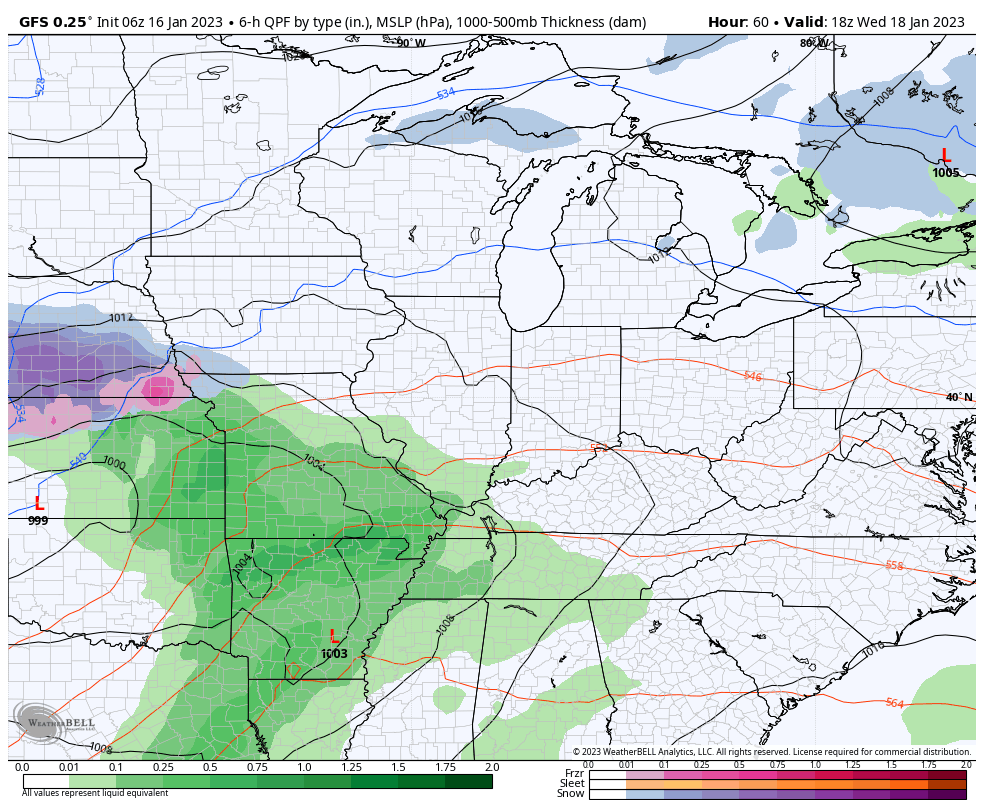
The GFS continues to struggle with the handling of these systems. Here’s the latest run…
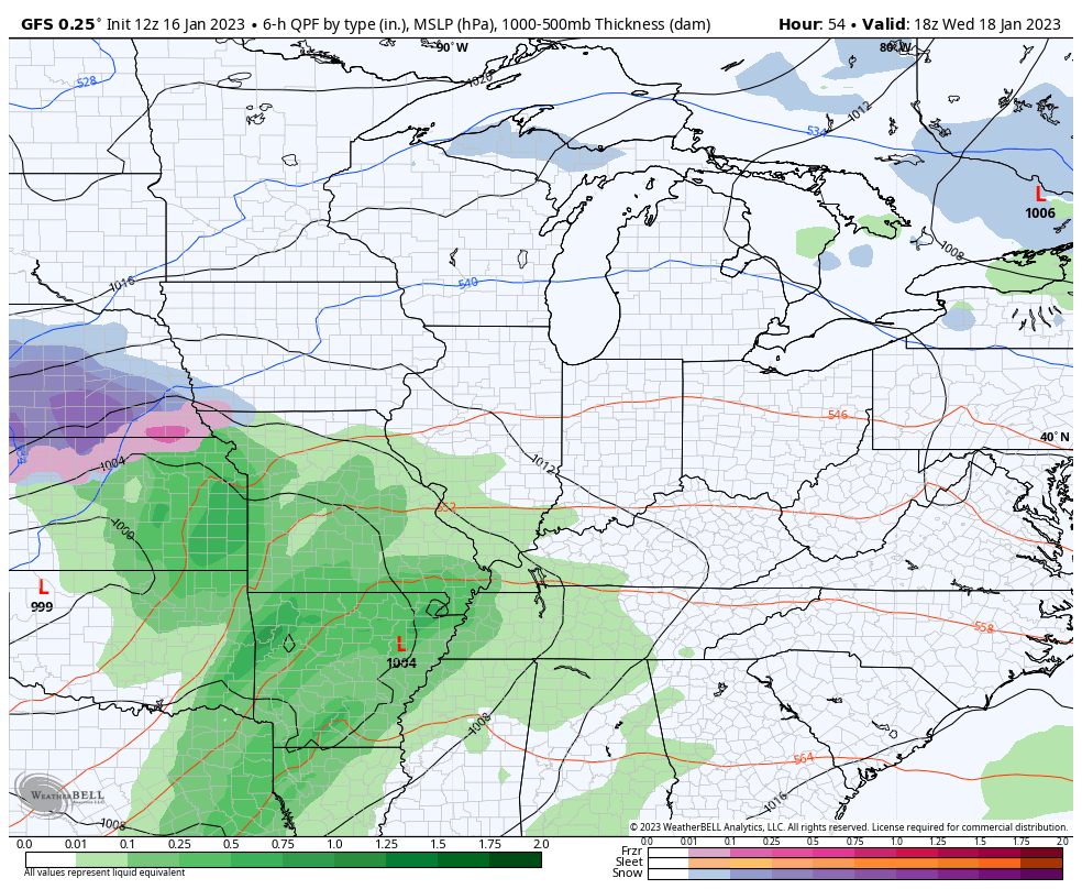
That has no chance for winter weather with the second system, but the prior run of the same model did…
We shall see what the EURO has to say later in the day.
This active storm track will continue through the rest of the month and is likely to sink farther south, bringing winter weather threats to the area.
To prove what a crazy weather world we are living in, the National Hurricane Center is tracking a possible Subtropical Storm in the Atlantic…

I’ll update everything later today. Make it a great day and take care.

Typical winter so far this year.
Only had one extreme cold period.
That one cold period was a doozy though and enough for me.
It has been a pathetic Winter so far, but we are receiving some beneficial rains from a weakening ” Pineapple Express. “
I will probably receive my heating bill tomorrow for that extreme cold we had at the end of last month. I’m glad that didn’t last too long.
With a warm and positive Atlantic Ocean, that cyclonic disturbance doesn’t surprise me any.