Good Tuesday, folks. A very active pattern continues and it’s about to be joined by a pattern change. This change means winter weather is likely to show up over the next couple of weeks, so hang in there, snow lovers!
Let’s focus on today before we look ahead.
Showers start the day across the eastern half of the state, but a drying trend quickly settles in from the west as the day wears on, so much of the day is dry. Here are your radars to say bye-bye to this round of rain…

This pattern fires another storm system at us with rain and some thunderstorms late Wednesday into early Thursday. This one may even spit out a few strong storms in the west…
Winds will be gusty and may hit 40mph at times. Colder air pours in behind this late Thursday into Friday with a few flakes possible.
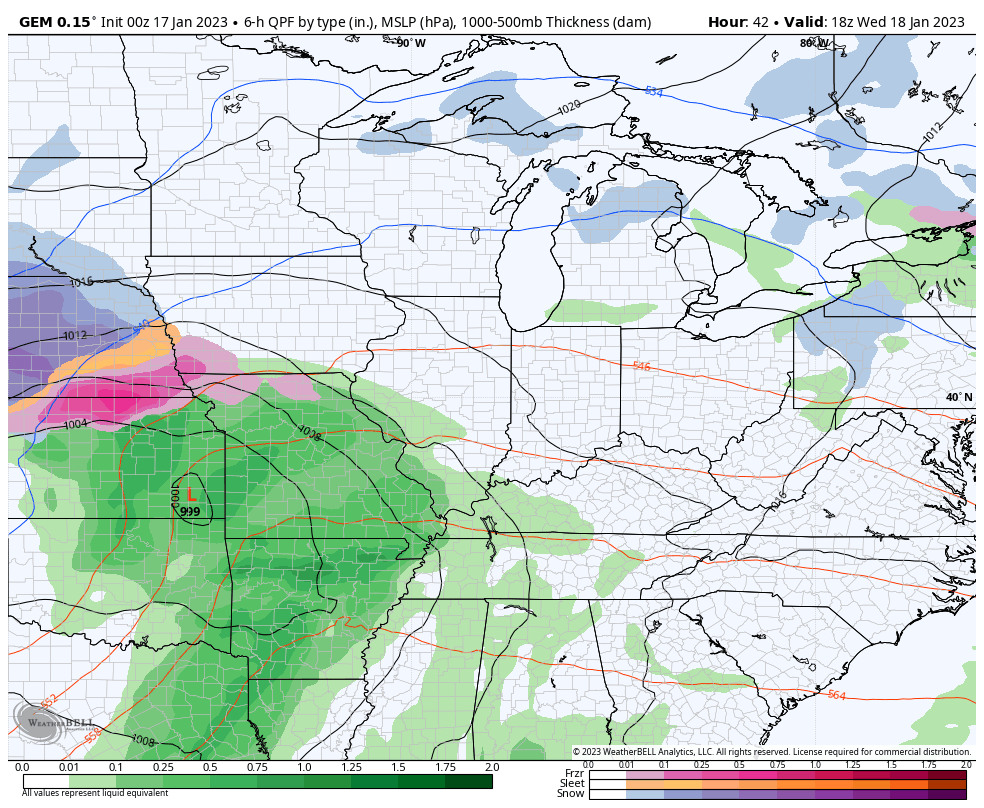
That sets the stage for the next storm system to be a track a little farther south and east later this weekend and early next week. This kind of track can bring rain and snow into the region, with the track of the low being the determining factor on which precip type wins out. Here’s a look at how some of the models handle this system…
CANADIAN
EURO
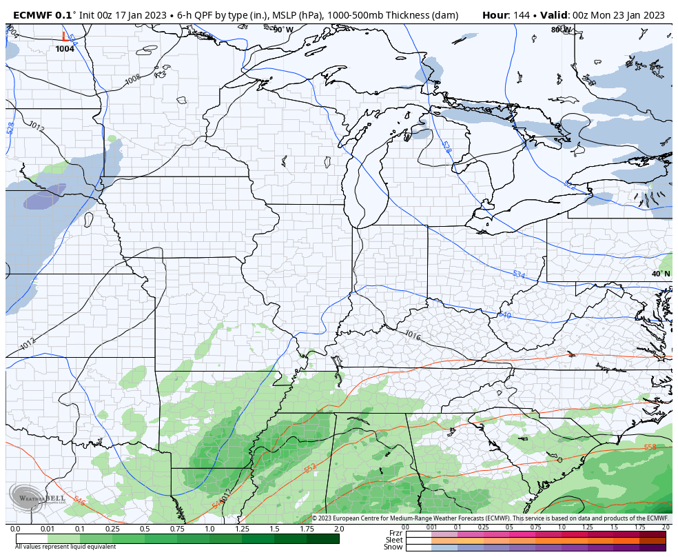
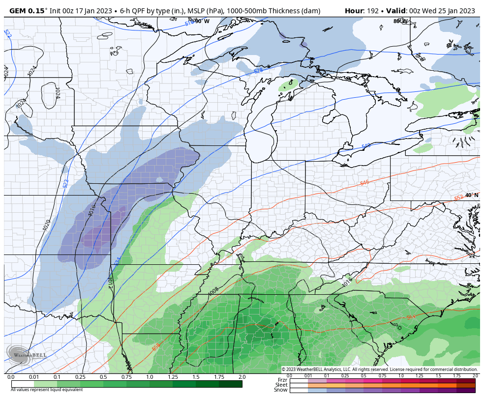
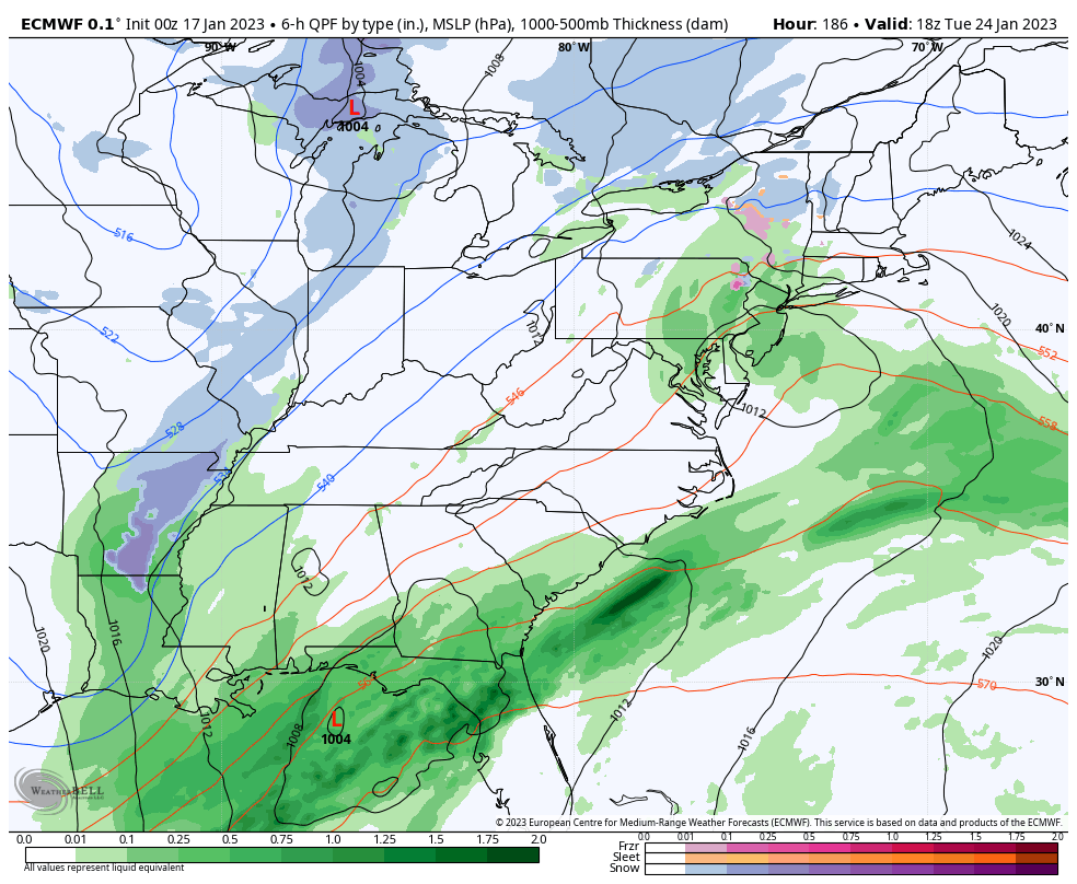
The stage is then set for a additional storm systems to track farther south and east as cold air starts to take control of the pattern, again. That means a storm track with a better threat for winter weather…
Canadian
EURO
The EURO Ensembles have a very healthy winter look…
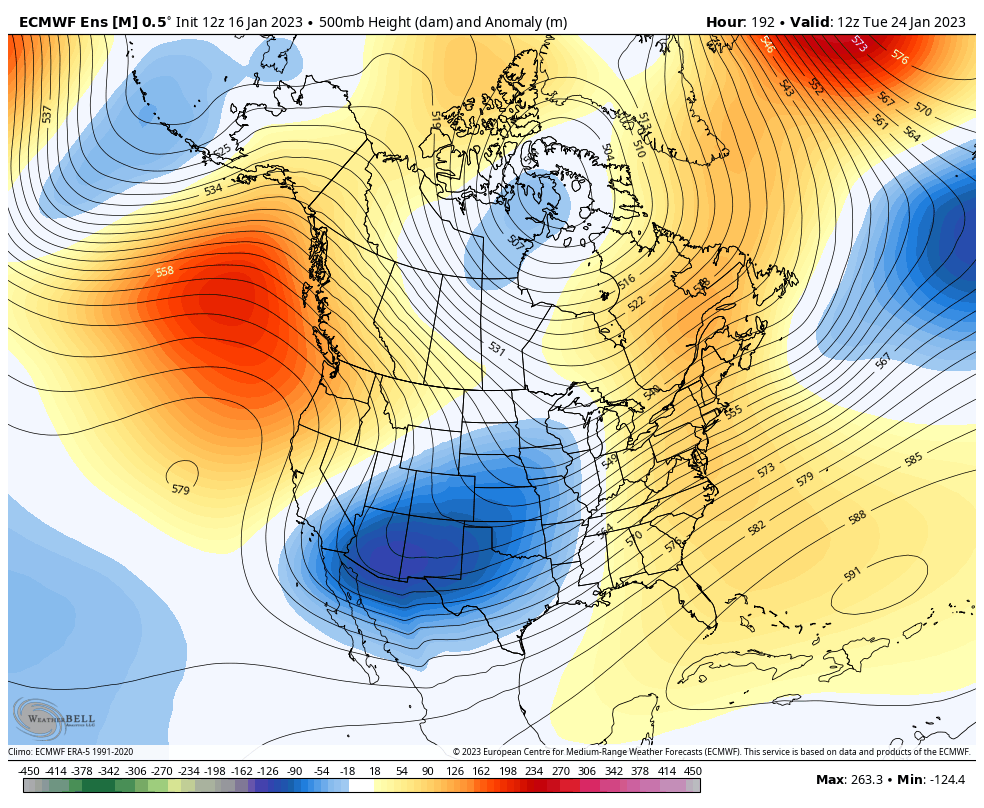
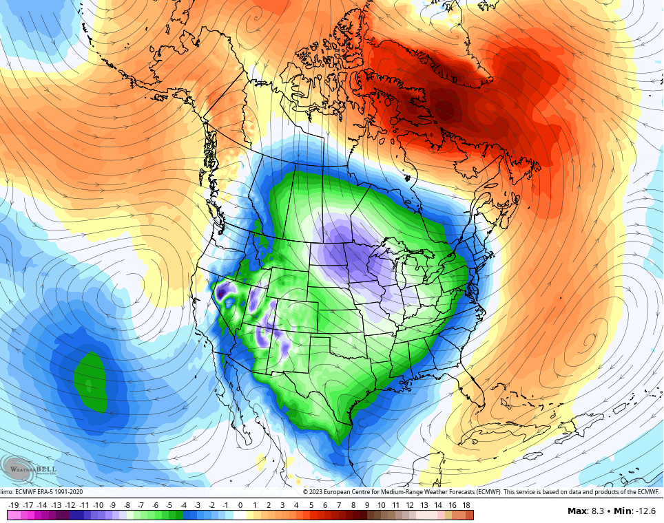
Check out the cold air coming with that trough…
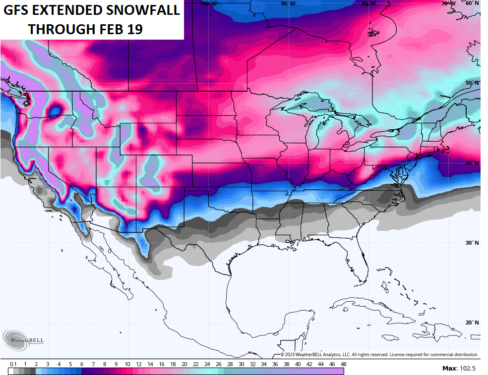
Looking at the latest extended models, they are also locking in on a busy second half to winter. This would obviously go against my winter forecast, but I already hit the Bold Prediction so I don’t care now. 🤣🤣😎
The GFS extended goes through the middle of February and shows the snow potential…
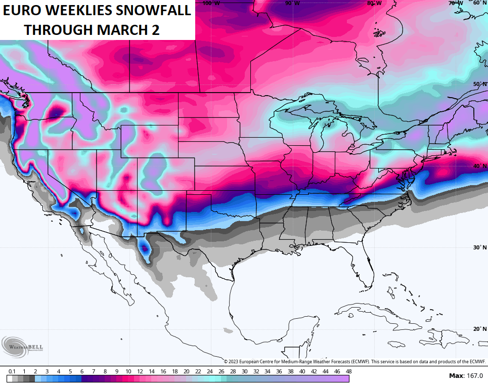
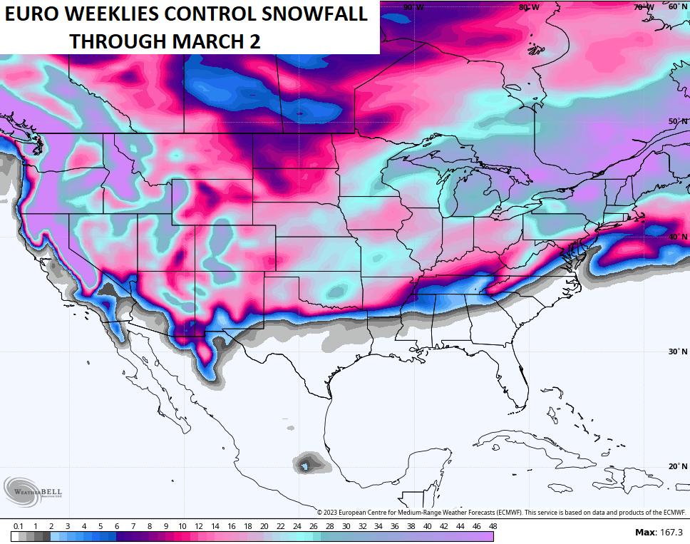
The EURO Weeklies go through the first few days of March and also show the snow potential…
The control run is even more aggressive…

It figures, just when January lulls us into thoughts of Spring, Winter decides to come crashing back, although I’m not convinced that it will be as extreme as the ensembles are predicting. Our never-ending La Niña finally seems to be prepared to loosen its grip, but it will do so gradually, and the transition towards ENSO Neutral will add another level of unpredictability. It’s confused the tropics, and I believe that it could accelerate the arrival and intensity of our severe weather season.
Notice the word “ice” in a few of the posts..Modeling has been showing the possibilities..Just saying..
One thing about a back loaded Winter is that decreases the chances of unwanted freezes in April and sometimes May.