Good evening, folks. We are putting the wraps on a springtime day across the region, but the days of this March pattern are numbered. We have a major pattern change taking place and it’s one that may throw winter weather at us as early as this weekend.
Before we can get into this pattern change, we have another spring setup for Wednesday and early Thursday. That’s when temps take off once again on a strong southwest wind. That wind is ahead of a potent storm system sweeping into the Ohio Valley Wednesday night and Thursday.
This will bring scattered and showers into the area by Wednesday afternoon before giving way to a squall line of thunderstorms racing from west to east across the state. A few strong to severe storms will be possible and the Storm Prediction Center is now highlighting central and western Kentucky for severe weather late Wednesday and Wednesday night…

Damaging wind is the main player, but a few storms may try to rotate. That gives us a low-end risk for a few tornadoes to go up, especially in the west.
The weekend storm system is an interesting one as we are seeing more and more models pressing the storm track farther south and east. What may wind up happening is one weak low works toward the southern Appalachians while the main low cranks in the Carolinas and strengthens up the east coast.
The latest EURO has much more of a snow signal around here…
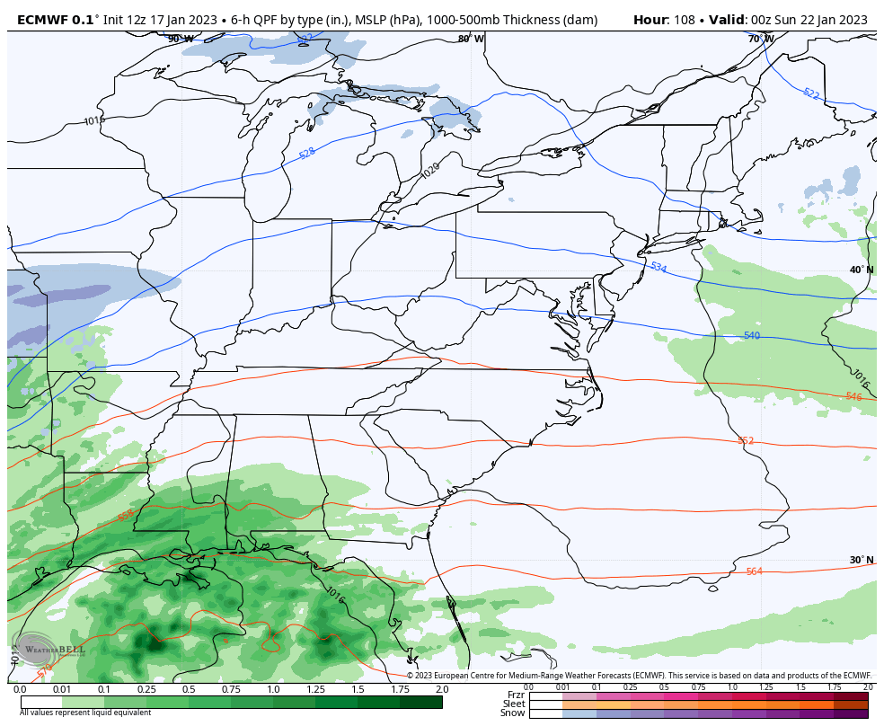
For a big system around here, you want the first low to be fairly weak and give way to a farther west tracking main low.
The EURO and Canadian Models are similar with the track of this weekend’s system, but the ICON is also jumping on that same train…
![]()
![]()
Of course, the GFS is different and places too much emphasis on the northern system…
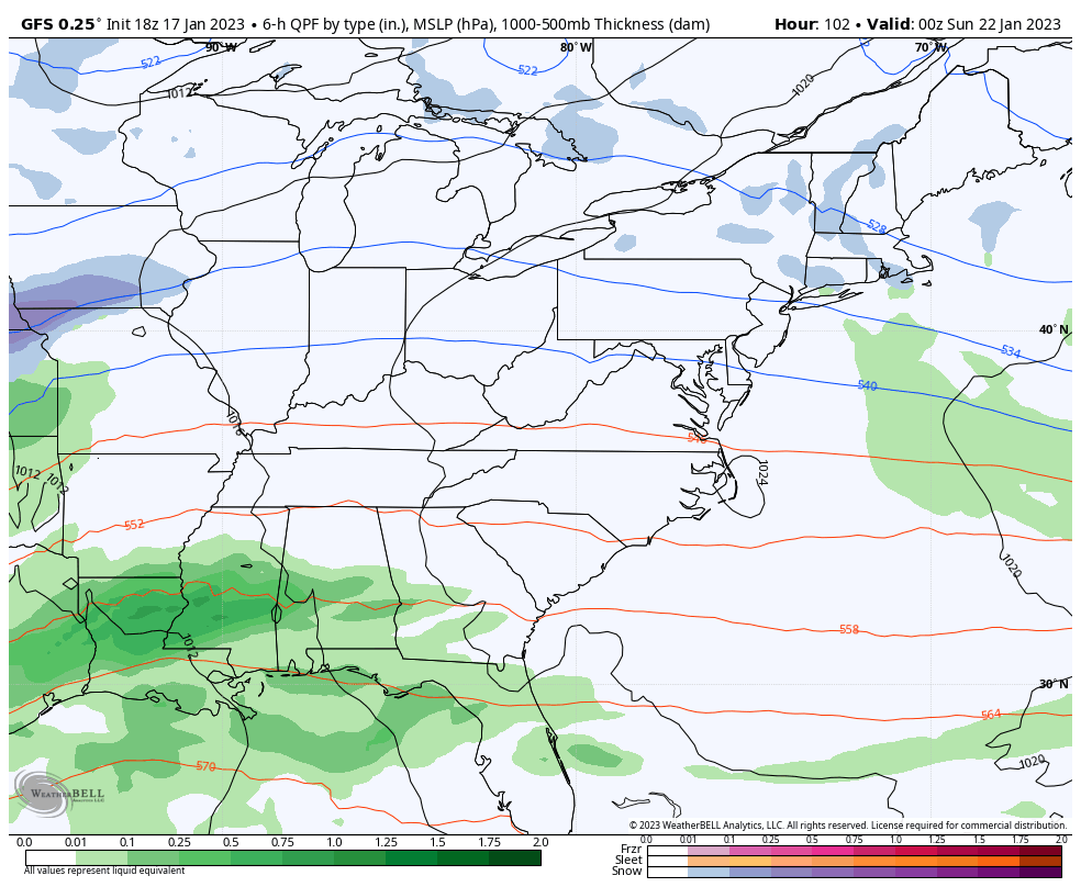
The GFS has the lowest skill score of any model going right now. Watch for it to trend toward the other models in time.
If we look upstairs at the operational EURO, we can see these deepening trough digging into the eastern half of the country this weekend and early next week…
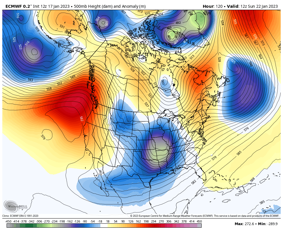
If you look at the last few frames of that animation you can see a chunk of the Polar Vortex diving into the western Great Lakes and upper Midwest.
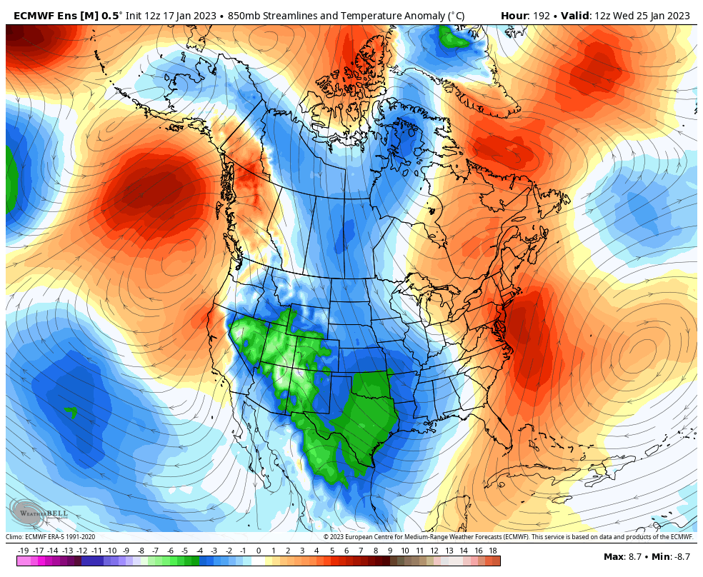
The EURO Ensembles have been leading the charge on this change for a while now and they continue to grow colder as we get closer…
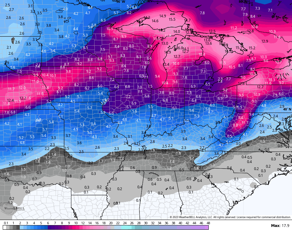
Those same ensembles aren’t just seeing the cold, but they’re also seeing several snow threats over the next 2 weeks…

That’s a bullish signal considering its’ the average of 51 different members that make up the Euro Ensembles. The GFS Ensembles back that up…
Hang tough my fellow winter weather weenies! Our time is coming. 🥶❄
Enjoy the evening and take care.

A Coming Out Party. I hope the Old Man brings his party favorites with him this time.
I’m still getting that southeast ridge in the don’t do it for us again mode. I see hanging down there just waiting to flex its muscle. Looking quite interesting over the coming weeks, But we shall see.
Hopefully WKY gets a good snow!
One more good snow and then let spring come.