Good Wednesday to one and all. We are tracking a spring-like setup across the region today and it’s bringing the potential for a few strong to severe storms. Once we get rid of this system, the pattern stays active but takes on much more of a winter look.
A warm front is lifting northward across the state today as low pressure works across the Mississippi Valley. This low heads toward the Great Lakes tonight and Thursday, dragging a cold front in from the west.
Scattered showers and storms will go up today across the west, with the increasing potential for strong to severe storms in the west by late afternoon. These storms will work into central Kentucky during the evening before slowly weakening overnight.
Here’s today’s Severe Weather Outlook from the Storm Prediction Center…

Damaging winds and large hail are the usual suspects, but there’s just enough spin for a low tornado threat across the west.
The showers and storms exit eastern Kentucky early Thursday as gusty winds follow. Temps briefly spike into the 60s across central and eastern Kentucky. Cold air and clouds then quickly collapse in from the northwest during the afternoon and evening. This sets the stage for a few snow showers and flurries for central and eastern Kentucky into early Friday.
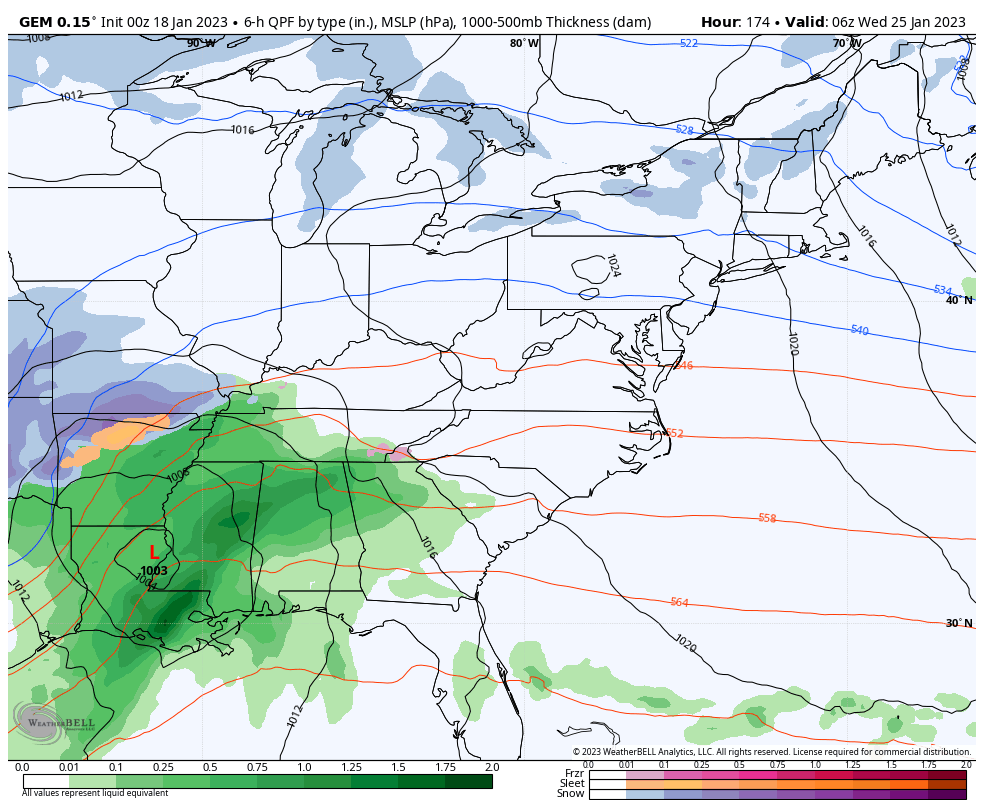
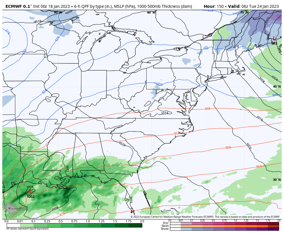
Our next storm system rolls in Saturday night and Sunday, but the jury is still out on what that means for precipitation types. One low moves toward the southern Appalachian Mountains Sunday and weakens before giving way to a bigger low on the eastern slopes of the Appalachians. The exact tracks and interaction between these two lows will determine what kind of precipitation we see around here.
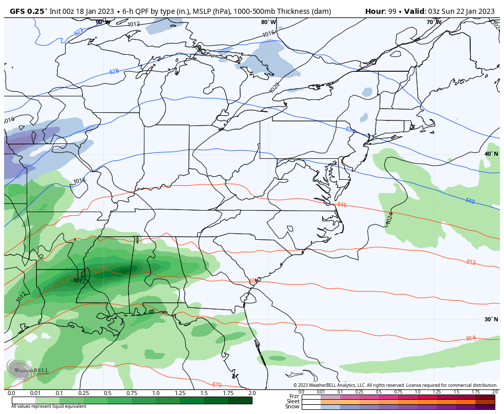
The Canadian continues to show rain, snow and a mix for us…
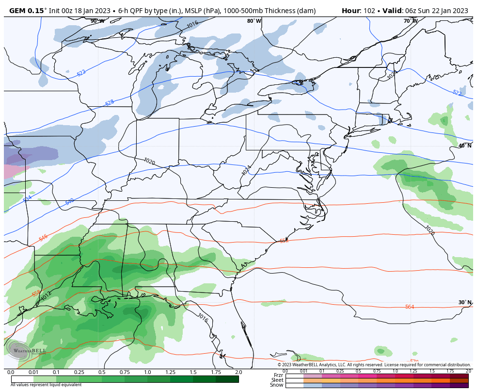
So does the EURO…
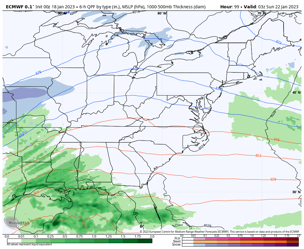
The GFS continues to be the farthest northwest with the lead low, but it’s trending farther south and east compared to earlier runs…
This is the beginning of what is likely to become another harsh winter pattern setting up for the closing days of January into early February. Several models have even been hinting at the Polar Vortex dropping into the country. The Canadian Model is showing that possibility…
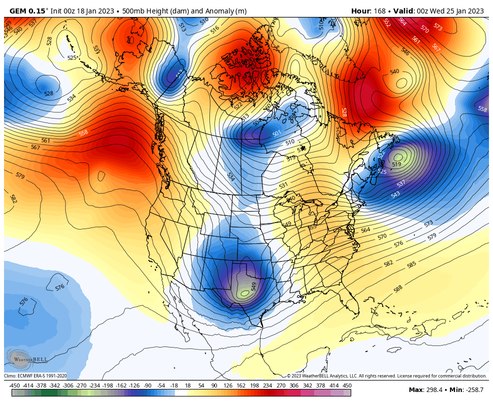
Look at the storm it has preceding that…
That storm is also showing up very well on the EURO…
This will mark the 5th straight month where the end of the month features a major amplification of the jet stream, leading to anomalous cold in our region.
I will have updates later today. Until then, here are your tracking tools to keep you company…

Current watches

Possible Watch Areas

Have a wonderful Wednesday and take care.

Thanks Chris, hoping the severe weather is weakened by the Southeast Ridge today. On the European model 06z to 18z shows a phased Snowstorm 24th to 27th. Hoping this scenario plays out as our total Snowfall to date here in Maple is about 2 inches. Hoping the extreme Arctic air stays lock up in Siberia.
This wet and mild January has caused some of my crocus and day lily plants to sprout. They should be hardy enough to pull through should the weather turn colder, as long as it’s not a repeat of that pre-Christmas outbreak. The good news is that we have not seen signs of stratospheric warming, which would necessarily precede a standard Polar Vortex outbreak. Instead, any PV intrusion we see is more likely to be of the “stretched” variety, meaning it should have a short persistence.
I’m continuing to see the eastern equatorial Pacific waters temperatures trending warmer, and the CPC is now forecasting an 82% chance of ENSO-Neutral conditions in the March – May timeframe. The 3 year La Niña may finally on the way out!
Joe, I have never had a Crocus or Day Lily freeze out in over 50 years in the Nursery business, but I grew primarily Azaleas and Rhododendron and some American Holly in my Nursery.
La Nina may be switching to ENSO / neutral before the Winter is over ?
Check that water off the coast of South America!
https://www.ospo.noaa.gov/Products/ocean/sst/anomaly/
Yeah, La Nina is finally showing signs dissipation. ENSO / neutral soon.