Good afternoon, everyone. Overachieving snow will slowly wind down across northern Kentucky as light snow kicks in for many tonight and Monday. This is ahead of a much bigger storm system for the middle and end of the week.
I had far northern Kentucky in the 1″-3″ range today, but Old Man Winter decided to go a little above that. Check out some of the pics from this area…
@NWSILN @Kentuckyweather Burlington KY near CVG. pic.twitter.com/EKZy6k19O8
— Dan Ford (@dford5475) January 22, 2023
@Kentuckyweather
It’s just some snow…… nothing to see here. pic.twitter.com/LSMIZiQgAX— Jim Dusso (@jimdusso) January 22, 2023
@Kentuckyweather this is Union Ky pic.twitter.com/sSxV3f10cn
— franny saville (@fransaville) January 22, 2023
Local 4″ and 5″ amounts showed up with some 6″ amounts north of the Ohio River. The NWS went from having nothing but a Special Weather Statement to start the day, to a winter storm warning a few hours later. With the exception of a couple of forecasters, the local NWS offices have a serious issue with winter weather.
One solution would be for some of these folks (certainly not all) to stop trolling TV mets and snow lovers on social media as it seems to impact their own forecasting judgement. I’m can’t think of another federal agency that allows employees to do this.
Just my two cents. 😜
The rest of our weather day is still messy with the heaviest precipitation moving away. Light snow and snow showers will then kick in tonight and Monday and will likely cause some travel issues.
Coatings to 1″ of snow will show up across areas of central and eastern Kentucky. This may cause a few delays on Monday.
Here are your tracking tools for the rest of the day…

Go to our weathercams page to check out the winter views from across the state…
I have no changes on the next system coming in Tuesday night and Wednesday. This will bring the fence into Kentucky with the greatest risk for a winter storm impact across the northern and western parts of the state…
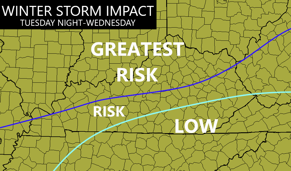
That doesn’t mean the rest of the state gets shut out. I expect snow to wrap around into the entire state Wednesday night and Thursday with snow showers into early Friday. This part of the system looks like a 1″-3″ snowfall for many.
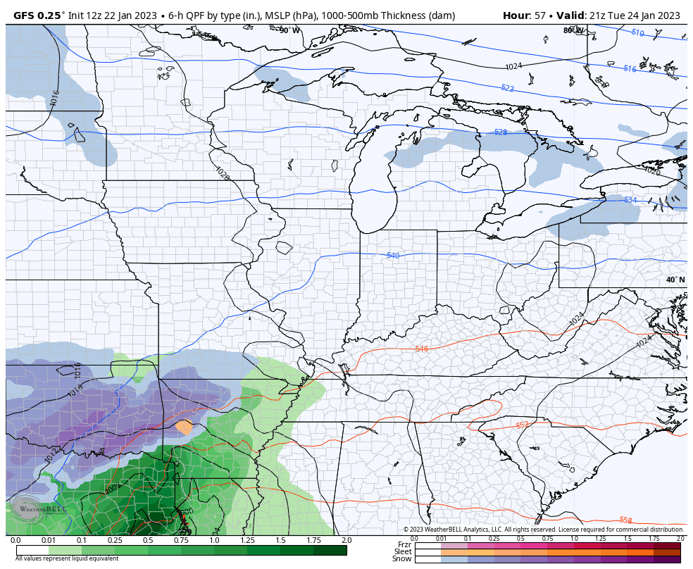
You can see the entire evolution of this storm on the GFS…
I will have another update later today. Have a good one and take care.

Don’t know if it’s the case this morning, but I’ve seen these “surprise” snows in KY / Cincinnati before. A light mix of Rain / Snow is forecast then a pocket of cold air settles in the Miami and Ohio valleys and we get all snow. Models still don’t pick up on this for some reason.
That next week snow needs go south for ky gets the bulls eye of the storm.
Thanks Chris, Really beautiful Snow photos. I always like and enjoyed the late heavy wet Snowstorms the best. Brings back memories of making Snowmen and fun Snowball fights after school. I still believe our chances for an accumulating heavy Snowstorm here in Maple this Winter is slim to none. Thanks for sharing the beautiful Snow photos.
I prefer a windless gentle snowfall with temps. in the upper 20s. I like my snow martini dry. Lol.
We need a like button
Unfortunately, the southeast ridge will keep it mostly rain here in central KY. Wraparound snows will be pretty though but light. With that southeast ridge in place, i don’t see much in the way of winter storms here other than wrap-around snows. Maybe next year.
Sometimes the Southeast Ridge will keep the rain away too. This happened in the 1987 to 1990 drought. This years Southeast Ridge is just as large as the one in the late eighties. Hoping it breaks down before the growing season begins, but NOAA predicts there is no grantee that will occur as we enter ENSO / neutral.
Never thought I’d live to see the day when it dumps snow a few hours away in Kentucky but doesn’t do anything but rain here in West Virginia. Everything is all messed up now. Somehow our climate has become more like we’re part of the Deep South and it’s just warm, rainy and humid all the time. I hate it. That isn’t normal for these parts 🙁
Welcome to the new normal I’m sorry to say
I believe in Climate Cycles not the New Normal. Nothing to base this theory on. Man hasn’t been on Earth long enough to make this a*s*sumption. Major Snows are rare in Kentucky, but they do occur. Our last major Snowstorm here in Maple was in 2015 during an El Nino Winter. We have not had a major Snow event since then. May be that the Pacific Decadal Oscillation is in the negative phase. If you are a Snow Lover one would want the Pacific Decadal Oscillation in the positive phase. Widespread Snowstorms ( here in the East ) would be more common then.