Good evening and Who Dey!! Our messy Sunday is about to turn into a flake filled Monday as a light snow maker rolls in from the northwest. This is ahead of a winter storm likely to impact the region with snow and a mix from Tuesday night through Thursday.
Let’s focus on the light snow tonight and Monday. This isn’t much and may also be accompanied by some freezing drizzle in a few spots. Here’s the areas most likely to see some light accumulations through tomorrow…

This may cause some delays on Monday, especially in the east.
Here are your radars to follow along with what’s falling for the rest of the evening…

No changes to the winter storm impact map for Tuesday night and Wednesday…
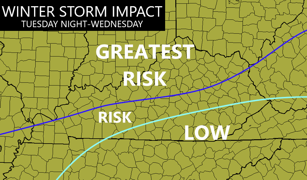
I will likely go with a Winter Storm Threat later tonight.
Keep in mind, that map is for the initial part of the storm. Wraparound snows will be likely from Wednesday night through Thursday with snow showers into Friday. Accumulations are likely with this wraparound stuff.
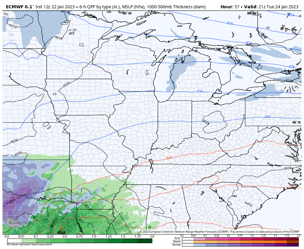
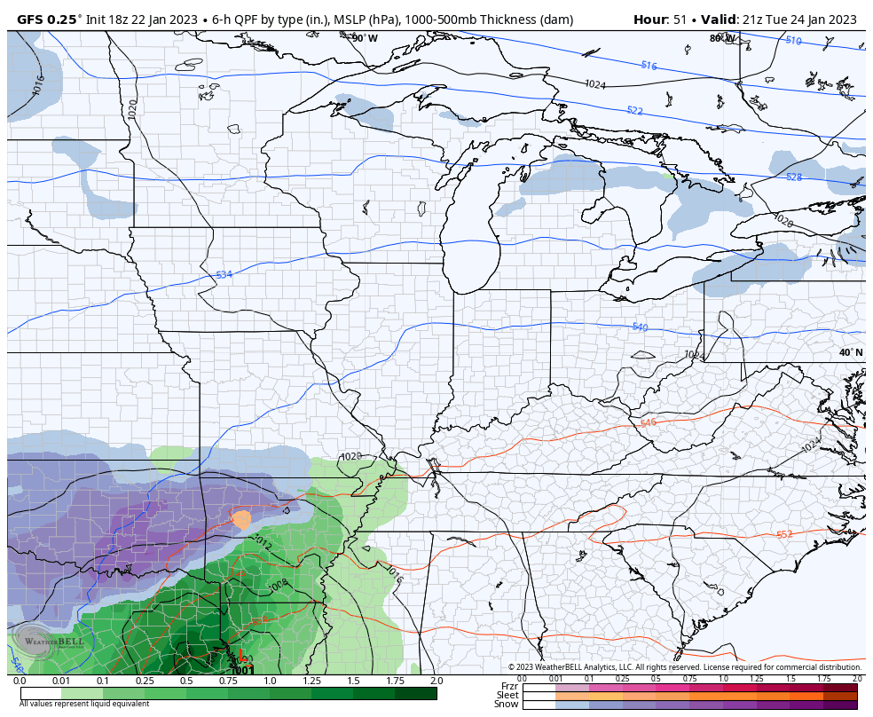
The EURO and GFS are fairly close to one another and close to my map…
EURO
GFS
The average of the 30 members of the GFS Ensembles for the week ahead…
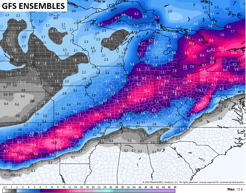
Here are the individual members that make up the above map…
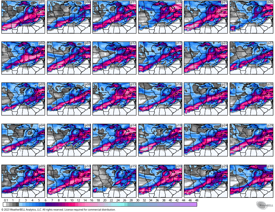
Most are targeting my greatest risk area for the best snow threat from the actual winter storm.
Enjoy the rest of the evening and take care.

Hopefully WKY gets a big piece of the action…
I keep hearing of this southeast ridge…..I’m so confused with that….because we apparently have a southeast ridge in place and yet they had rains throughout GA… SC… NC…. I guess I’m confused because where there’s a ridge it shouldn’t be raining, right?
Mark, Good question I can’t answer. All I know is this ridge has kept Winter weather out of our area for more than 9 years going and it’s strength is amplified by La Nina.
That’s for sure Schroeder something has. Wasn’t it though about 7 years maybe 10 I can’t remember when we got plummeted with snow the big one?? Oh wow it was something to see.As a kid I remember the big snows we had! I don’t remember us wondering is it going to be rain or snow or talk of a fence. Oh well times have changed and for snow lovers not for the better but what can you do???? Is it me or does it seem the snow has moved even farther north????
Crystal, its the phase we are in. I’m hoping it will change before next Fall and Winter.
Mark, the Southeast Ridge has to do more with Temperature than precipitation.
We had three record snows in one year, about eight years ago. Not much since then. I joked back them we probably had our share of big snow for at least tend years. All we got big after that was ice.
then, ten