Good Monday, everyone. Light snow and snow showers are pushing across the region today, putting down light accumulations for some. The focus, though, is on a developing winter storm that targets the region Tuesday night through Thursday.
Before we get to the big system, let’s begin with the light stuff out there today.
Rounds of light snow and snow showers will be noted across central and eastern Kentucky. Pockets of freezing drizzle may also show up, especially early. Some light sticking snow will be possible in these areas with the greatest chance for an inch or so of snow being in the high mountains of the southeast.
With temps around the freezing mark, a few slick spots can’t be ruled out. Here are your radars to follow today’s flakes…

Let’s get to the heart of the weather matter and that’s the mid-week system.
I’m still watching the same area as before for the greatest possible impact…
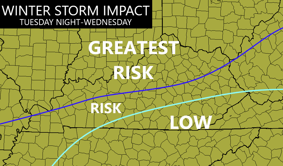
You can see how I’m highlighting the northern and western parts of the state for the greatest risk of decent snows.
Here’s a breakdown of how things may play out:
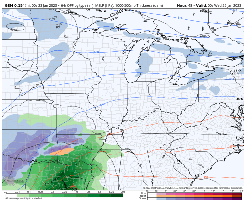
- This is a far-reaching storm that will impact areas from Texas to New England.
- Rain and snow move into Kentucky Tuesday night.
- A heavy band of snow will likely impact areas of the north and west. This takes us into Wednesday morning.
- This band of snow can be a thumper of a wet snowfall for a few hours.
- Areas across the south and southeast are mainly rain.
- The actual low pressure looks to move across Kentucky on Wednesday, with a switch to rain for a few hours.
- As the low goes by, cold air quickly rushes back in with wraparound light snows developing Wednesday evening.
- A healthy wraparound light snow event then looks likely for most of the state Wednesday night and Thursday.
- Snow showers would linger into Friday.
- Snowfall from Wednesday night through Friday could be on the tune of 1″-3″ for many.
- I expect some snow days later this week.
The models are in pretty good agreement on how everything plays out…
GFS

CANADIAN
EURO

I’ll throw you updates later today. Have a good one and take care.

Thanks CB. Looks like the trend of the Canadian and GFS are more north now. Euro seems only KY friend for snow fans.
Another Ohio River Valley event.
Sloppy wet snow.
Beggars can’t be choosy.
This snow forecast is not what we usually get in January not very much cold air is coming with it. Besides what we had in December it been a dud winter that warm air is beating the cold air out.
Those areas that got the beautiful Snowfall yesterday will see another beautiful Snowfall Tuesday and Wednesday. South Central Kentucky will likely have another depressing period cold rain / showers. Wrap around Snow showers never amount to anything.
As usual, another potential snowstorm will turn out to be a nothingburger for South Central Kentucky. It’s what I’ve come to expect out of this front-loaded, La Niña dominated Winter.
The most recent ENSO discussion is forecasting an 82% likelihood that we will transition to ENSO-Neutral in the February – April time frame, which is welcome news, although it has the potential to amp up our Spring severe weather season.
Already Winter Storm Watches are out for parts of Illinois and Indiana. The Snow’s swath has trended farther north than this past Sunday’s Snowstorm. The Southeast Ridge has push the storm’s track farther north and west once again, but that may change. Always that possibility.
ENSO- neutral means there is no longer any reaction taking place between the Pacific and the Atmosphere. The weather may be even more unpredictable. Not good with severe weather season coming soon.
Has anyone checked out the two main teleconnections lately ? Both the AO and NAO are reading neutral to weakly positive. Might mean that Spring is here, with late Spring freezes a possibility. Don’t know about that.
My bold prediction : the Ground Hog will not see his shadow on February 2nd. 2023. # teamspring