Good evening, folks. It’s all eyes on a winter storm working from Texas to New England and it’s going to impact our weather. Rain and snow are on the way to the region as we continue to see this pattern going more and more toward winter.
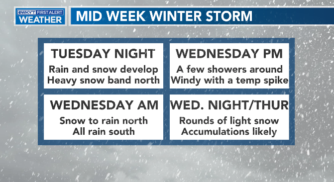
Here’s a quick breakdown of what I’m expecting in terms of this system…
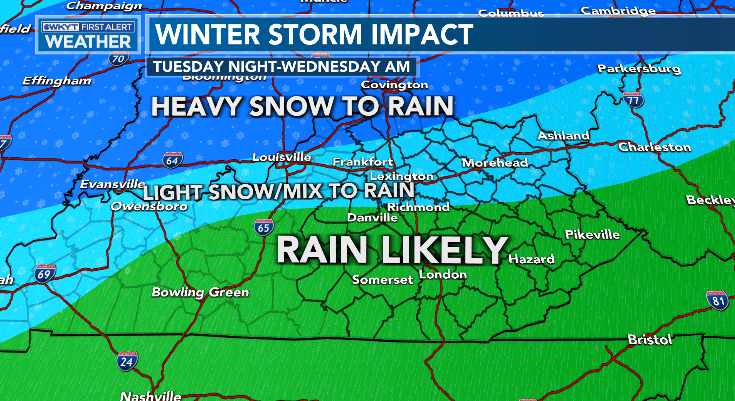
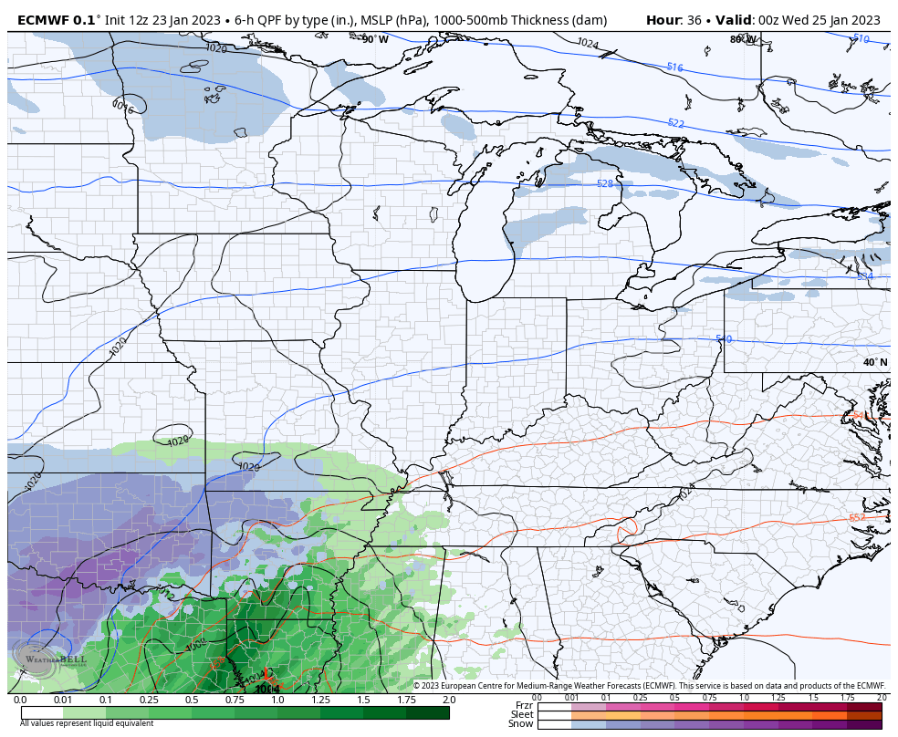
Here’s the map on the initial part of the storm Tuesday night and Wednesday morning…
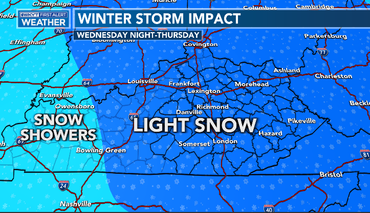
That goes over to all rain as we get into Wednesday with a nice temp spike. Once the low goes by to our northeast, cold air quickly returns with periods of light snow through Thursday…
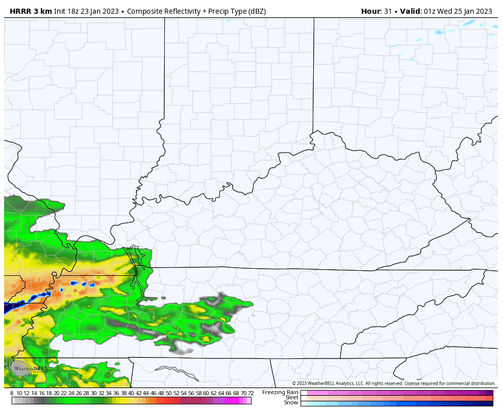
The future radar from the HRRR continues to show a healthier band of snow in the northern half of the state before the rain takes over…
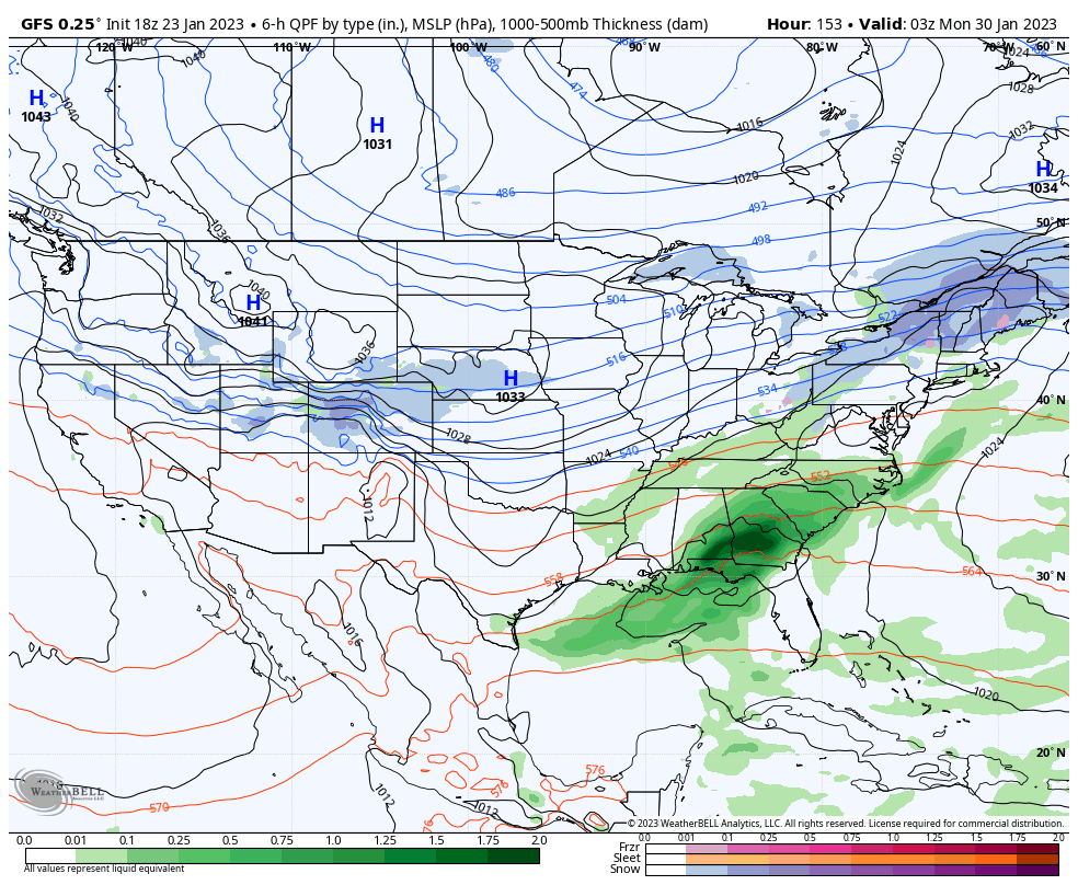
The EURO and GFS are also showing that band of snow before the rain, with some nice wraparound…
EURO
GFS

I’ll get a First Call For Snowfall map on the first part of the storm later tonight.
Not to be lost in the shuffle continues to be the east and southeast progression of the overall storm track as cold air gets set to really settle into much of the country. That storm track continues to get pushed to our east in the extended…
Enjoy the evening and take care.

Looking at global temperature/pressure maps shows a very large dome of extremely cold air sitting over Siberia. If a stretched Polar Vortex develops (and that’s a BIG IF!), it could pull frigid air into East Asia, and eventually into Eastern North America. Stay tuned…
The Arctic Oscillation (AO) is currently negative and is predicted to trend positive over the next two weeks. The North Atlantic Oscillation (NAO) is currently positive and is predicted to straddle neutral the next two weeks as pressure/geopotential height anomalies are currently mostly negative but are predicted to remain mostly mixed across Greenland the next two weeks. The La Niña that has stuck around for 3 years may finally be taking the hint, as the CPC has forecasted an 82% chance that we’ll finally see an ENSO-Neutral condition in the March/April time frame. However that time frame coincides with the start of our severe weather season, so this condition shift could signal an increase in the intensity of severe weather during that period.
Hopefully it won’t!
Looks like my home town in Indiana is going to receive another heavy wet Snow. When I was growing up we would have a lot of these Snow events mostly in February and March. The largest was in March 1960 when we receive up to 3 feet of Snow. The good packing kind. Lots of Snowmen, Snow forts and Snow tunnels were built all over town. The sledding was great !
In my local forecast a warm front will past to the North of us. Maybe some rain ahead of the warm front, then a dry slot followed by a short period of Snow flurries. I concluded today that we are just to far South for any of those beautiful heavy Snowstorm. Never seen one here in South Central Kentucky ever in the 15 years I been living here. All we had this Winter was frigid Arctic air with very little Snow at Christmas that manage to destroy the one Rhododendron I had in my yard. Was looking forward to the bloom this Spring. # teamspring
Schroeder I spoke to my sister in the Greenwood Indiana area her current forecast says they possibly could get as much as 10 inches that’s the latest forecast I am jealous lol.