Good afternoon, everyone. It’s all eyes on a developing winter storm set to target the region tonight and Wednesday. This will impact areas along the Ohio River and into northern Kentucky and be followed by rain, then more light snow.
A Winter Weather Advisory is out for north central Kentucky tonight and early Wednesday…
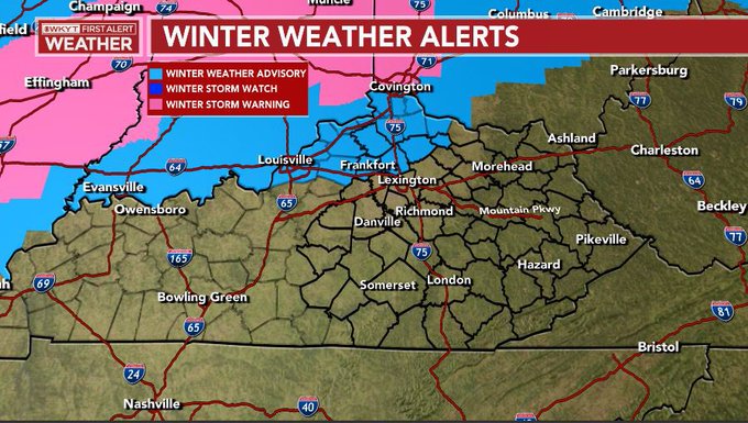
Some counties along the Ohio River to the southwest of that may have to be added. I also wouldn’t be surprised to see far northern Kentucky upgraded to a Winter Storm Warning.
I’m rolling with the forecast I already have out…
Obviously, I will freshen that up later today.
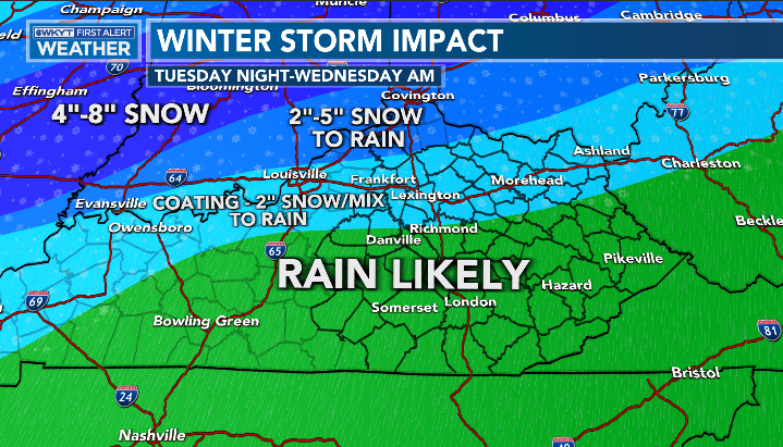
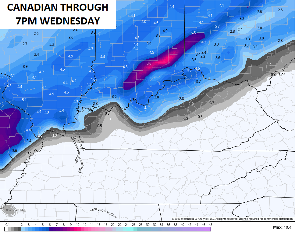
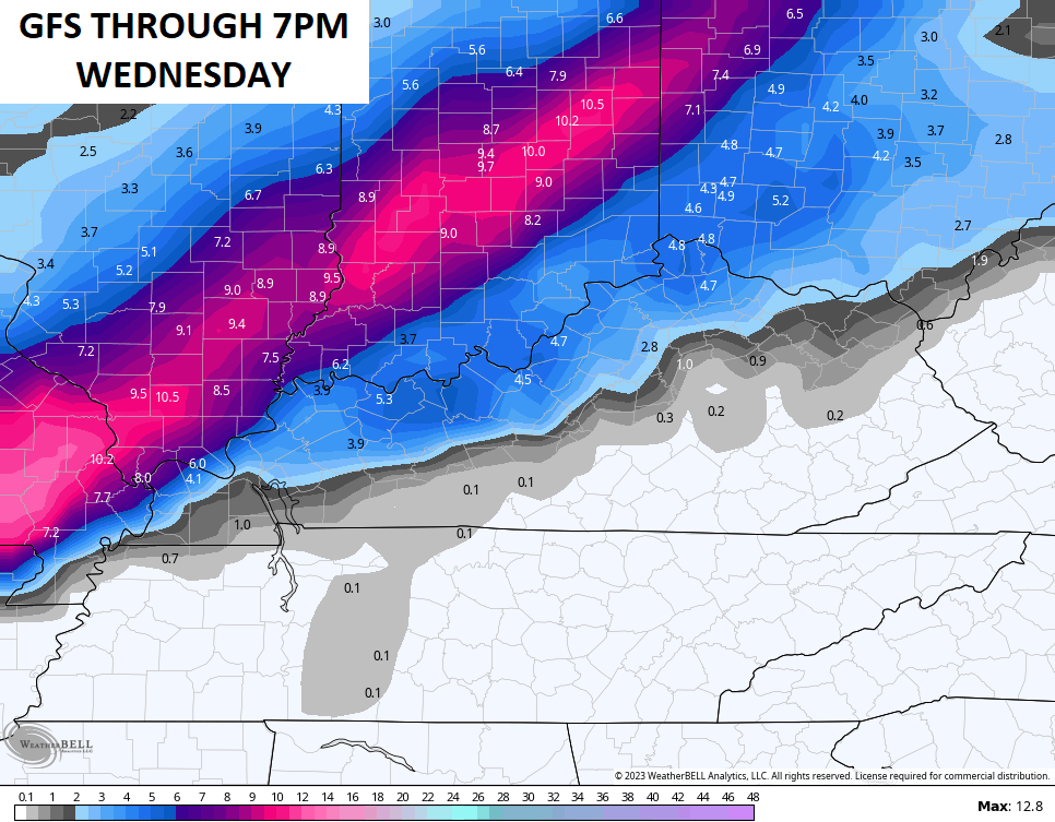
Some of the models continue to hit the chance for accumulating snow a bit farther south than my forecast…
Everyone sees rain quickly take over early Wednesday, so areas that do get some overnight snow may have that washed away fairly quickly.
Once the low goes by to the northeast, wraparound light snow kicks in Wednesday night and goes through Thursday night…
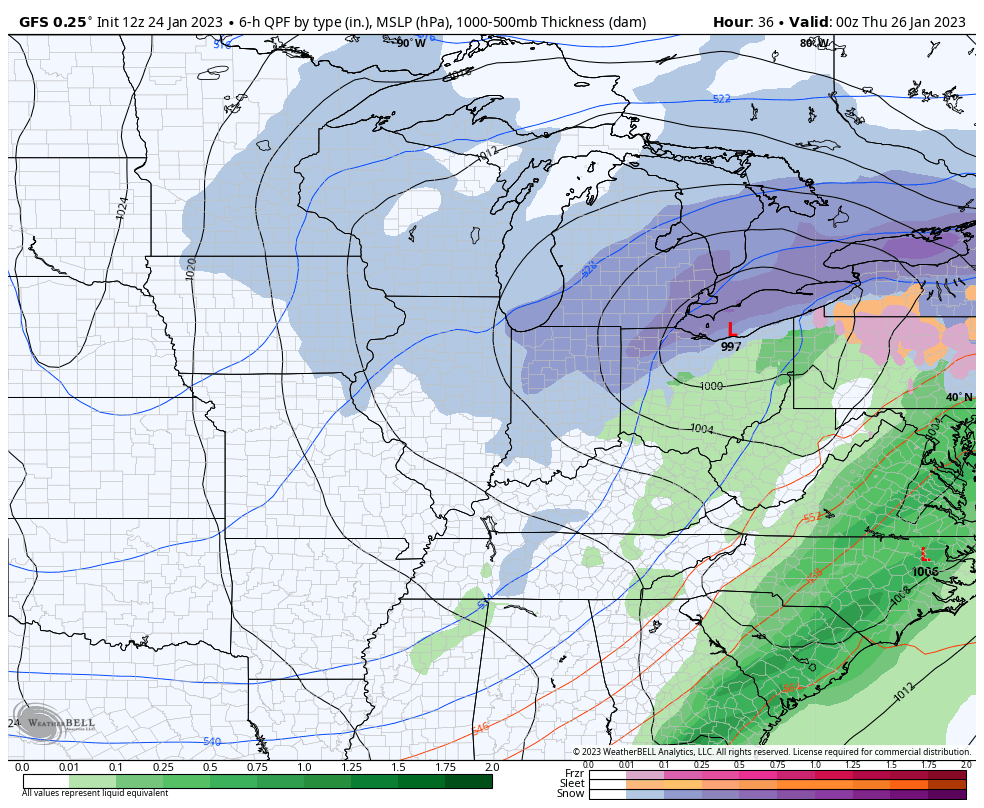
That’s when we see light accumulations across the entire region and likely see snow days showing up.
I will have the latest on WKYT-TV starting at 4pm and with another update on KWC this evening. Until then, here are your radars to track the system in from the southwest…

Enjoy the afternoon and take care.

Snow is playing “hard to get.” What a tease.
All I got out of this pursuit was a few Festive Flakes.
Two to three inches of snow is on tap for the Chicago area from late tonight through tomorrow, which would make this possibly the biggest snowfall of the season here. Winter Weather Advisories are in effect for the SW and South Suburbs of Chicago.
Thank goodness the pattern is finally going to change to much colder and snowier to end January and begin February.
Mike, we have had absolutely no Snow here in South Central Kentucky. I think that’s normal for our area. I’m not a native of Kentucky, but I been living here about 15 years and went through one of the worse Ice Storms in 2009 and one 10 inch Snowstorm in 2015. Pretty pathetic compared to where I was raised in South Central Indiana. Up to the North of my county of Taylor the NWS issued a Winter Weather Advisory for Snow tonight changing to rain tomorrow morning. How sad is that for Wintertime. I remember seeing forecast in the past saying ” rain changing to Snow and becoming heavy after midnight. ” Next morning there would be at least 8 inches of Snow on the ground. The climate hasn’t changed just my location has change, but I’m beginning to get use to the Winters here in Kentucky.