Good afternoon, everyone. We have a wet weather maker rolling into the region tonight and Sunday, and this is ahead of a series of systems set to bring winter weather in here next week. This happens as a cold front stalls near the region.
Rain will arrive in western Kentucky during the evening and then overspreads the rest of the state tonight and Sunday. Heavy rains are a good bet for some with up to 1″ of rain falling, especially in central and eastern Kentucky.
Here are your radars to track the developing showers in the west…

Temps are in the 50s ahead of the rains with a mix of sun and clouds. Get out there and enjoy the day.
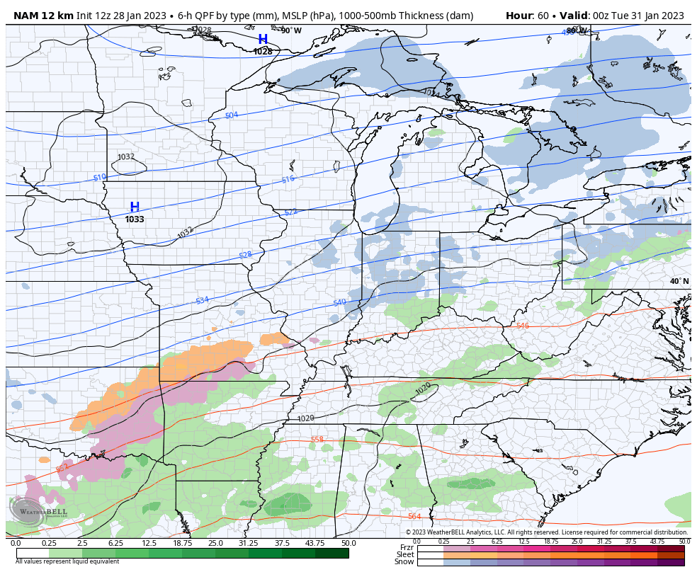
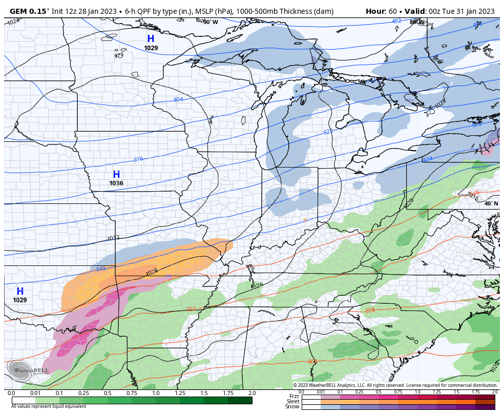
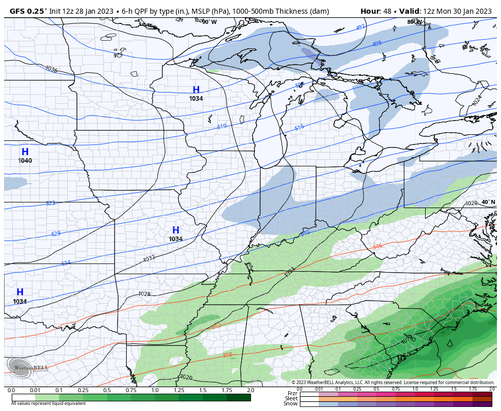
The setup for next week features that boundary hanging around with waves of low pressure developing along it. This can mean all modes of precipitation are possible at times during the week, but it’s difficult to pinpoint exactly when any one area gets hit by anything.
So far, the models are only showing some light stuff.
Here’s the NAM through 7pm Tuesday…
The Canadian for the week…
And the GFS for the week…
Enjoy the afternoon and take care.

Go GFS.
RIP winter system again.
Looks like another bust right now.
Never expect much Snow when we have a La Nina Winter. Ice storms may happen, but I hope not like we had in 2009. If we would happen to phase into an ENSO / El Nino our chances for a major Snowstorm increases state wide. NOAA, however has low confidence of this happening anytime soon. Looks more like ENSO / neutral which means the climate could go either way.
I heard this morning that New York City has had a Winter without any Snowfall accumulations to report. First time in meteorological history. We are not the only place that this has happen. Buffalo, NY. had the best Snowfall off the Lakes. Recorded over 5 feet of Snow accumulation.
I’m concerned about what kind of Spring and Summer growing season we will have. We certainly had an uneventful Winter so far ( understatement ) A late freeze this Spring. Severe weather for sure will occur somewhere, and a possible drought and heat wave this Summer. I hope not !!!