Good evening, everyone. We have rain rolling across the region, setting the stage for a soggy Sunday across Kentucky. This will be followed by a wintry setup that may include a few rounds of rain, snow, sleet and freezing rain next week.
My time is rather limited, so let’s start things out with your radars to follow the rain from west to east…

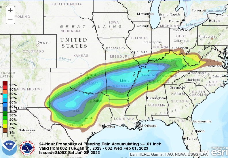
I have no changes to the pattern for next week. A stalled boundary will produce waves of low pressure rolling along it, putting us in the wintry setup. The Weather Prediction Center is already highlighting the region for some freezing rain accumulation late Monday into Tuesday…
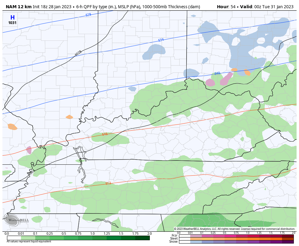
The NAM is the most threatening of the models right now. This animation is for Monday night through Tuesday…
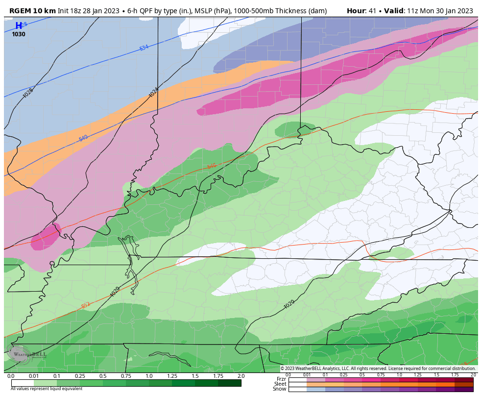
The Shor Range Canadian has a similar look, with lighter precipitation…
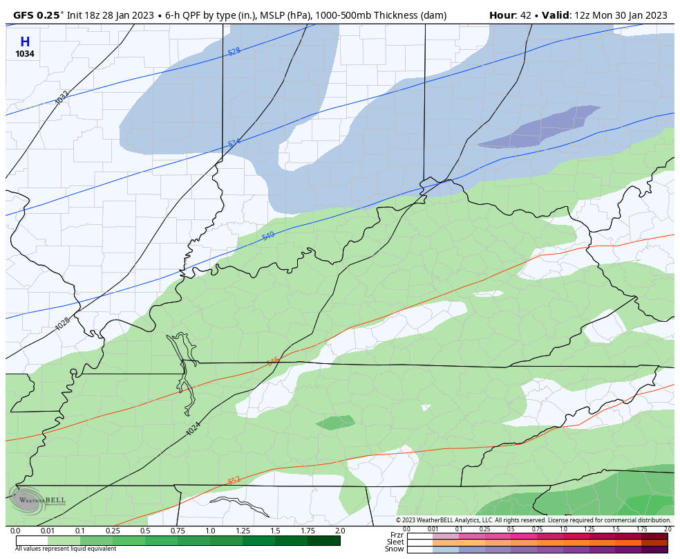
The GFS seems to be on its own with the look for the entire week…
I’ll see you guys back here tonight for the main update. Have a good one and take care.

I’m hoping this mess turns to all rain sometime Tuesday and then maybe some Snow showers on Wednesday and then the rest of the week turns mild and dry. #teamspring
Im on #TeamGFS for once… Always #TeamSpring
Wimpy winter that made a deep fake in late December. LOL Hopefully cold rain rather ice.
Of greater concern to me now is the strengthening ENSO-Neutral condition, its potential to interact with the northeast ridge, and an increasing threat for severe weather,especially over the southern and western portions of our region.
Joe when you say severe are you talking heavy rain snow or ice because I don’t know much about ENSO??? I hope your recovering nicely. I am with Schroeder BubbaG and everyone else I hope no ice event.
Crystal, here’s ENSO explained by the NWS :
https://www.weather.gov/mhx/ensowhat