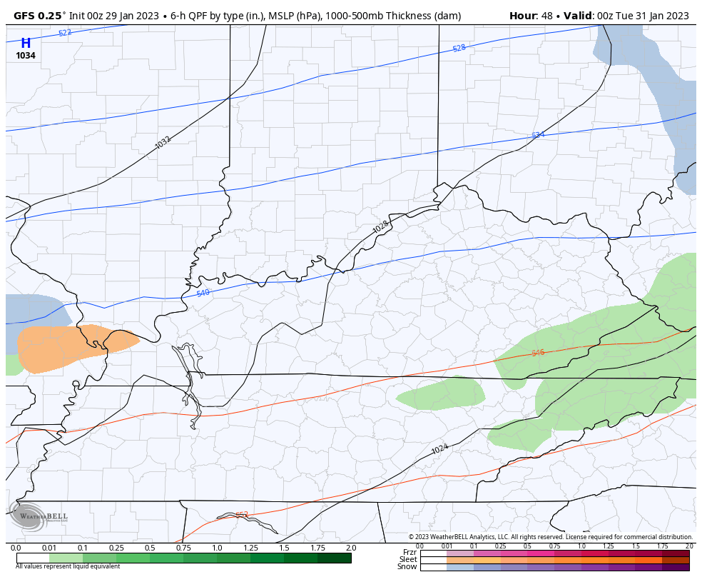
Good Sunday, everyone. Rounds of rain continue to push across Kentucky, giving us a very wet end to the weekend. The front responsible for today’s rain will then slow down and play a role in the winter threats for the week ahead.
Let’s start this out with the rain out there today. It’s locally heavy at times, especially early on before tapering to showers into the afternoon. Some areas may pick up a half to 1″ of rain through tonight.
Here are your rain tracking radars to keep you company…

The boundary pushing through here on Monday slowly brings much colder air in from northwest to southeast. At one point Monday, temps may range from the upper 20s north to the middle 50s south and southeast.
As that cold air continues to sink in from the northwest, we will see light overrunning precipitation showing up across the state. This means a combination of sleet, freezing rain and some snow will be possible as early as Monday night into Tuesday.
The NAM is the most aggressive with this first system. This animation starts at 7pm Monday and rolls through 7am Wednesday…
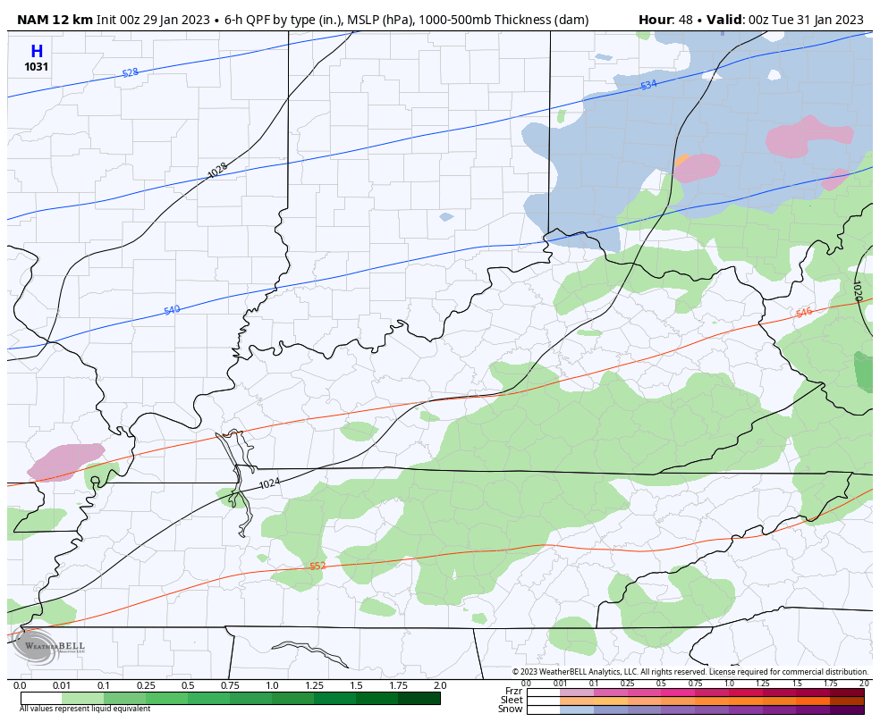
That would cause some issues.
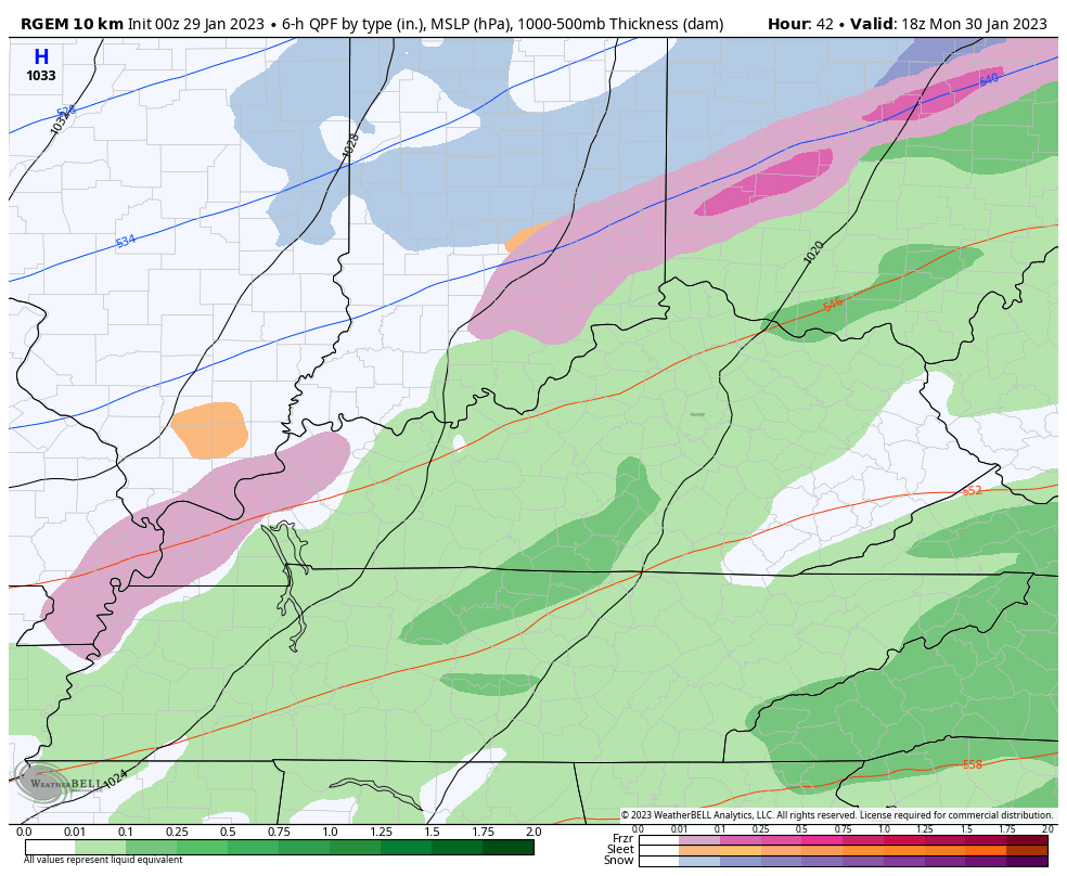
The Short Range Canadian has a similar theme, but with much lighter precipitation…
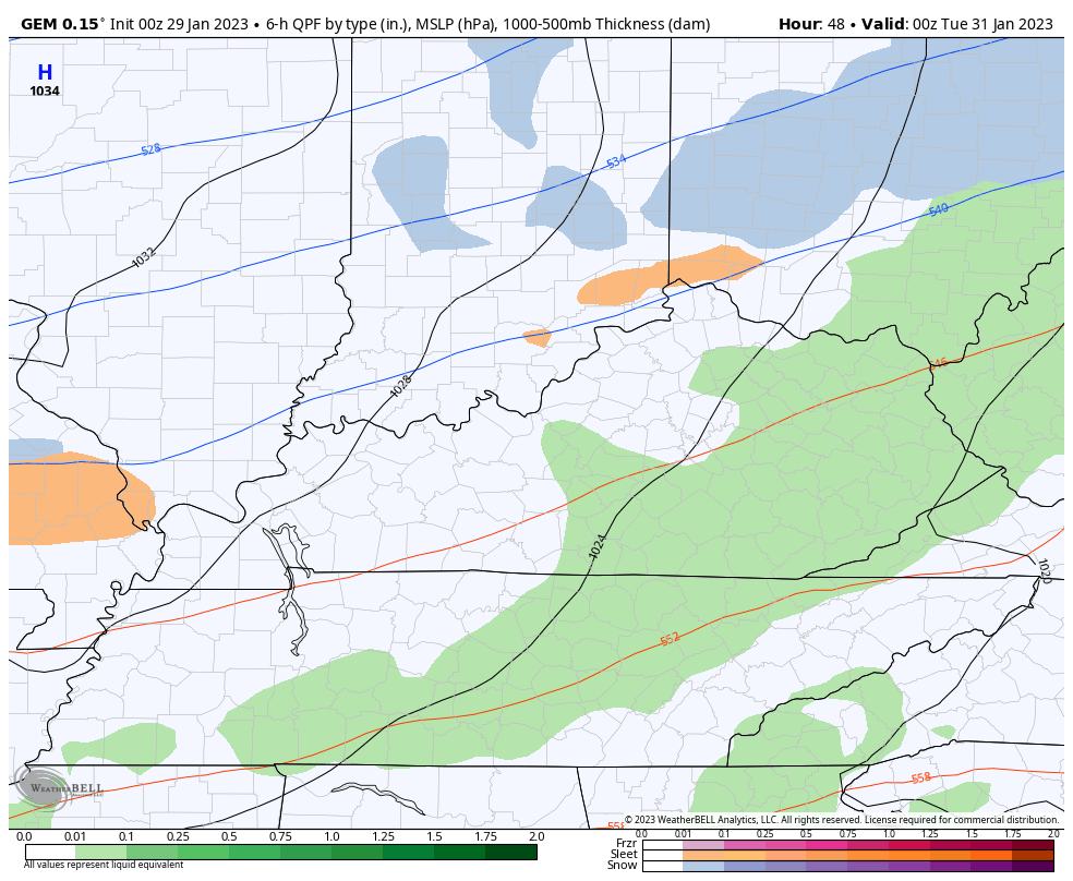
Here’s the full week from the Canadian. It keeps the late week system rather suppressed to the south…
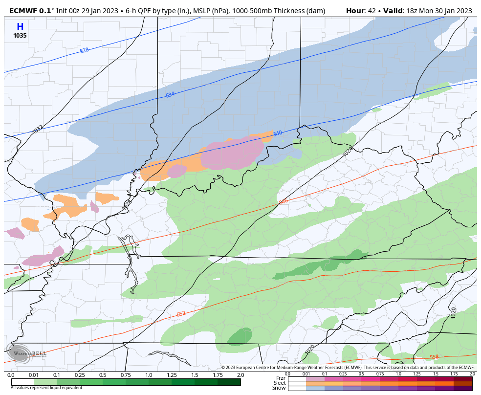
The EURO is lighter with the first system and is also suppressed with the late week system…
The GFS continues to be the odd model out with mostly light snow with the first system and rain and a little snow with the second system…
I will have updates through the day, so check back. Make it a good one and take care.

Looks like this will be one of those “hurry up and wait to see what it does” systems! Ugh! I hate the freezing rain possibilities! Anything but that! And the NAM shows my area possibly taking a big hit this time!
My area is an Ice Storm magnet, so I will prepare for the worst and hope for the best. Models were accurate before we had that terrible Ice Storm in 2009. Three days away the NWS issued an Ice Storm Warning and it let the areas that were going to be affected prepare for the event. Now it’s not that way. The models are useless.
No matter what happens it appears it’s going to be another gloomy week ahead.
Late December was the ultimate winter fake shot. Turns out that might have been the main winter. As long as there is no big ice, that conjecture works for me.
I went from big snow aspirations to just being happy if there is no big ice. The trends lower expectations
Lake week storm suppressed to the south… with a southeast ridge in place??
Mark, I found that the Southeast Ridge has weak areas where the warm air rises to condensate which results in precipitation in those areas where that occurs. That processes occurs is like isolated thundershowers during the Summer months.
As the Southeast Ridge moves further away the storms move to our south and when it moves back towards the Ohio Valley it pushes the coldest air and precipitation back to the north and west.
We are a legit fence zone, so snowy winter influenced events tend to go above or below us. To get past the irony, a lot of meteorological stars have to align for good or big snows for a lot of KY.
The Southeast Ridge is a cruel game Mother Nature plays with Snow Lovers.
LOL…. Yes it is…
Bitter cold has returned for many areas West of the Mississippi River. It’s 26 below zero this morning in International Falls, Minnesota. Even further south in Minneapolis, it’s 5 below zero. Several states have temperatures below zero.
Here in the Chicago area, it’s in the low 20s and will slowly fall throughout the day.
Here is the summary regarding Saturday’s winter weather event for the Chicago area. The heavy snow, from 5 to 8 inches, was confined to areas near the Wisconsin border. Freezing rain and much lighter snow occurred in the SW and Southern Suburbs, creating light icing and dangerous travel. https://weather.gov/lot/2023jan28
Mike, Nice Snowy Landscape photo in Grayslake ( Lake county. ) Thanks for sharing. Winter has definitely returned to the Northern States. The phasing of the Polar jet with the Pacific jet may bring your area a lot of Snow in the coming days. My sister who lives just a few miles Southeast of Chicago received around 4 to 6 inches of Snow last week. The kind of Snow one may build a Snowman in.
You also have the greatest arcade in the world at the Galloping Ghost. I hope to go there sometime this year.