Good Monday to one and all. A cold front is slowly crossing the state today and it’s about to unleash a healthy round of winter weather. We have light snow, sleet and freezing rain all on the weather menu later today into Tuesday. Another round may follow that up.
Let’s kick things off with a look at what I’m expecting…
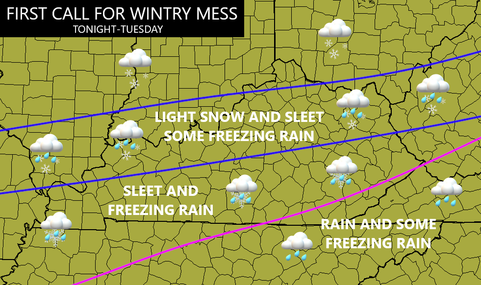
Exact numbers of each precipitation type is the challenge of the day because we are literally dealing with all modes of winter weather. One thing is certain, travel conditions will go downhill quickly later tonight and early Tuesday.
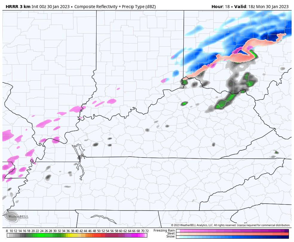
Here’s the mess of a system courtesy of the Future Radar from the HRRR. This animation goes from 1pm today through Noon Tuesday…
I will try to get more specific on amounts later today.
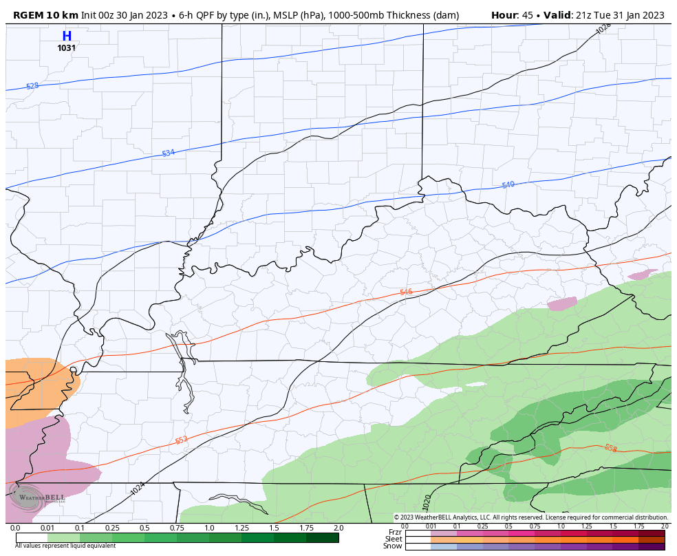
Another wintry mix may very well follow this up late Tuesday into early Wednesday. The Canadian models continue to be most aggressive with this…
The EURO is slowly catching up to this idea…
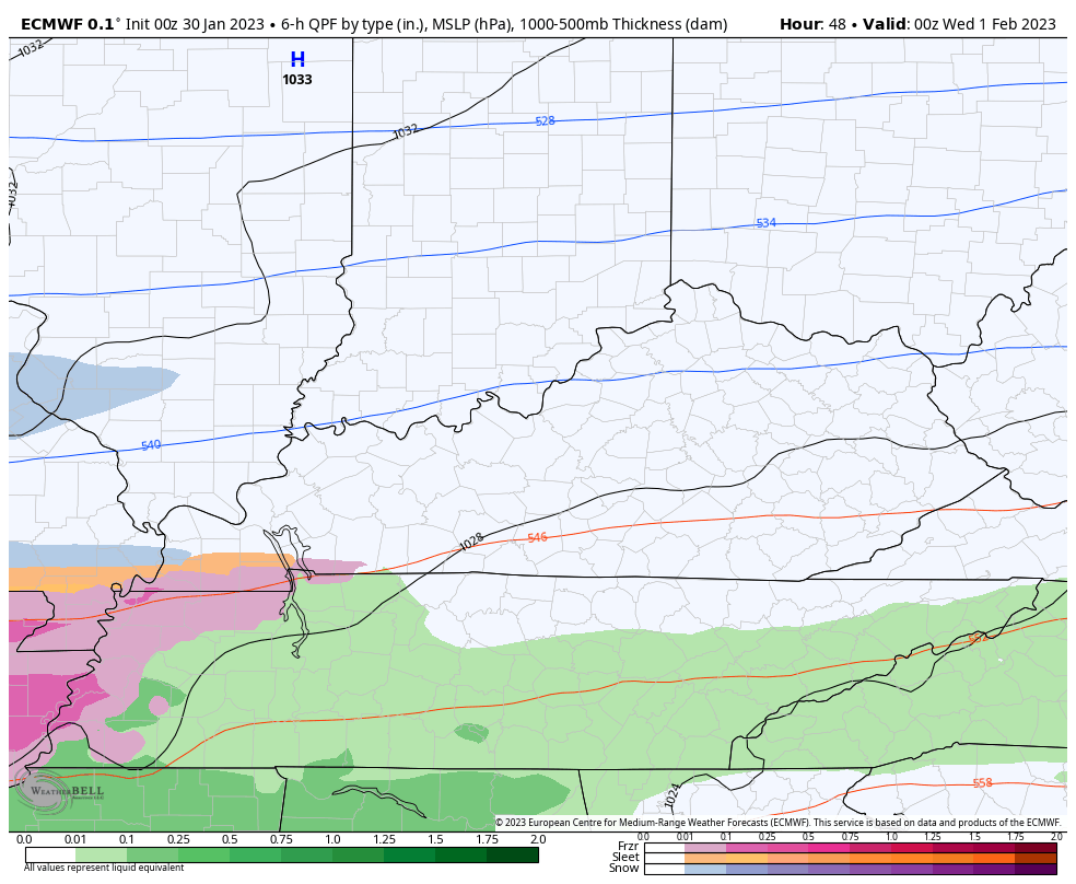
Again, that could be another mess maker for travelers to kick off the month of February.
I will have updates later today. Until then, here are your tracking tools to start things out…

Go to our weathercams page to check out the views from across the state…
Make it a great Monday and take care.

If the models are correct, my county of northern Taylor county is selected to have the Freezing rain. Any amount of Freezing rain will likely be a power knocker outer in my area. I went through this in 2009, but I was younger then. Don’t really know how I will come through this time around with the health issues I have ?
If the Power Companies would have just buried their lines after the last Ice Storm I wouldn’t be so concerned. Maybe the Ice accumulation won’t be much of an issue this time. It’s just an advisory and not a warning so far.
I’ll be thinking about you Schroeder. I hope this one isn’t anything like 2003 or 2009. I’m jumping on the team spring bandwagon so I think I’ll just go look at my garden catalogs and think about what to plant this year.
Thanks Dottie, I’ll will do the same.
Had freezing rain and sleet here in East Jefferson County. Schools are out and streets are glazed over.