Good afternoon, everyone. A nasty combination of winter precipitation is about to roll through Kentucky, causing issues along the way. Snow, sleet and freezing rain develop later this evening and carry us through early Tuesday. Another wave may follow that later in the day.
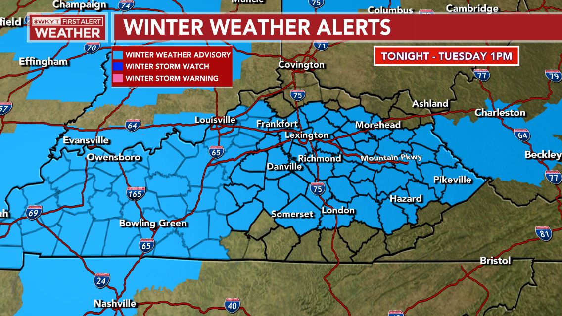
Let’s start with the Winter Weather Advisory that’s out for much of Kentucky. This has been expanding farther north, but it’s still not far enough north…
The NWS needs to retool the entire way they forecast and message winter weather situations.
With all modes of precipitation falling, it’s a tough call for specifics for any one location. Here’s a rough call for this mess…
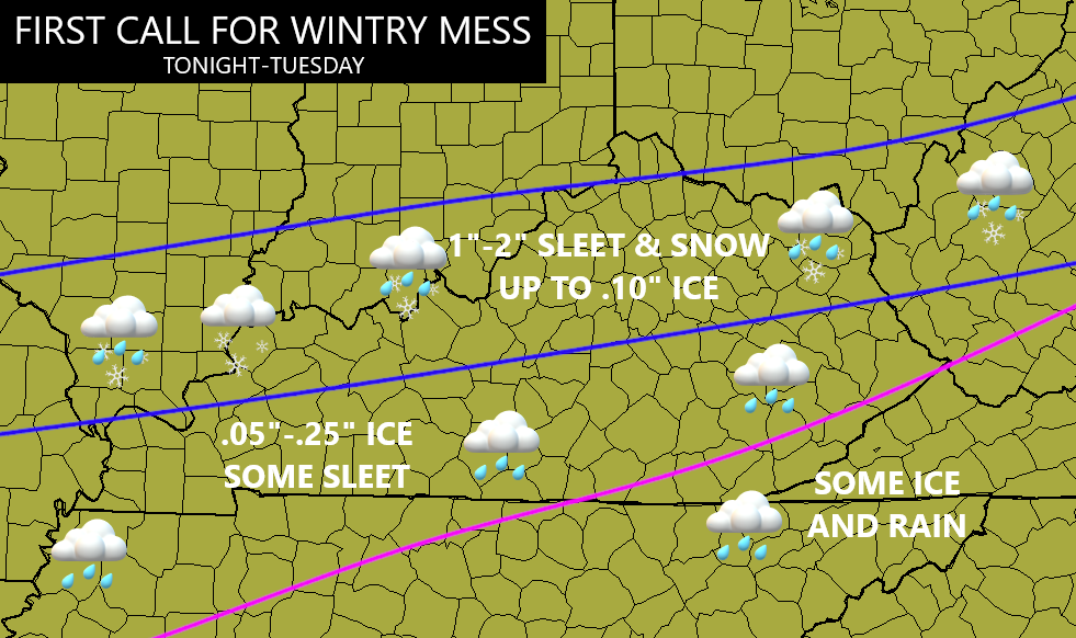
Again, those are rough estimates given the fact I’m trying to forecast totals of 3 different types of precipitation. 3 types that may actually fall at the same time in a few spots. 👀
Regardless, roads will become slick overnight into early Tuesday. Delays and cancellations are a good bet.
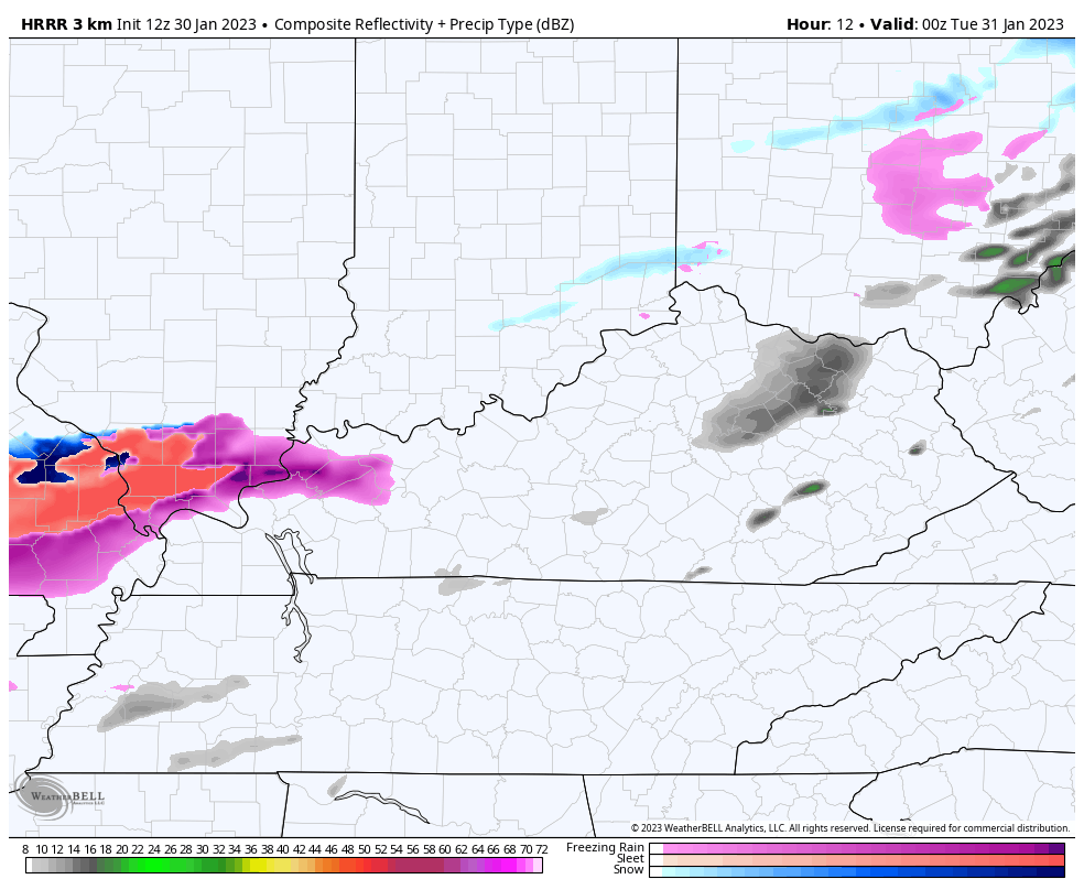
Here’s the Future Radar from the HRRR with this first wave of winter weather…
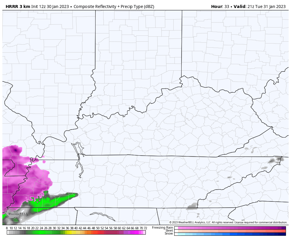
Another wave of light wintry weather is then likely to impact the southern half of the state late Tuesday into Tuesday night. Here’s the HRRR Future Radar with this wave of winter…
That will likely cause additional travel issues, leading to more delays and cancellations for some.
I’ll have the latest on WKYT-TV starting at 4pm and I’ll be back on KWC for another update later today. Until then, here are the tracking tools to help out…

Go to our weathercams page to check out the views from across the state…
Enjoy the rest of the day and take care.
