Good afternoon, everyone. Our first wave of a wintry mess is pulling out of the region as a lighter wintry weather maker rolls in. These focusses farther south than the what we had last night, and we have one more left in the tank for Thursday.
Freezing rain was a big player with the overnight and early morning system. Take a look at some of the pics and videos from my Twitter feed…
@NWSLouisville @Kentuckyweather @kymesonet 0.2" of glaze observed in east Frankfort this morning. Observed freezing rain at 2 AM, mixed with some sleet. #kywx pic.twitter.com/CMixIp5xNh
— Joel Thomas (@casualsocsci) January 31, 2023
Downed lines kept utility crews busybin Central, KY this morning. Video coming! @Kentuckyweather #kywx pic.twitter.com/2nWDPUC8Fa
— KY-WX Video (@KYphotog1) January 31, 2023
Nice ice picture. #Maysville @Kentuckyweather pic.twitter.com/qEAcPlA1VL
— Brian Young (@Brian_Maysville) January 31, 2023
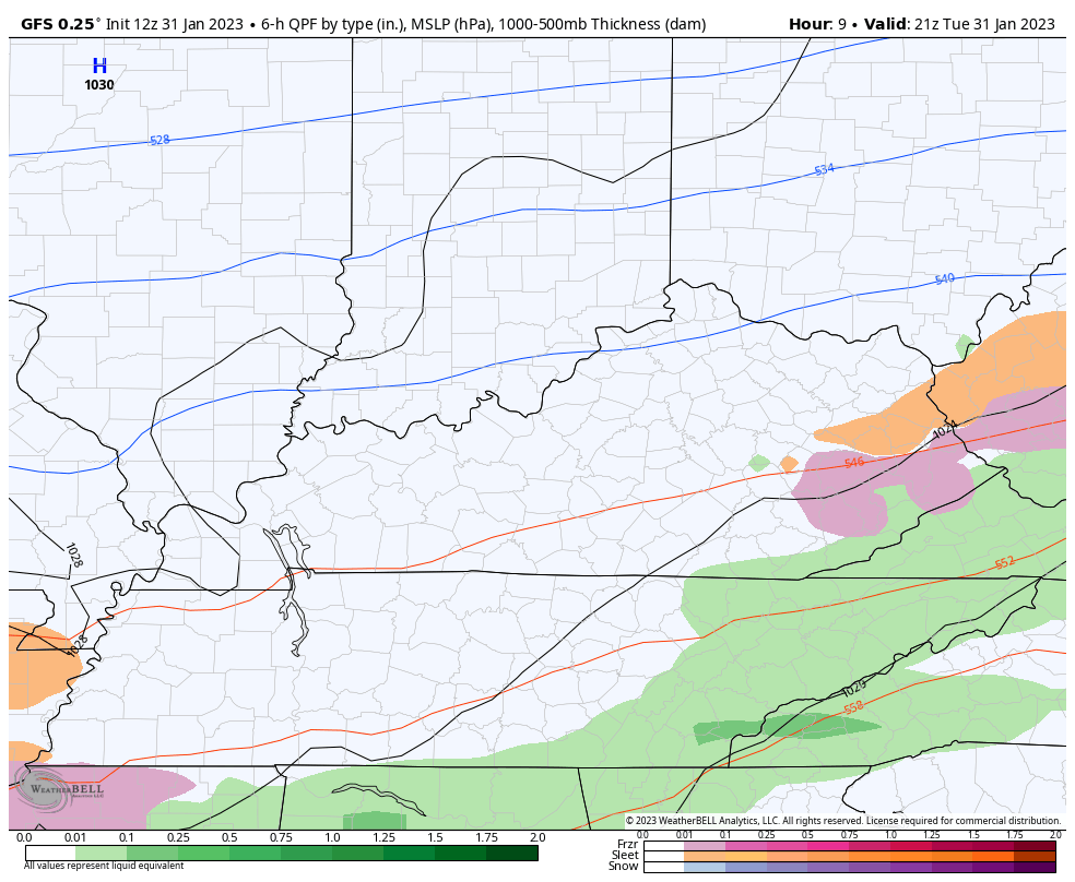
Temps remain cold this afternoon with our next system bringing a wintry mix into the southern half of the state this evening. Some of this may get as far north as the Interstate 64 corridor. This could lead to additional slick roads tonight and early tomorrow.
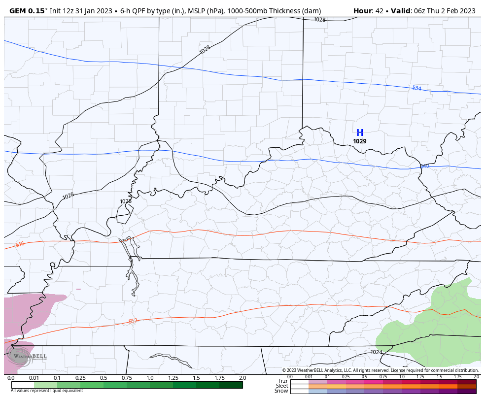
The system coming behind that is even farther south for Thursday. Here’s how the GFS plays these next two systems…
The Canadian Model has a much colder push of air behind the second system and even brings some lake effect snow showers on Friday…
I’ll have the latest on WKYT-TV starting at 4pm and then again on KWC later this evening. Here are your afternoon mix tracking tools…

Go to our weathercams page to check out the views from across the state…
Make it a good one and take care.

Blowtorch Feb. is about to begin *IF* the models are correct. Which is cool with me.
But there is a signal that temps. will drop below normal in March.
In my Indiana hometown our biggest Snowfalls occurred in March. I have yet to experience one of those late heavy Snows here in Central Kentucky, but there’s always the first time. One weather model is indicating 2.4 inches of Snow tomorrow here in Maple. WOW ! That’s a lot of Snow for Maple.
Those power failures could have been avoided if the electric lines were buried. Where’s the infrastructure improvements we were promised ?
More and more it appears that we’re experiencing a front-loaded Winter, which combined with the fact our 3 year long La Niña could portend the start of our severe weather season, since Spring ENSO-Neutral transition usually signals an uptick in severe weather. The progression to Neutral is evident in the most recent Sea Surface Temperature Anomaly chart:
https://www.ospo.noaa.gov/Products/ocean/sst/anomaly/
We had a little bit of Ice early this morning with no issues. I checked the latest forecast for our area and appears the worse weather is behind us. Joe, I kind of wonder if La Nina will dominate a 4th year ? A question I asked on the ENSO Blog. Haven’t received my answer or thoughts yet. The one domination that really stands out is the large expansion of the Southeast Ridge. This is very unusual for the Bermuda High to be this far west. This High pressure system was responsible for steering the Hurricane into Fort Myers, Florida and our mostly mild Winter. This High pressure shows no signs of dissipation at this time. I believe it’s being amplified by a negative Pacific Decadal Oscillation. ENSO- neutral has no reaction with the Atmosphere, but we still seem to have the severe weather threats. Here’s to a speedy recovery from your recent surgery.