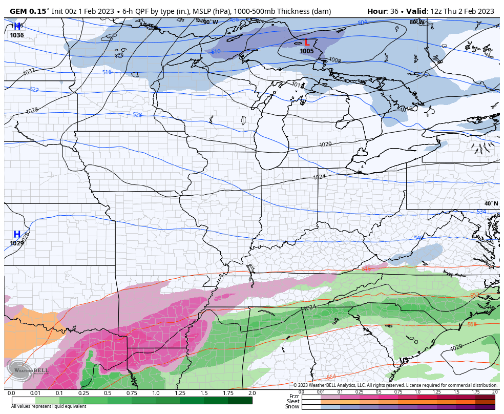
Good Wednesday to one and all. A light wintry mix is impacting parts of the state early on this first day of February and we have one more to go through on Thursday. Things calm down after that as our temps slowly start to recover into early next week.
This light mix is causing some slick travel again for parts of the region early today. The action winds down fairly quickly this morning with a mix of sun and clouds coming up by the afternoon. Temps will continue to be on the cold side with upper 20s and low 30s for many.
Here are your early day mix trackers…

Go to our weathercams page to check out the views from across the state…
The next system coming in here for tonight and tomorrow and, once again, this likely impacts the far southern areas of the state. Much of this will be pushed farther south into Tennessee as very cold air comes in from the north. This may even bring a few flakes into northern Kentucky from Lake Michigan on Friday…
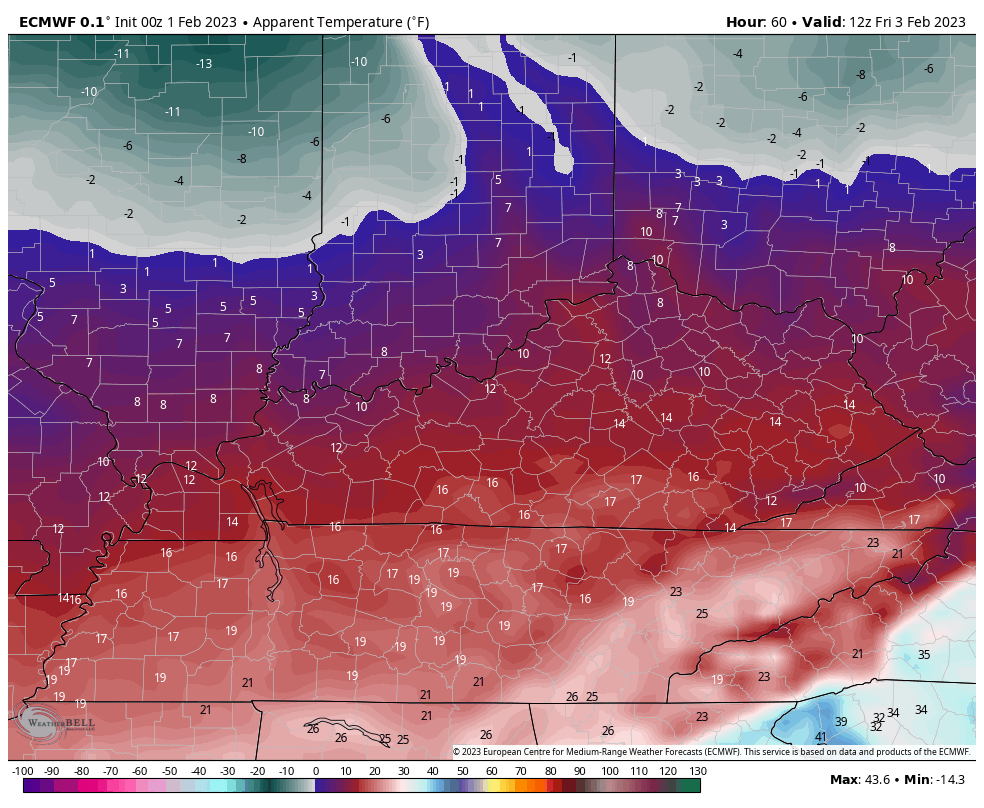
Windy and cold weather will be noted Friday into Saturday. Check out the wind chill numbers on the EURO from 7am Friday through 7am Saturday…
Temps rebound late weekend and early next week ahead of a rain maker arriving Tuesday or Wednesday of next week. That may be followed up a few more cold fronts later in the week.
The longer range looks much milder overall as we head into the middle of February…
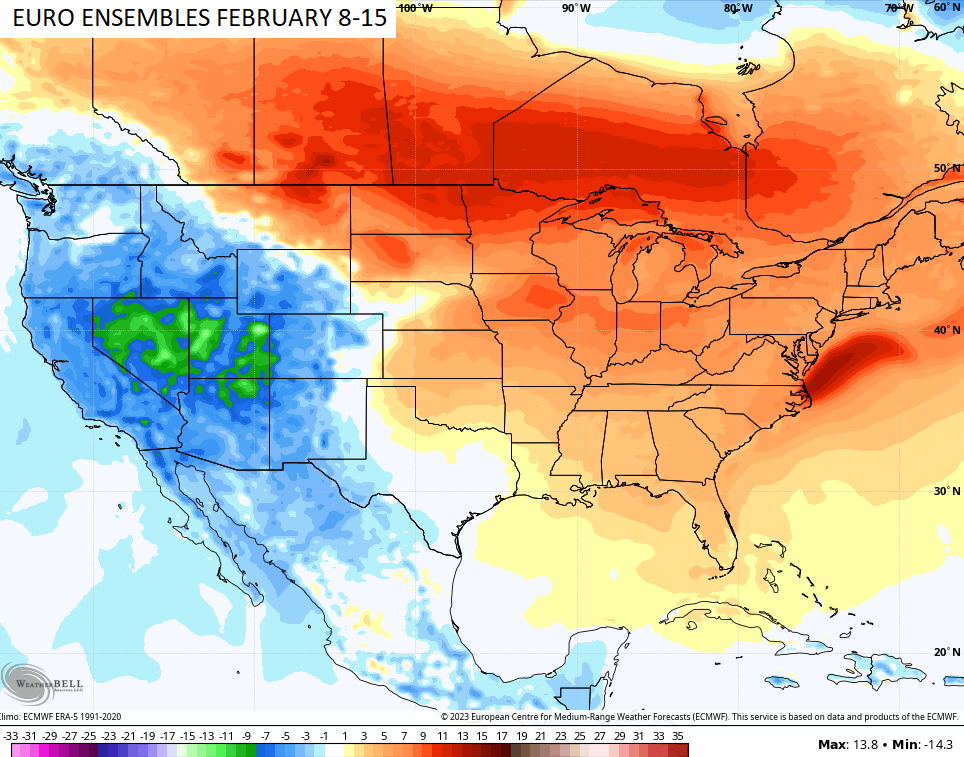
#TeamSpring is happy with that map. 🌼🌷
I will have updates later today. Have a great day and take care.

Well it looks like February will also be a no snow go. The winter has certainly been a disappointed to say the least for us snow lovers .(except the Christmas event). theres always a chance next year I suppose with el nino event forecast. I guess il join #teamspring too.
I am already thinking about my landscaping project. Although we could have a disappointing March.
After what this lousy Winter did to my Rhododendron buds. I plan on retiring Horticulture for good. I can’t walk very well let alone planting any landscape plants.
ENSO / El Nino is not yet forecast to form. Too early to determine according to NOAA.
Test
seems like this has been the year for the west in terms of cold/snow.. scrolling through Twitter I saw a long of complaining in the northeast…their NWS even posted years with least snow for the big cities. One entire winter (I think it was the winter of 72/73, Philadelphia got NO snow at all…well, there was a trace but that’s it
Mark, I know you must be getting tired of me talking about the Southeast Ridge, buts that’s why the Northeast coastal areas didn’t receive the Snowfall they normally receive. The Ohio Valley too.
LOL it’s OK…..And you’re right… that’s why! from what I’ve read tho…the southeast ridge can also cause snowstorms in our area…. it all depends on where it’s located, how strong it is at that moment, etc…So for snow lovers, the southeast ridge can be both a good and bad thing. That is, if I read what I read about it “correctly” lol
Exactly, it all depends where the High Pressure is located in the Atlantic.
Most of my comments on ENSO are blocked. WHY ?
Got information on ENSO through on my last post. This site doesn’t post comments to well.