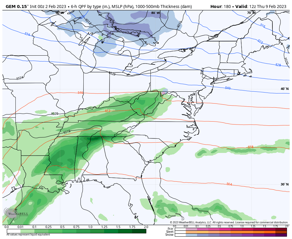
Good Thursday and Happy Groundhog Day! A southern winter storm is grazing far southern Kentucky early today as we focus on a blast of cold for the next couple of days. This will knock our wind chills way down and may even be accompanied by a few flakes on Friday.
This big southern winter storm is mainly impacting areas from Tennesse south and west. Some of that moisture is trying to get into our far southern Kentucky counties, but this looks fairly light. Your radars are tracking the close call…

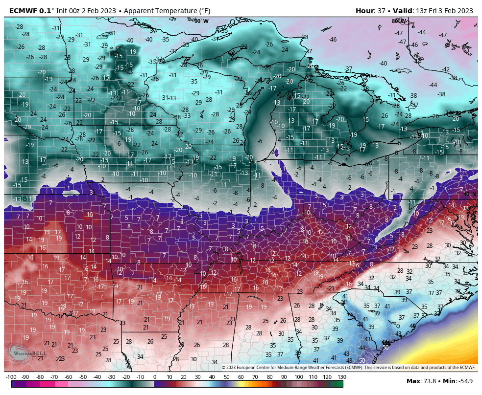
Much colder winds kick in tonight and Friday and those winds may even bring a few flurries or a snow shower into the area on Friday. The wind chills from Friday morning through Saturday morning will pack a bite, or should I say…
We are just on the cusp of some VERY cold air to the north of us. Look at the numbers from 7am Friday through 7am Saturday…
Winds will really crank late Saturday into Sunday morning. Gusts to 40mph will be possible…
Temps surge on this strong southwest wind into early next week. That’s ahead of a weak front that brings some showers in here for later Tuesday and Wednesday.
The operational models and various Ensembles are trying to bring a trough into the east late next week into the following weekend. That may bring our next winter potential with it…
I will have updates later today, until then…
Have a Happy Groundhog Day and take care.

Here is the link for the climate summary for the Chicago area for January. It was a very mild January, 7.1 degrees per day above normal, with below normal snowfall, 9.9 inches. https://weather.gov/lot/January2023
The month did not have a high temperature below 32 degrees until the 28th. Only three days averaged below normal (all in the final week), and the only below zero reading of -1 occurred on the last day of the month.
So far for the season, Chicago’s O’Hare Airport has received a meager 14.2 inches of snow, which is 7 inches below normal. The NWS Forecast Office in the SW Suburbs has received just 13.2 inches.
ahh hell with groundhog day, best thing is two and half men marathon on ifc.