Good Tuesday to one and all. We have a very windy and mild setup for the next few days as a powerful storm system rumbles in. This will be followed by a colder system to start the upcoming weekend and that may bring some flakes into the area.
Temps out there today are in the upper 50s to middle 60s across Kentucky. Winds will be a little gusty as clouds thicken ahead of a weak front dropping in from the northwest. This front won’t fully make its way through here, but it will get close enough to spawn a few showers in the north and west later today.
Here are your radars to follow along…

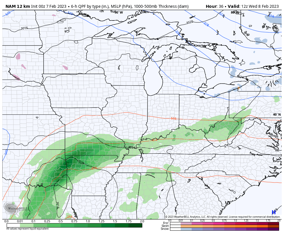
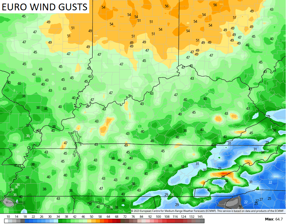
A potent low pressure rolls from the southern Mississippi Valley to the Great Lakes Wednesday and Thursday. This will bring a lot of wind and showers in here with the chance for a few storms Wednesday night and early Thursday…
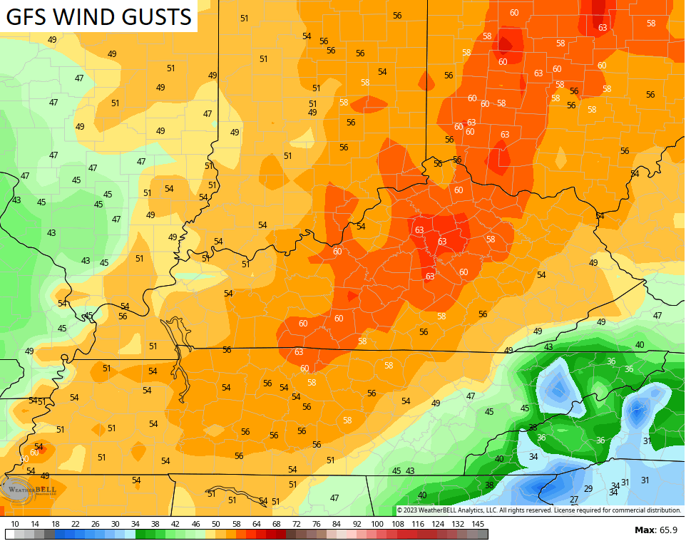
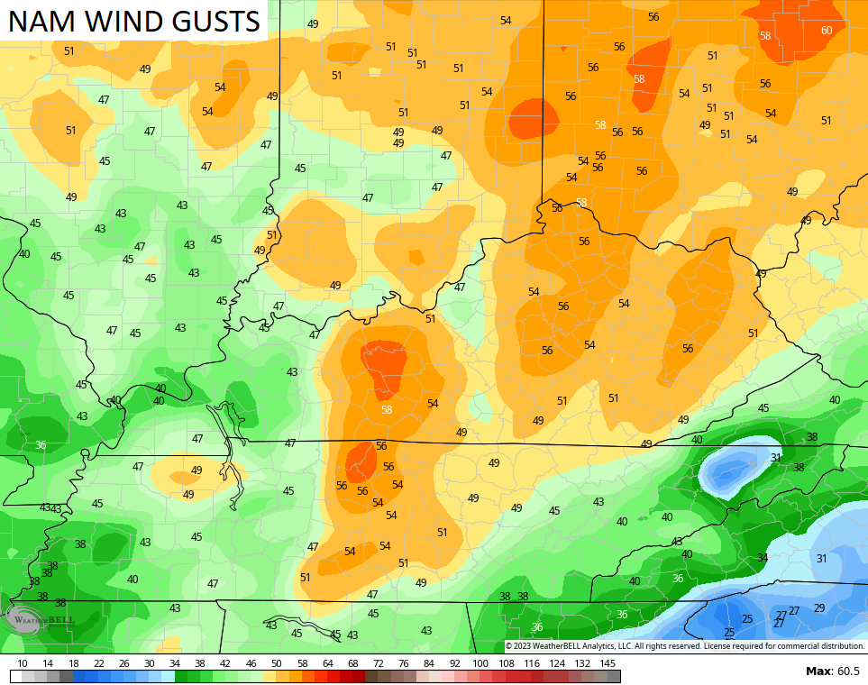
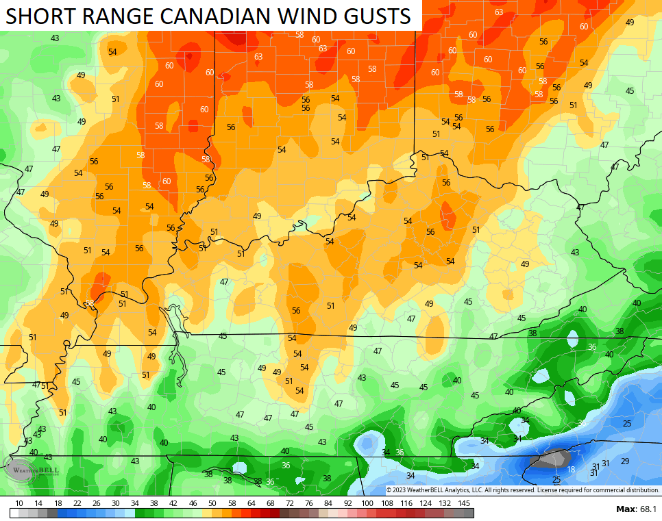
Winds with this setup may very well cause issues Wednesday night and Thursday morning. Gusts of 50mph of greater can’t be ruled out and the models are forecasting some big numbers…
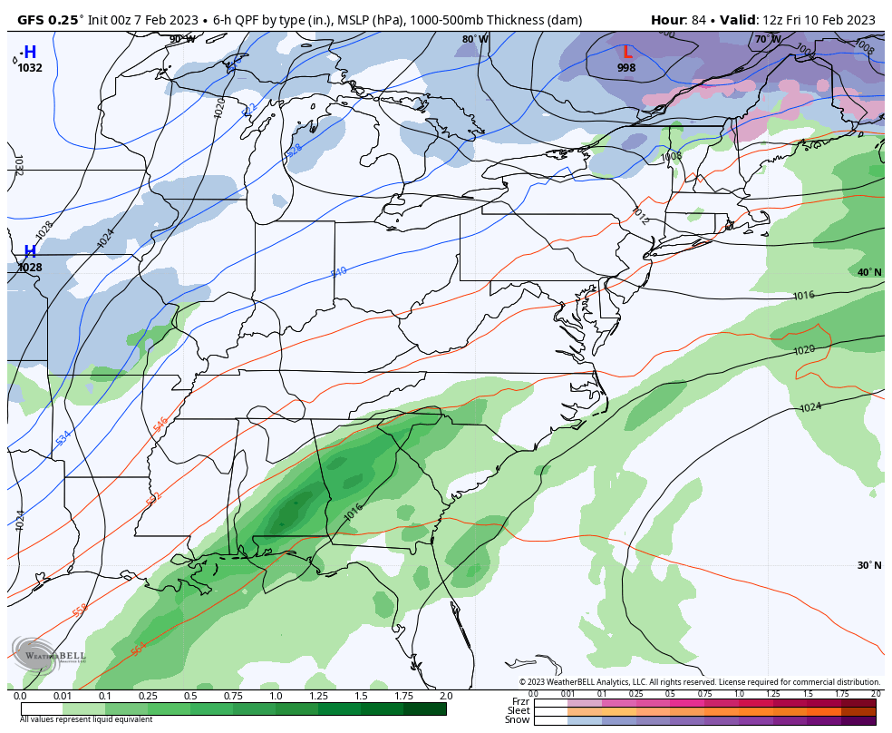
The next system then works in here on Friday with rain and some snow before going over to a period of light snow Friday night and early Saturday morning. The GFS has the best signal of the models…
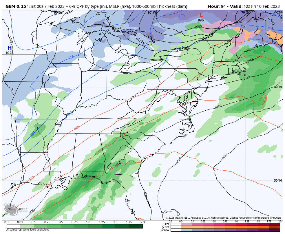
The Canadian has a similar look…
The EURO isn’t as enthusiastic…
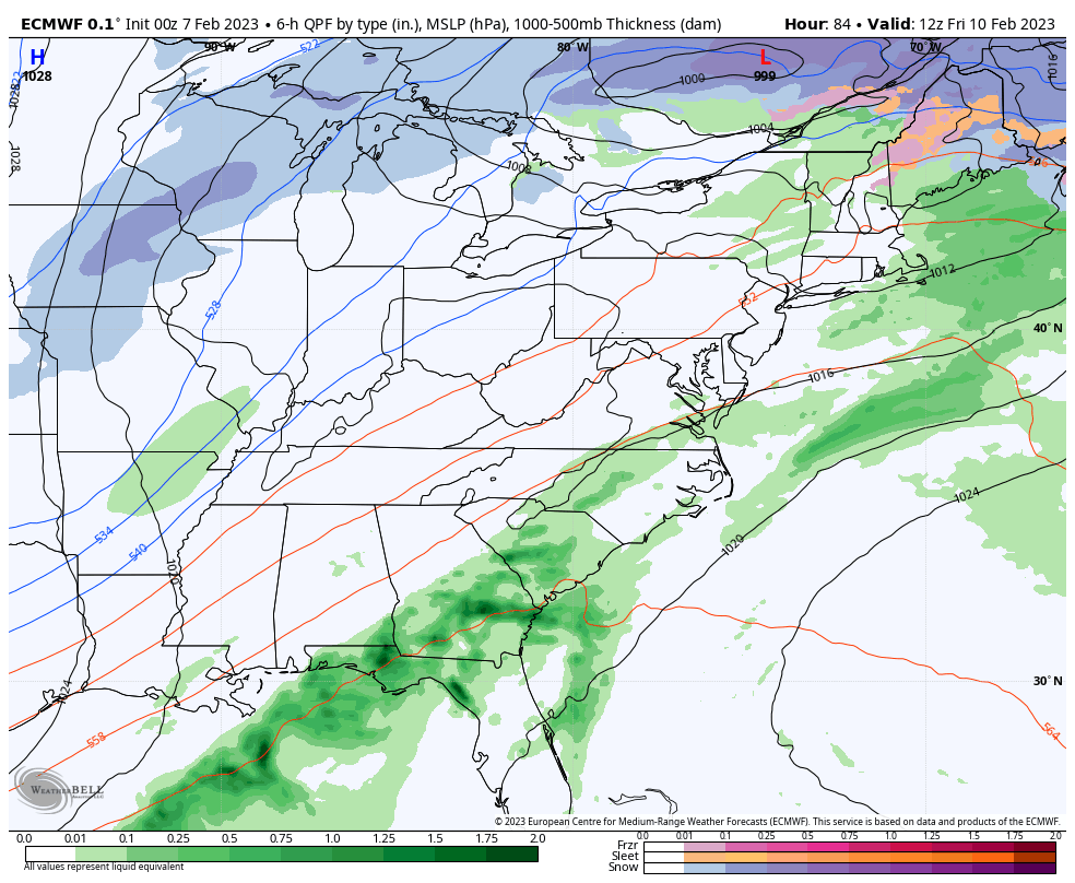
That’s a rather odd look to it and is likely because the EURO is too slow with the energy coming in from the southwest.
In looking at the overall setup, it wouldn’t take much for this to become a much bigger storm system and that’s something I’ll be watching for over the next few days.
Milder air surges back in here early next week as this active pattern shows no signs of letting up. Arctic air is likely to make a few more visits into the United States before February is over and this likely means we aren’t just going to slip straight into Spring. As a matter of fact, the Euro Weeklies are ugly for spring lovers deep into March.
I’ll have another update later today. Make it a good one and take care.

Thanks Chris, the battle between Winter and Spring has begun. Would explain the high winds. Hopefully not as high as the various weather models are indicating ?
The cold air this winter could never sustained itself. It was kind of like it was fighting a guerrilla campaign. Hit and run.
I certainly hope the weather holds out for ‘hamfest’ this weekend in Squirellybottom WV. I realize the Euro has been on the money this winter compared to the GFS with their daily coverage. If this continues, I suspect more winter just as the groundhog predicted.
The way it’s looking, Richmond might see one its lowest if not the lowest total snows for a winter. I do not think we’ve gotten 4″ total and that counts the late Christmas event. That seems to ironically have been our main winter.
Jut read the warm air will stick with us for the most part of February and March will be below normal as far temps go.
” the Euro Weeklies are ugly for spring lovers deep into March” – that’s the saddest thing I’ve read today. how extremely depressing. I’m always in #TeamSpring #TeamSummer mode. sometimes I wish I could live in permanent May through August.