Good Wednesday to one and all. A big storm system is set to bring a little rain and a lot of wind to the region over the next few days. This will be followed up by a cutoff system that may impact our weather over the weekend.
Temps today are a little cooler than yesterday with just a few showers showing up. The numbers climb from south to north through tonight and should reach the 60s for many areas. As our low passes by well to the west and north, a cold front works in from the west early Thursday with a broken line of showers and maybe a thunderstorm. Here’s the future radar from the HRRR from 1pm today through 1pm Thursday…
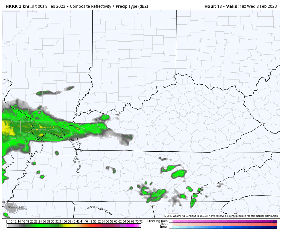
Some of the storms may be strong or locally severe across the west later today. The Storm Prediction Center has a low-end risk for severe storms…

Winds are a MAJOR player later tonight and Thursday. Gusts of 50mph or higher will be possible and the models are all agreeing on this…
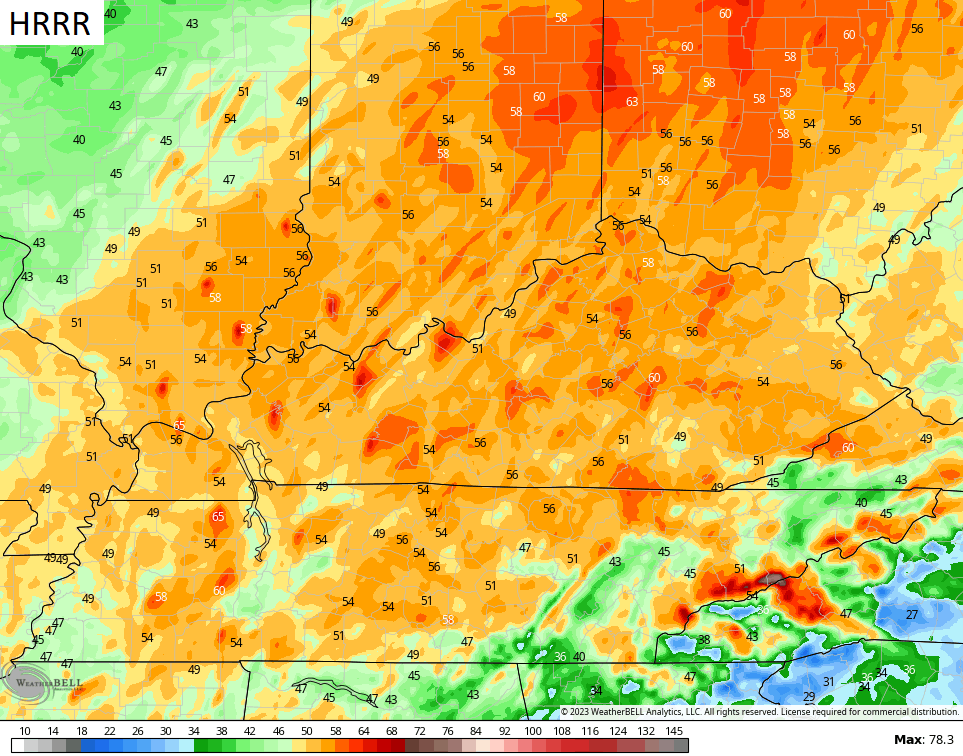
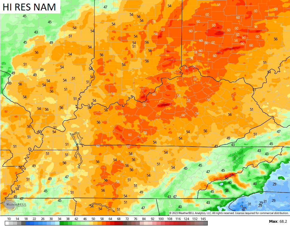

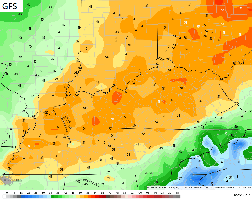
Wind damage and power hits are a good possibility during this time, so take precautions now.
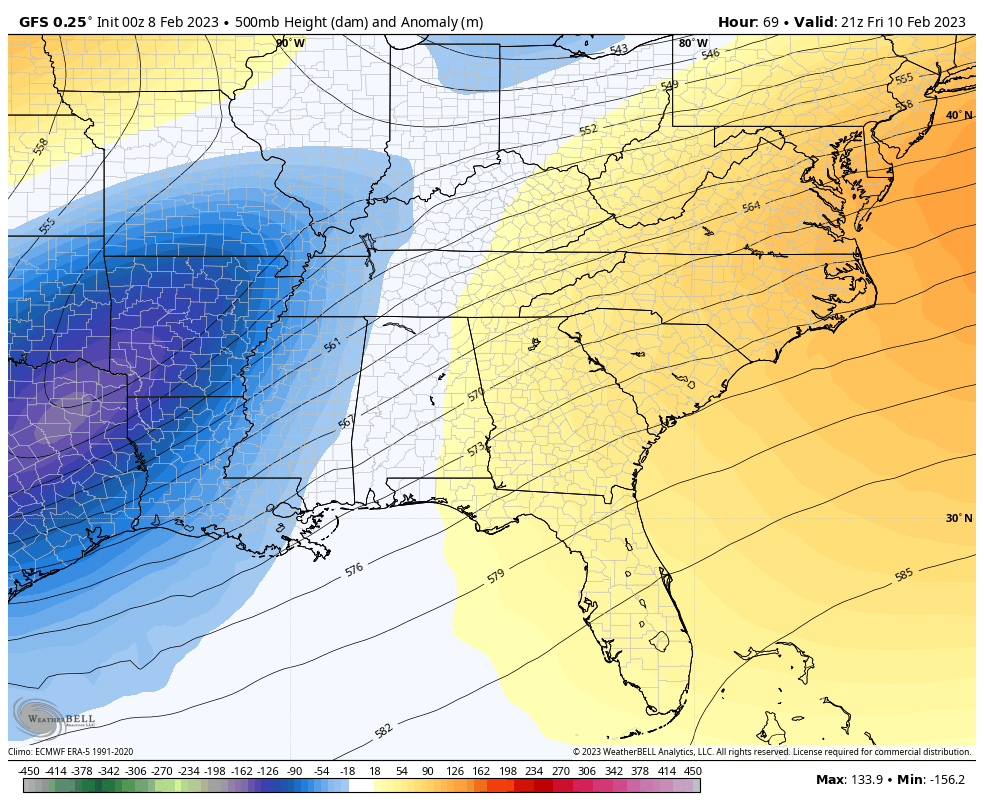
The next system on tap for the weekend is a tricky one because we are dealing with an upper level low that becomes cutoff from the main flow. Typically, winter weather falls on the north and northwest side of the track of these things.
Here’s the GFS with this…
Here’s what that looks like at the surface…
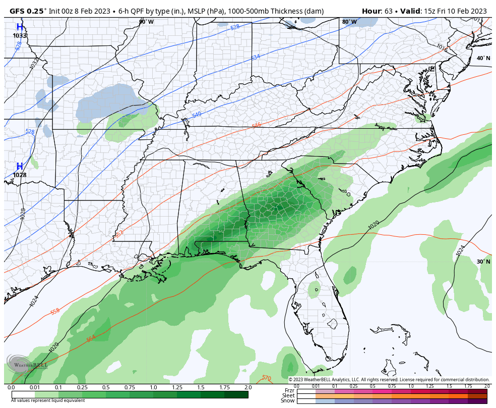
Notice how that takes some wintry weather into areas of the deep south before brushing the southeast with some snow.
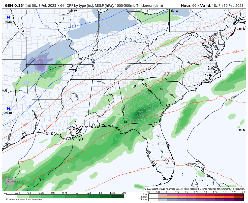
The Canadian is very similar…
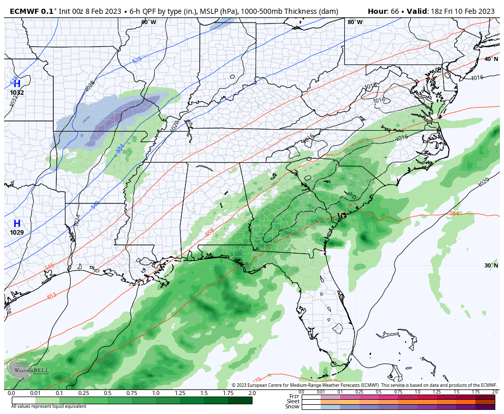
The EURO is a little farther south and east with this system…
I will update things later today. Until then, here are your radars to track whatever showers and storms are roaming across Kentucky…

Current watches

Possible Watch Areas

Have a great day and take care.

how bout them wildcats!!!!!!!!! calipari needs to go. running basketball into the ground.
Incorrect
You happy with the direction of the program are ya?? Lol
Jeff, i after last night what Cal did during his post game with Tom Leach you can tell Cal is burn out, We need someone recharge our program that on rock bottom.
As the old saying goes ” Spring in February is worth nothing ” Late Easter, Late Spring with the possibility of damage to plant life from hard freezes. This seems to be trend we may be entering again with each year that goes by.
Regarding the weather…..I feel that it’s the Groundhog’s Day movie in the Ohio Valley on a recurring basis. My planters almanac says early spring and cool summer. I guess the gov’t won’t be firing up the HAARP to manipulate the weather for a few months here? If your not familiar with HAARP, get ready go down the rabbit hole of weather skulldugery.
Aware of it and nothing would surprise me in 2023
No evidence that weather control is occurring. Only weather cycles are occurring in Nature.
Heavy rain on the way for the Chicago area later tonight into Thursday morning. Many areas will receive more than an inch of rain.
There’s no way this February will be anything like the February of two years ago, when we had so much snow and bitterly cold temperatures, particularly in the first half of the month.
Mike, so far we have been missing the rains to our north. Just cloudy and very mild today with a wind advisory late tonight and tomorrow. Winter has been missing in action since Christmas. Here in Maple, Ky. I only recorded around two inches of Snow. Is Winter over ? The teleconnections say it is.
Maybe a surprise starting Super Bowl Sunday for far SE Ky..Limb breaker maybe..As far as cal wish people would worry about there own lives..Trust me as you get older you will mellow out and find there’s more to life than worrying over a silly game..
I watch all sports for pure enjoyment.