Good evening, folks. Our high winds of the day turned out to be every bit as crazy as advertised. Now comes some cooler air for the next few days and the chance for a little late weekend winter weather in the far southeast.
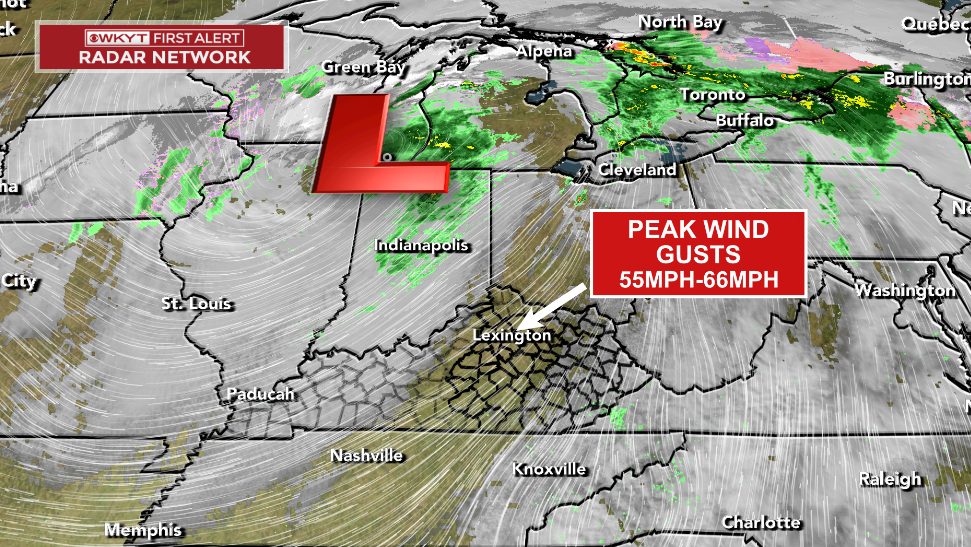
Today’s winds absolutely cranked, giving central Kentucky one of the windiest days every recorded. Some areas hit gusts greater than 60mph and all of this was without thunderstorms.
This low cranking to our northwest is the culprit, but clearing skies during the peak heating of the day allowed for the atmosphere to bring higher winds down to the surface into the Lexington metro and northern Kentucky…
Temps turn seasonably chilly with a mix of sun and clouds into Friday and Saturday.
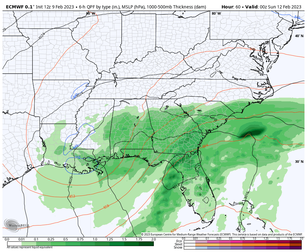
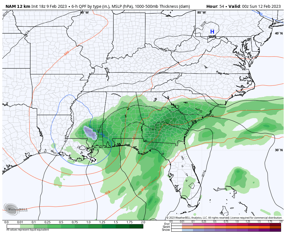
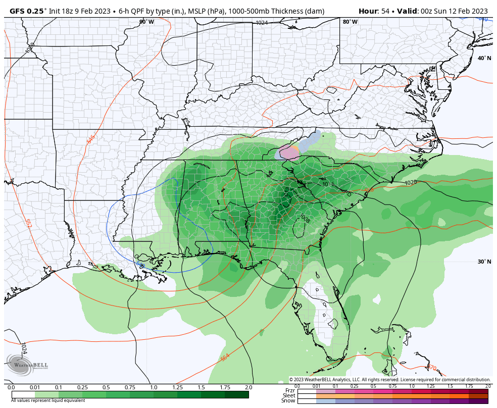
The southern storm continues to look like it may graze far southeastern Kentucky with some late Saturday night or early Sunday snow. The models haven’t moved much in terms of track over the past few days.
The EURO ticked just a touch east from earlier runs…
The NAM is a little weaker with the storm and doesn’t manufacture as much cold air, resulting in more of a rain and mix in the southeast…
The GFS is the snowiest across the southeast…
While the southeast may have some snow, the rest of the state would see some sun and temps that can hit 50 or better. Ya gotta love Kentucky weather. The actual weather, no me. 😁😜
Enjoy the rest of the evening and take care.

Wow wind gust in 60 mile an hour range hang on down there Chris. The wind was kind of bad here too in the east.