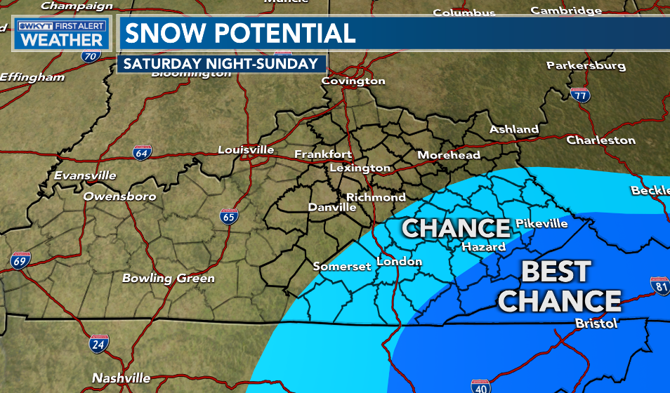
Good Friday, folks. We’ve made it to the end of the week and we have the weekend ready to kick off with cooler weather. The focus continues to be on Saturday night and Sunday as a big storm rolls out of the south toward the Carolinas. This may bring some snow into southeastern Kentucky.
Temps are on the colder side today with readings generally in the 40s. Skies feature a lot of clouds with a little bit of sun getting into the mix from time to time.
Saturday looks like another seasonable day with temps in the 40s and some clouds filtering in from the southeast.
This is ahead of the big storm coming from the south and working toward the Carolinas. This may very well bring a band of snow into parts of southeastern Kentucky as we walk the fine line on the northwestern edge of this system. Here’s the area most at risk for accumulating snow…
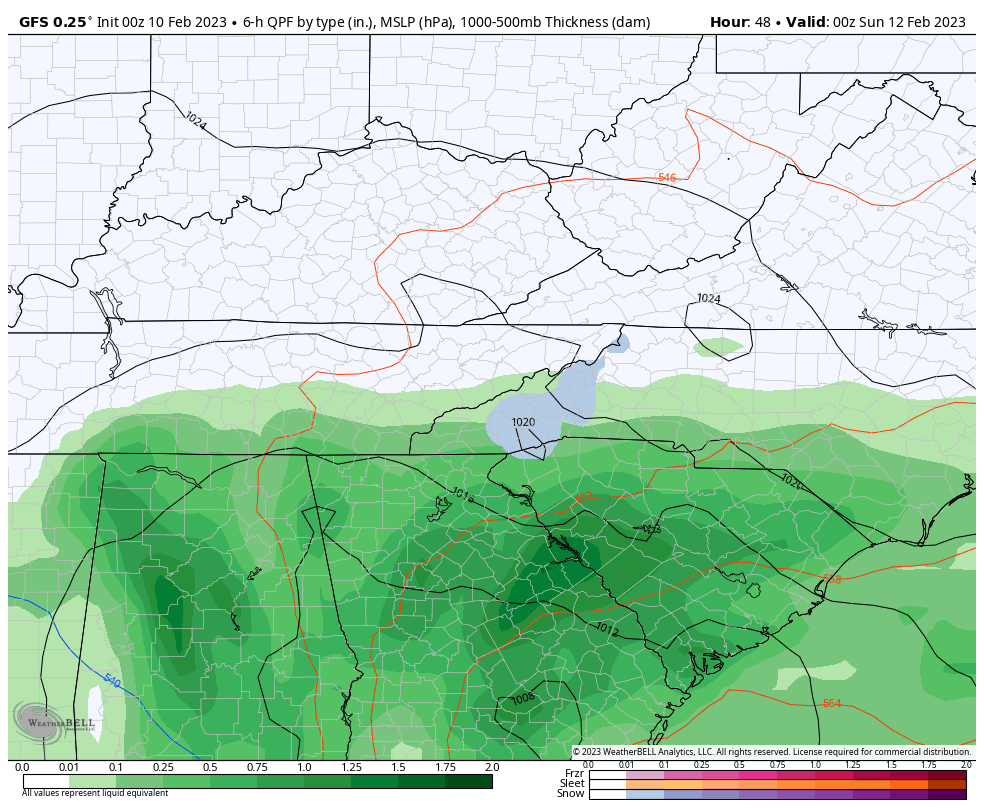
In terms of the models, we find some agreement between the GFS and NAM…
GFS
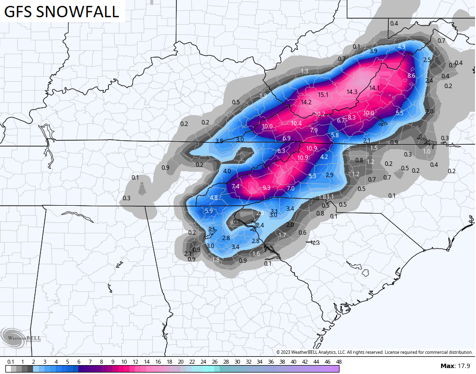
Here’s the snow map from that run..
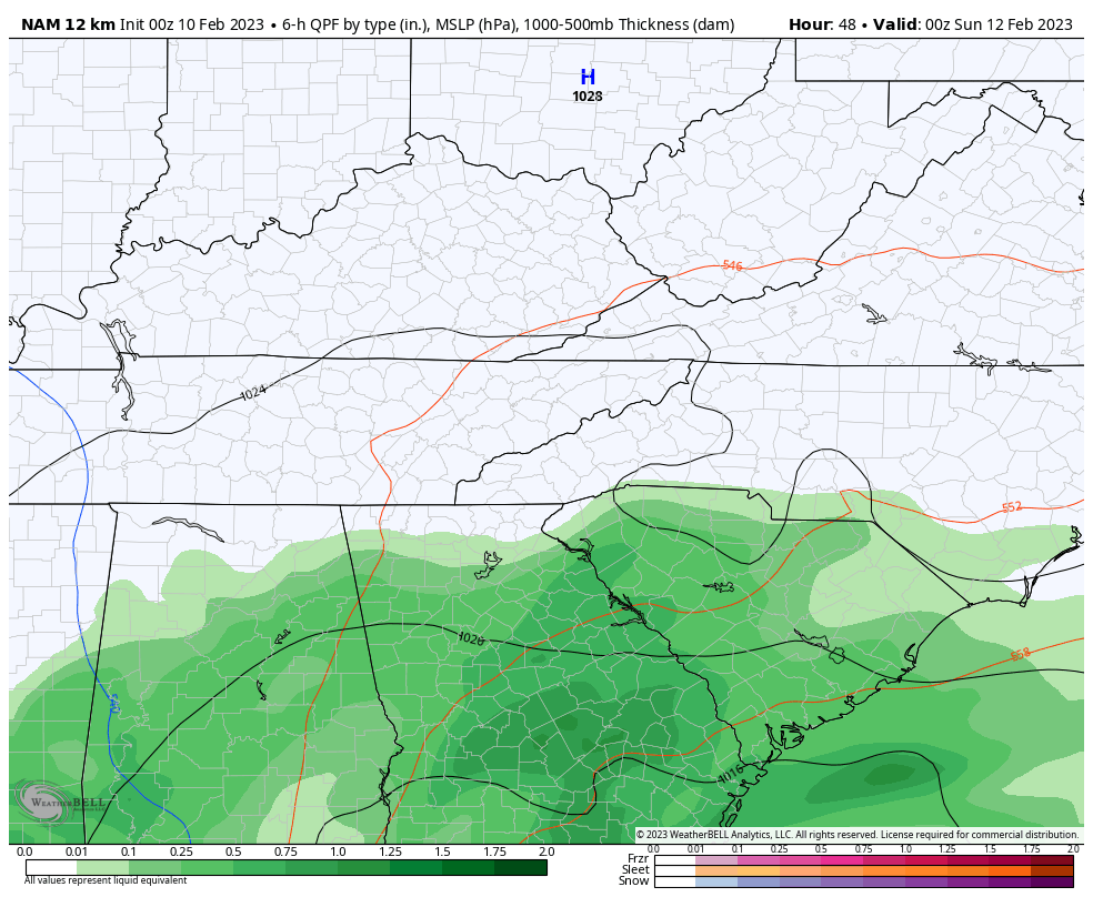
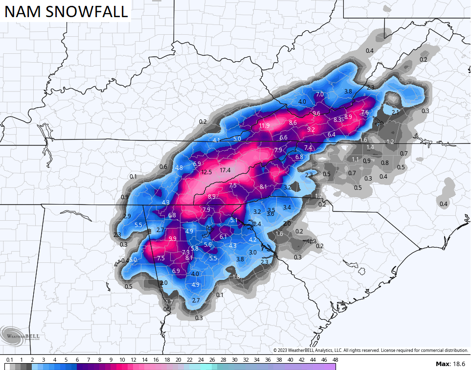
Here’s the NAM…
And the snow map from that run…
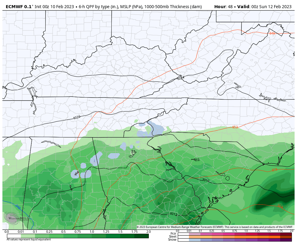
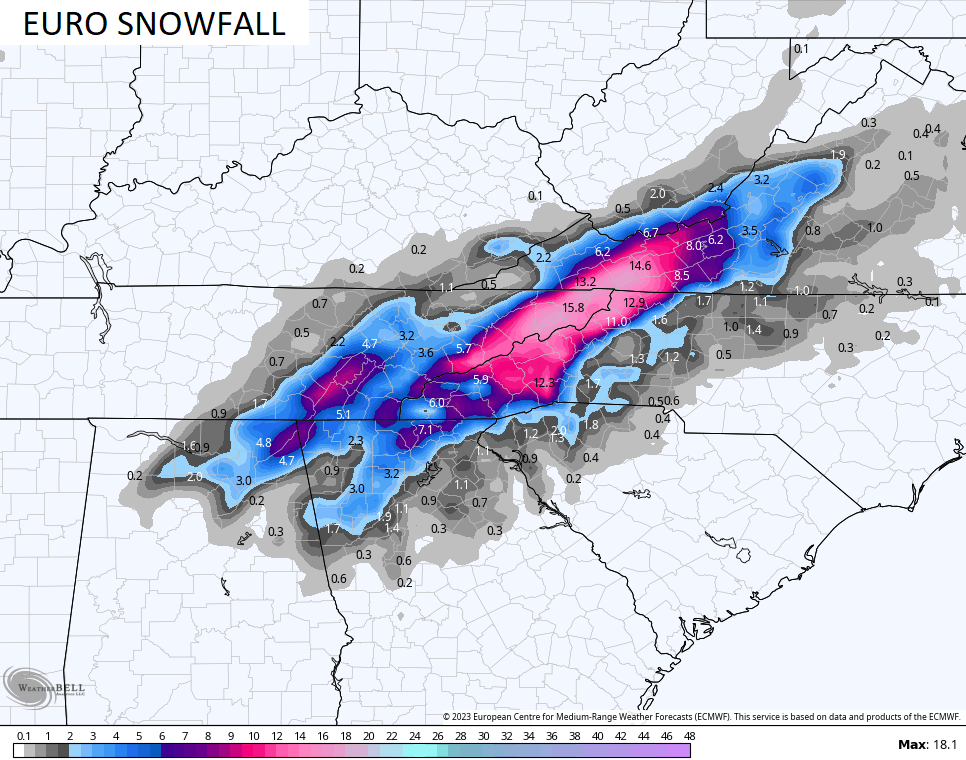
The EURO looks like this…
The EURO snowfall is a little farther southeast with the snowfall…
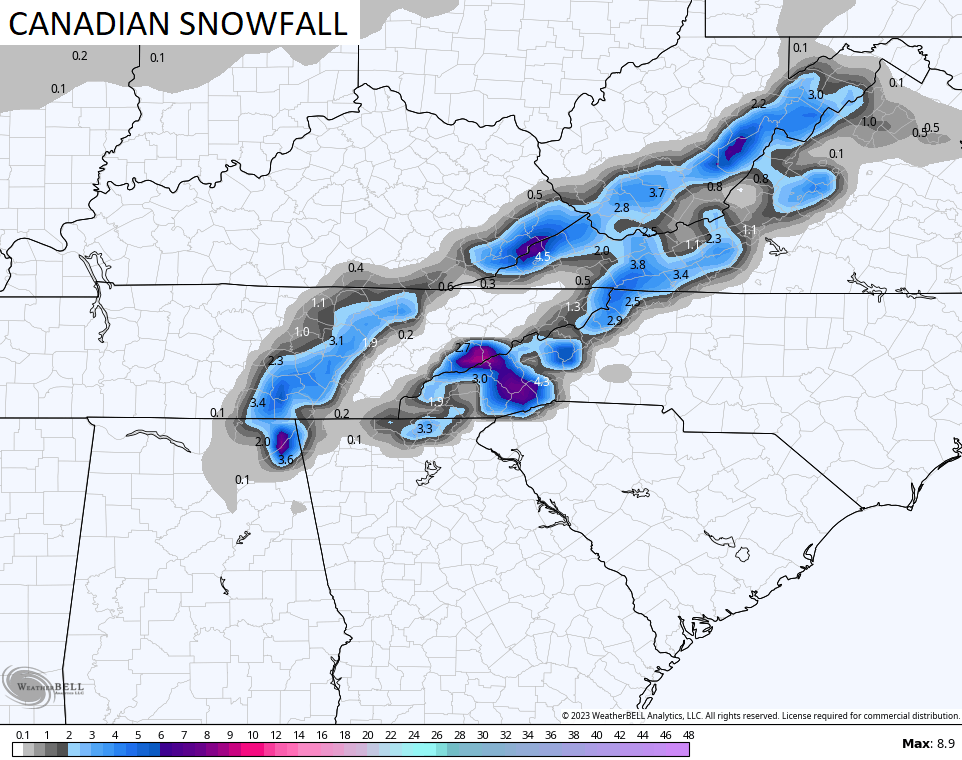
The Canadian snowfall map is much more disjointed…
The weather across the rest of the state will be much better with some sun and temps hitting the 50s. Those numbers climb into next week with another surge of VERY windy and mild weather. The threat for showers and strong storms will then show up.
I’ll give you another update later today. Make it a good one and take care.

Once again South Central Kentucky gets locked out of the snow game, but that doesn’t bother me, as I’ve stowed the snow shovel and broke out my #TeamSpring apparel. My wallet appreciates it as well, since the mild weather will be reflected in a substantially lower electric bill!
Looking further down the road, I’m still of the opinion that we’ll be seeing an above normal stretch of severe weather during the late March/early April time-frame.
Maybe next year for Western and Central Kentucky for Snow. I agree Joe bring on # TeamSpring with the low heating bills. Glad that Crystal may receive that big Snow. Severe weather always a concern in our part of the World.
Team sunshine!
This tired teacher needs sunshine and warmer days. #TeamSpring!
I can only hope the GFS takes out their bias in forecasting. Their model is skewed and many times ‘hyped’. I think the only thing they have forecasted correctly is wind gusts, nothing else. Hopefully sunny and warm next week, maybe a touch of 70+ on Wednesday, then back to Mr. Winter? Just keep the HAARP machine pointed at other continents.