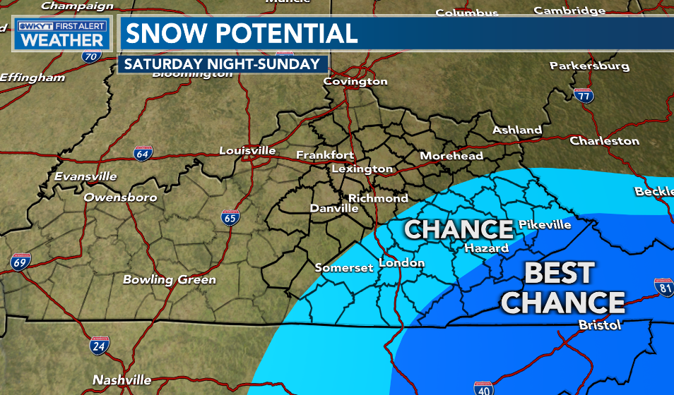
Good Saturday, everyone. It’s a rather typical mid-February weather day across the Commonwealth with a mix of sun and clouds. From here, all eyes continue to be on the potential for some snow to impact parts of southeastern Kentucky later tonight into Sunday.
The whole setup with this storm hasn’t changed much at all from the eyes of your friendly weatherdude.
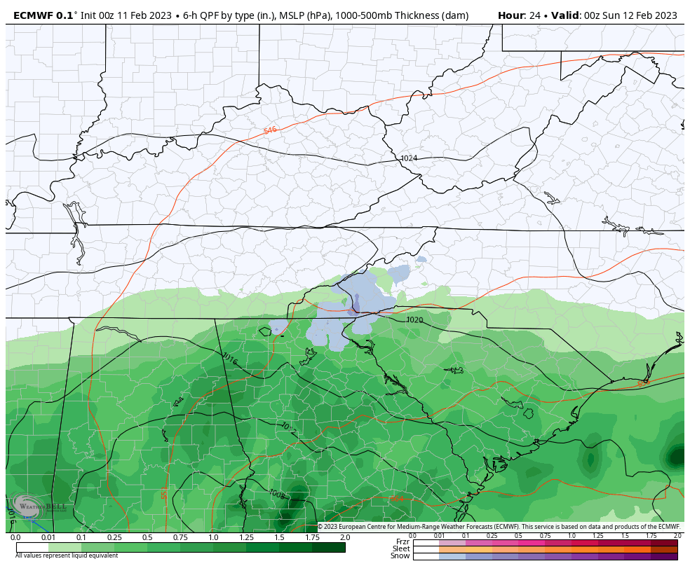
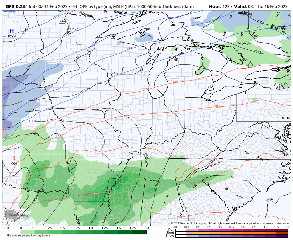
Low pressure across the southeast will slowly lift northward into the Carolinas tonight and Sunday. Moisture gets into far southeastern Kentucky during this time, with the potential for some accumulating snows. The best chance continues to be across the Virginia border counties…
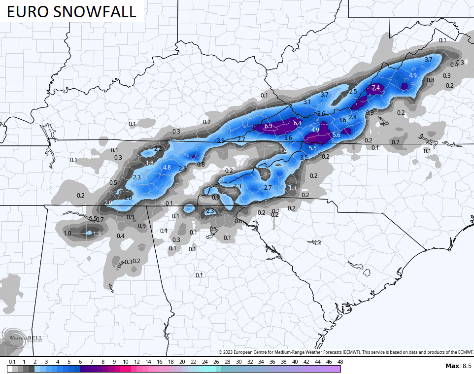
If you’re a snow lover in southeastern Kentucky, the EURO is your bestie…
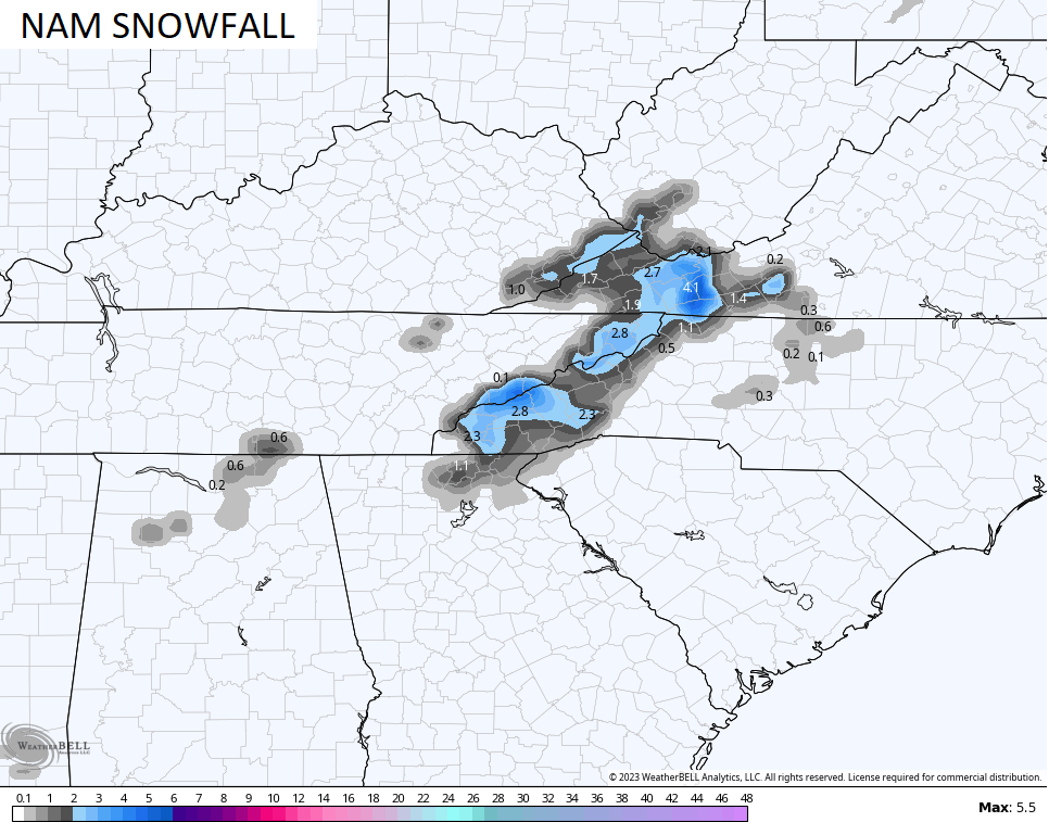
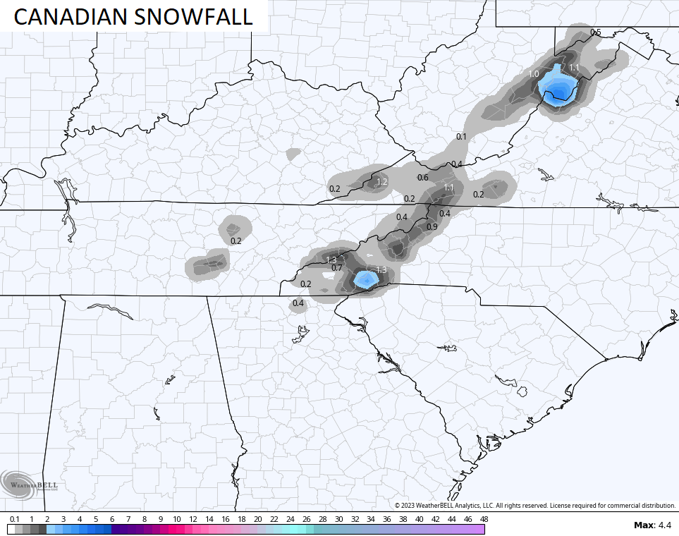
Here’s the snow map from this run…
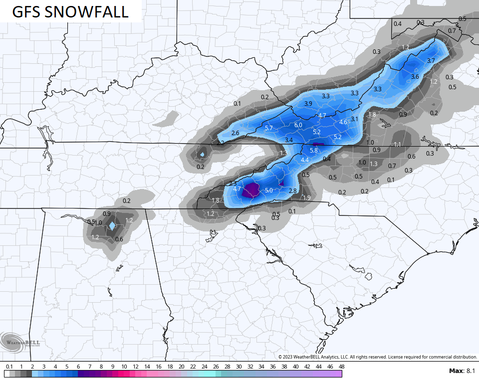
The GFS is ligher with the snows, but it also puts down a slushy snowfall in the southeast…
The NAM and Canadian Models are yawning at this whole potential…
The rest of the state will see pretty nice weather on Sunday with temps ranging from near 50 to the middle 50s.
Monday looks like a good day with temps in the 50s as clouds increase ahead of our next shower maker. That arrives on Tuesday, but itsn’t anything widespread.
Wednesday is a VERY windy and mild day with temps spiking deep into the 60s. Those gusty winds are ahead of a major storm system set to impact our region on Thursday. Strong to severe storms will be possible ahead of a big push of cold air behind it…
I’ll have updates later today, so check back.
Make it a good one and take care.

Looks more like mid-March than mid-February. Also, the severe weather “season” in the Gulf states seems to be trending several weeks ahead of normal. If that holds true, we may be looking for activity in our region to ramp up in mid-April. But since we’re only halfway through Winter, a LOT could change before then!
I think you meant to say that we’re over 1/2 way through festive flake season. LOL
And even that has been disappointing.
Exactly! Lol
Severe weather we will receive somewhere in Kentucky. That’s a given every year. Still time left to maybe receive one of those surprise heavy wet Snowstorms in late February or March. Looking forward to the nice early Spring weather today and tomorrow. Hopefully, with Sunshine.
I’ll have to check with my dad in Brevard NC to see how much snow they get… if any
I read the WSW for their area….and it says in the warning area 2 to 10 inches of snow…but looking at those models nothing looks even close to that.
Those winds were crazy the other day and the clouds at sunset were amazing
2 to 10!? Man that’s a lot of leeway.
A lot of that spread is probably dependent on altitude.
Models cannot accurately predict Snowfall totals yet. Let alone Snowstorms in our part of the World.
The Storm Prediction Center has identified a wide area of central Kentucky for the likelihood of severe weather this coming Wednesday into Thursday (Feb. 16/17), as shown on the link, below. The SPC’s accuracy on identifying events this far out is surprisingly good, so we definitely should watch for severe activity during this period:
https://www.spc.noaa.gov/products/exper/day4-8/