Good afternoon, everyone. On this Super Bowl Sunday, we have really nice weather for much of the state, minus the southeast. That’s where rain and snow continue to show up. The week ahead features the threat for strong storms as we head back into another active period.
Can we get winter back in here before the month is over? I’ll get into that in a bit.
Let’s start with our Sunday weather. Highs are in the 50s for everyone but southeastern Kentucky. Temps here are being held in the 30s with rain and some snow. This should end as wet snow along the Virginia border counties by late afternoon into the evening. Here are your tracking tools…

JENKINS

PINE MOUNTAIN

PIKEVILLE

Monday is another mild day with temps in the 50s with a mix of sun and clouds. Temps make a run at 60 on Tuesday ahead of a few showers moving in later in the day and into the overnight.
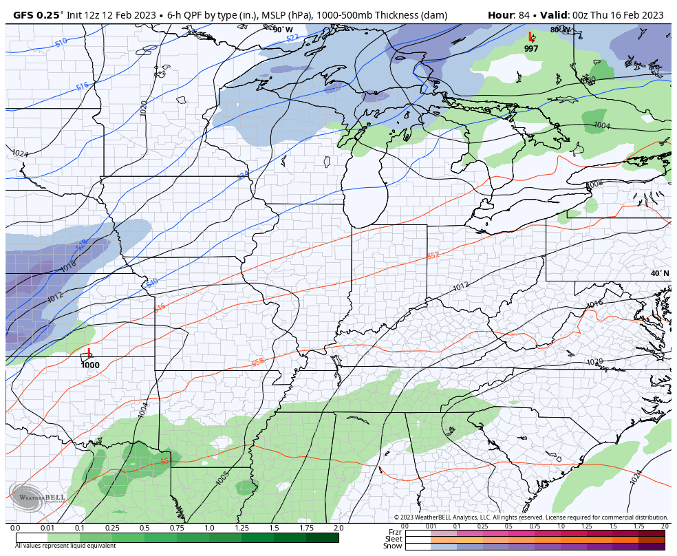
Wednesday is windy and VERY warm as temps make a run toward 70 or a little better. That’s ahead of a storm system likely to bring a severe storms threat to the region for Thursday. The Storm Prediction Center continues to highlight much of the region for the thursday severe threat…

The GFS puts us into the warm sector of the storm before cold air crashes in. The model is even showing a few flakes by Thursday night and early Friday…
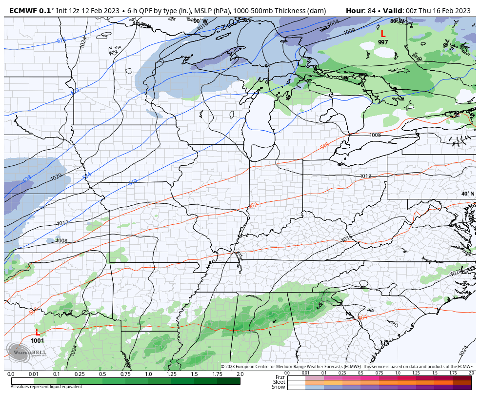
The EURO is very similar…
The Canadian Model takes a colder route from start to finish with this setup and would keep the severe threat well to our south. Notice how the model even blows up a wave of low pressure along the boundary with winter weather for Friday…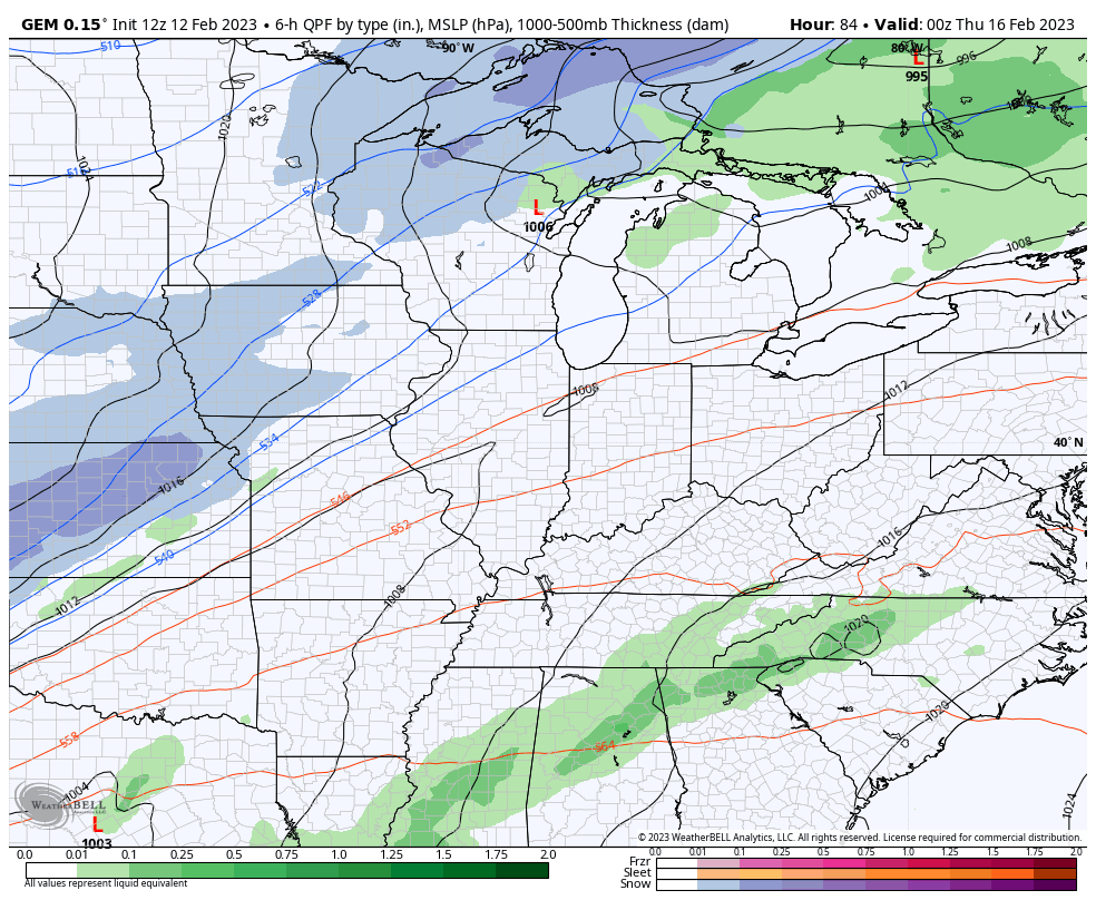
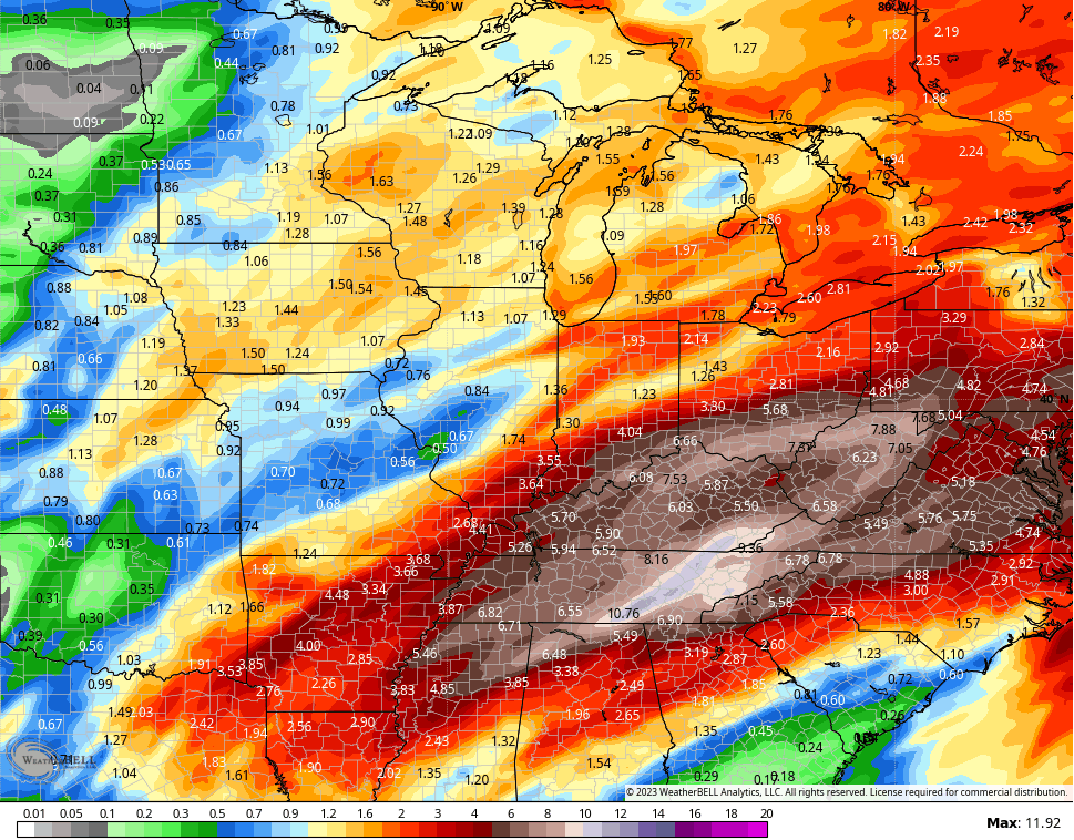
We are likely to see several similar storm systems impacting our region over the next few weeks, at least. That means some wild temp swings and could mean a lot of precipitation. The GFS says hello to a very active storm track…
Some of the ensembles are trying to let the cold overpower the pattern…
File that one under the “I’ll believe it when I see it” category.
Enjoy the rest of your day and take care.

Schroeder, I know that you raised azaleas for many years. Well, it appears that the cold snap we had near the end of this past December may have killed them off…
I’m wondering whether it would be worthwhile to cut them back severely, or just call it a total loss. I posted a few photos at the following link.
Thanks!
https://twitter.com/derosajoe51/status/1624843738437545985?t=XJ9N3s5b3erGZP0pWFm3cQ&s=19
Joe, those Azaleas you have are semi- evergreen. As long as the bark at ground level is not split they should be Okay. I had this happen many times when I was growing Azaleas in the nursery. Hold off pruning them back until they complete there spring foliage. Water them when it gets dry and don’t fertilize for a year.
Thanks Schroeder! The good news is, the bark appears to be in good shape. The main reason why I was concerned was because I regularly see their foliage “darken” over the Winter months and then recover, but never to the brown shade I see now. Another one of my bushes sustained freeze damage in April of 2020, and I ended up pruning that one back. The last time I had widespread damage was from the great hailstorm ’98.
I appreciate your help
Joe, I’am glad the bark on your Azaleas is Okay. It may take awhile for a complete recovery, but the Azaleas will come back by mid Summer with lots of buds for next Spring. If you are not satisfied with the way they turn out I would replace the Azaleas with these known hybrids : Herbert, Karens, Hino Crimsom, Elsie Lee are all good cold hardy Azaleas. Good luck on your gardening this coming growing season.
Joe, here is an Article on our nursery and the history of our Azalea breeding and propagation :
https://scholar.lib.vt.edu/ejournals/JARS/v60n2/v60n2-schroeder.htm