Good Monday, folks. We are looking at another spring-like week across the Bluegrass State with milder than normal temps and the increasing threat for strong to severe storms. This setup will also be accompanied by another big blast of high winds.
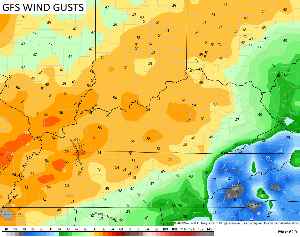
Temps today are in the 50s with a mix of sun and clouds. Winds will be a little gusty, but nothing like is coming at us Tuesday and Tuesday night. Strong southwest winds kick in and we could have another big wind event across the state. The models are spitting out 40mph-50mph gusts with the GFS showing some 50mph+ gusts…
Would you expect anything less this winter?
A few showers will also be possible late Tuesday and Tuesday night as temps continue to surge. Temps on Wednesday will likely reach 70-75 degrees for much of the state and that would put us within record high territory once again.
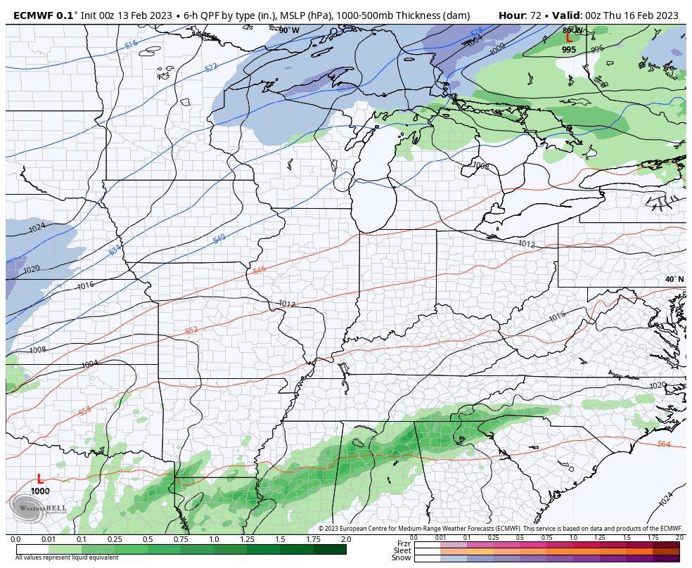
This is ahead of a potent low pressure working into the northern Ohio Valley on Thursday. This brings a severe storms threat into our region and into areas of the deep south…
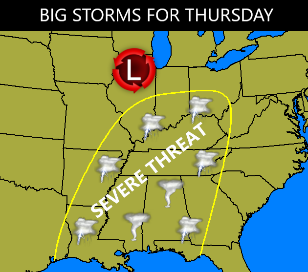
All modes of severe weather could show up in our region.
We are likely to see some strong storms working across the region Wednesday night with the main severe threat right along and ahead of the front arriving Thursday. Much colder air then crashes in behind this with the chance for a few flakes to fly by Friday morning…
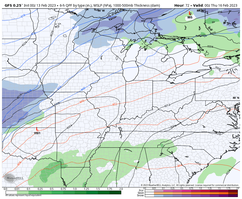
GFS
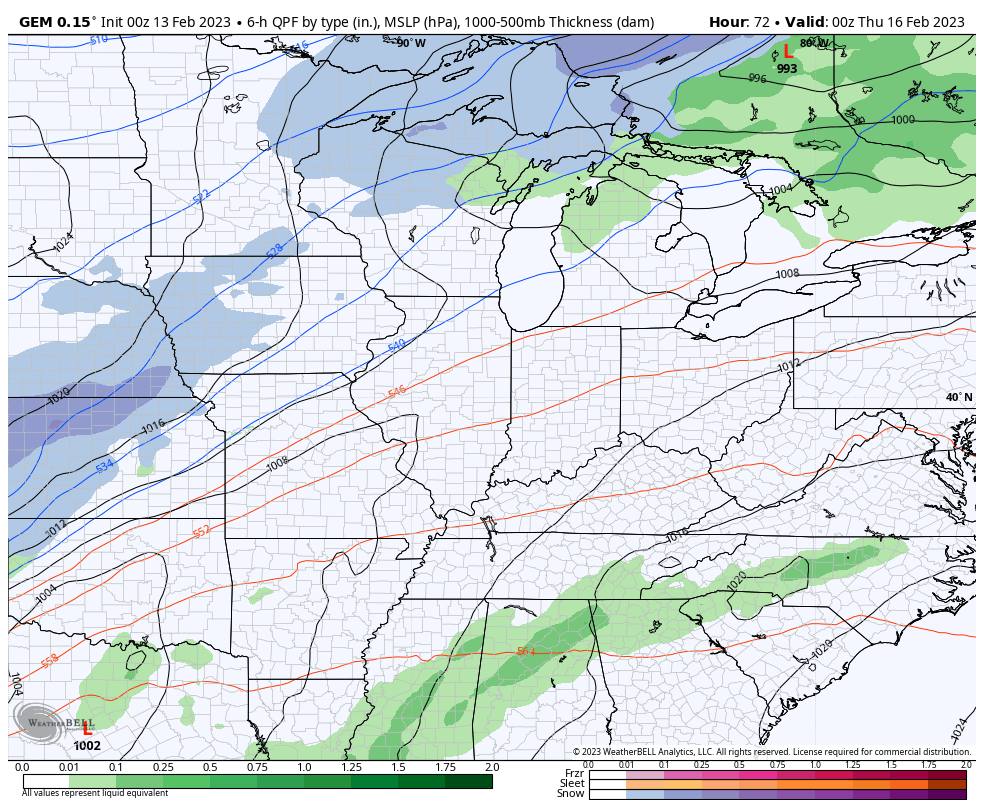
Canadian
EURO
This is a process we may see again on more than one occasion over the next few weeks. If things don’t change, we may be getting ourselves into some trouble soon.
I will have updates later today. Have a great start to the week and take care.

The weather patterns have not changed in at least the past three years. Going from ENSO / La Nina to ENSO / neutral and staying at neutral through the Summer and Fall months is not what we Snow Lovers want. We would want a change to ENSO / El Nino in the late Summer.
This might set a record for Richmond for lowest snow total for a winter. Snow fans don’t even have the Cats to go to for comfort. They kind of reflect this winter.
The Pacific Decadal Oscillation will likely continue in the negative phase. Although some weakening has occurred over the past few years, but not enough to destroy La Nina’s influence on our climate.
The Atlantic Multi- Decadal Oscillation strengthened in the positive phase in 2022.
This is the best explanation why are Winters are not what they use to be. Will it ever change to a positive Pacific and a negative Atlantic ?
The SPC “Day Four” outlook graphic and the Friday 1:00am jet stream forecast are lined up nicely (in other words, BADLY!) during the Thursday into Friday overnight period. Shear will be present, daytime temperatures in the Bowling Green area are forecasted to be in the mid 70’s which will help convection. The unanswered question is dewpoint levels.
https://www.spc.noaa.gov/products/exper/day4-8/
https://www.weatherstreet.com/models/gfs-jetstream-wind-forecast.php