Good Tuesday and Happy Valentine’s Day. We have a really wild period of weather unfolding for the rest of the week. It’s a pattern that’s straight out of springtime and one that will likely cause issues across Kentucky and surrounding states.
Here’s a breakdown of the rest of the week…
- High winds kick in late today through early Wednesday. Gusts to 50mph or a little higher will be possible and may cause some additional damage.
- A few showers and storms may be noted late today into the evening, especially in the west.
- Near record highs are possible Wednesday with readings reaching 70-75 degrees for some.
- Winds crank again Wednesday night and Thursday. Gusts to 50mph will be possible and that’s without thunderstorms.
- Rounds of thunderstorms quickly increase Wednesday night and Thursday morning. Some of those could be strong or severe.
- With low pressure tracking to our west and northwest Thursday, our region will be in the area to watch for additional strong to severe storms.
- Damaging wind is the main threat, but there’s enough spin for a low tornado risk.
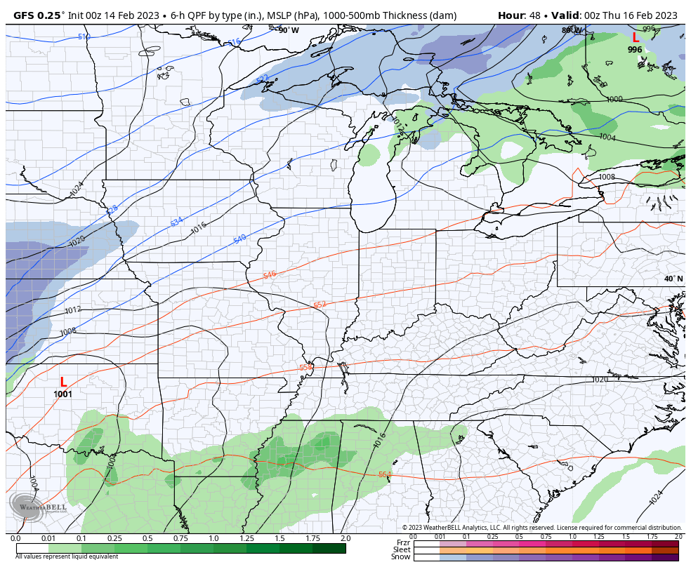
The Storm Prediction Center is highlighting western Kentucky for a low-end risk for severe storms late Wednesday…

That threat then increases and moves farther east across the region for Thursday…

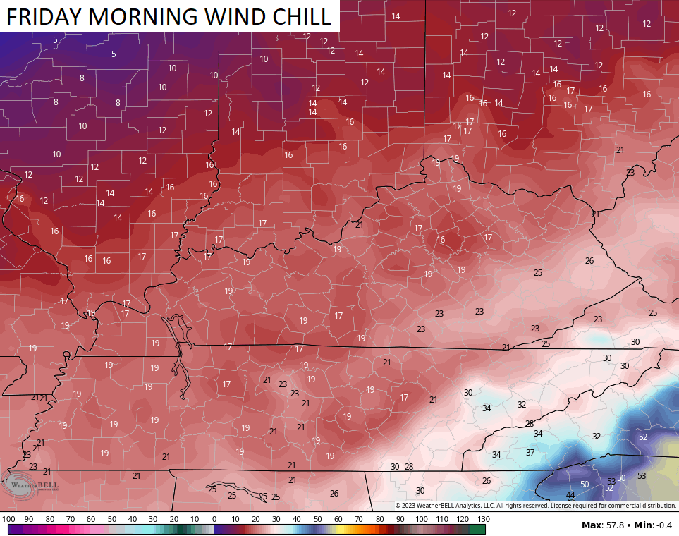
Behind all this comes a big temperature crash and the potential for some flakes to fly on Friday…
GFS
Look at those Friday morning wind chills…
I will have updates later today. Until then, here are your radars to follow the scattered showers and storms working in from the west…

Make it a great Tuesday and take care.

Tuesday & Wednesday(early) fantastic.
Late Wednesday & Thursday things go downhill quickly.
Friday we return back to lousy Festive Flakes season.
Same as last week’s pattern. We won’t have a major change in the atmosphere until the Pacific goes positive and the Atlantic goes negative. I hope we receive some measurable rainfall, as this month so far here in Maple has been on the dry side. Thanks Chris, appreciate the updates on the severe weather potential.