Good afternoon, folks. We are putting the wraps on a gorgeous weekend across the Commonwealth. As we roll into the week ahead, we find a very mild pattern that will likely lead to a few rounds of showers and thunderstorms.
Temps through Thursday will generally be in the 60s and 70s. Wednesday and Thursday will be the warmest days with readings reaching the 70s. This comes with a major temp gradient showing up from the Ohio Valley into the upper midwest and Great Lakes…
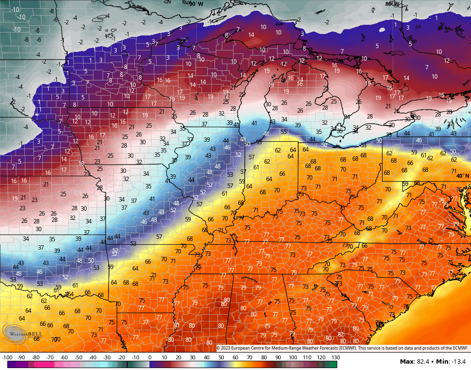
That’s pretty amazing to see!
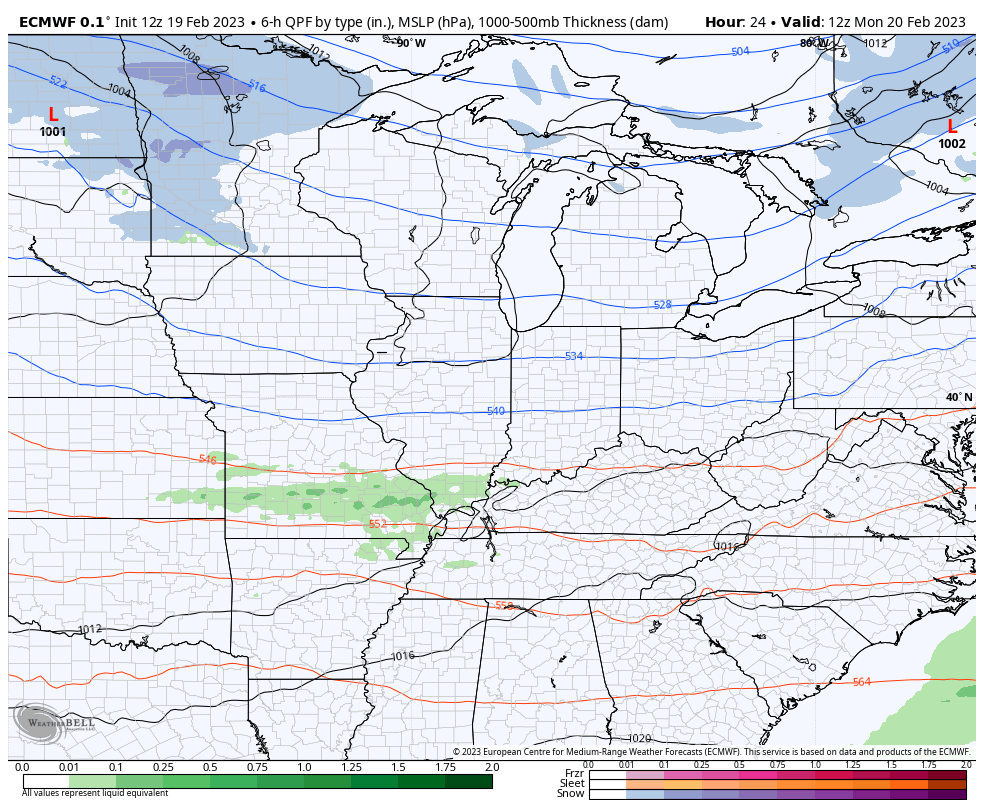
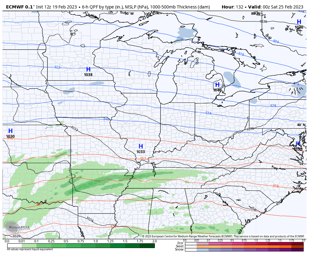
This bounday will also be the focal point for rounds of showers and storms to roll through here from time to time. The first chance comes Monday as you can see with this animation that goes from Monday through Thursday…
You can see some colder air pressing in for a day or so starting on Friday, but that’s likely to be followed by some additional showers and storms by the weekend and into early the following week…
This is a setup we are likely to see repeat itself as we get closer into March.
Enjoy the rest of the of the day and take care.

Once again, high temperature records will be challenged in South Central Kentucky, And like last week, we’re also looking at another bout of severe weather. Last week’s storms didn’t reach predicted levels, because dewpoints never got out of the 50’s, but this week mid 60° dewpoints will be in play, and a west to east jet stream will increase the amount of shear and potential for rotation.
Sounds like April or May type weather this week with those dew point temperatures. I’ll be glad to see this Spring and Summer go. Hard on my nerves.
Thanks Chris, Would rather have Winter weather now than what I think is instore for Kentucky in late March and April. A late damaging freeze ? Blame it on the strong Southeast Ridge.
Yep this stubborn southeast ridge and el nina have all bit snuffed out any snow for our region be glad to see the shift into neutral enso. Would be nice to see that happen around December into a el nino pattern. Mrs Ricvice is from central Wisconsin and I think her sisters and brother call us just to brag on how much snow they get lucky devils