Good Monday to one and all. We are coming off a fantastic February weekend, but some changes show up out there today in the form of a few showers. This kicks off a pattern full of sprintime temps and a few more rounds of showers and storms.
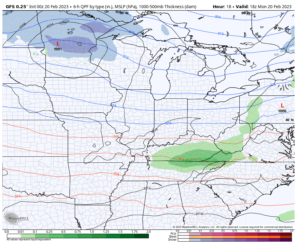
Let’s kick things off with what’s going on out there today. Temps are generally running from the middle 50s to the low 60s as a quick hitting band of showers zips through here. This will be more prominent across the southern half of the state.
Here are your radars to follow along…

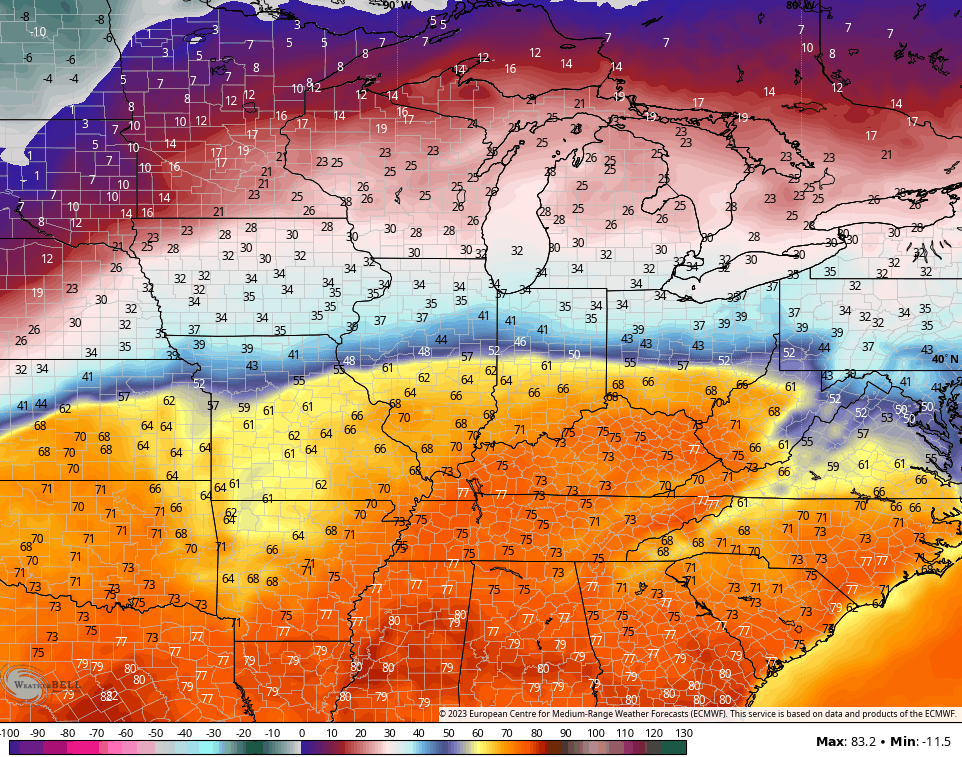
The threat for a few more showers and storms will be with us through Thursday as warm temps spike in from the south…
Temps Wednesday into Thursday will spike into the 60s and 70s across our entire area…
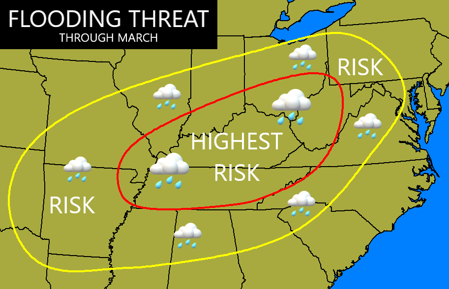
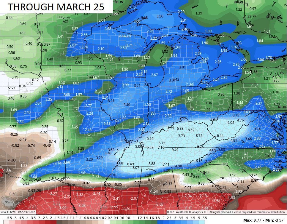
The overall pattern continues to paint the above normal precipitation bullseye right on top of us…
The GFS Extended Ensembles match my idea…
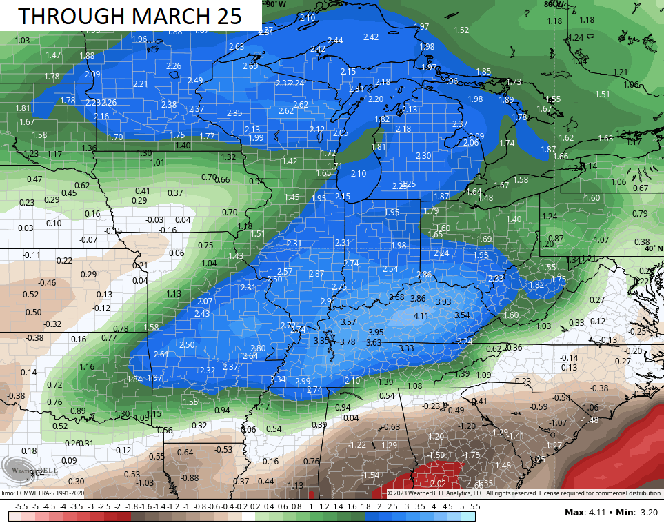
The control run…
I will update things later today. Make it a good one and take care.

Thanks Chris. Way too early for Spring like weather. Plants will be breaking dormancy soon and only to be destroyed by a late Freeze. Can’t wait for the entire year to be over.
You kinda of have some Winston Churchill vibes going on this morning. ‘This is the end of the beginning.’
LOL……
All across our Bowling Green neighborhood, maple and sweet gum tree buds have popped, my day lily plants are up, and a neighbor’s tulips, which he says have never appeared before the second week March, will be budding by the end of this month. Local forecast is calling for a high of 76° on Wednesday, 78° on Thursday, and 49° on Friday. Good news is that my February electric bill should be dramatically lower, unless TVA slaps on a “fuel adjustment.”
At my place, so far every thing except Daffodils are dormant. Next two weeks if the night temperatures are above 60 degrees, the growing season will commence. Two early, but I’ve seen this unfortunate scenario many times in Indiana. Here in South Central Kentucky it’s a yearly occurrence seems like.
I meant Too not two. Boy, I’m really dumb these days.
I have no complaints this Winter’s with the heating bills and I keep my thermostat at 68 degrees.