Good Tuesday, everyone. It’s a better looking weather day across Kentucky as some sunshine makes a return visit. This sun will be accompanied by better temps as near record highs surge in over the next few days. But, this is a pattern that will get us into trouble over the next month or so.
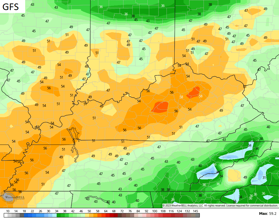
Temps out there range from the middle 50s to middle 60s depending on where you are. Skies will stay partly sunny with just a small shot at a shower going up.
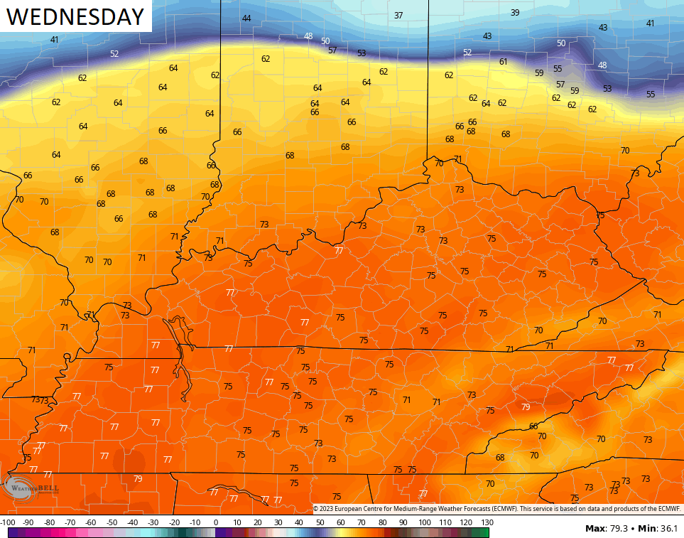
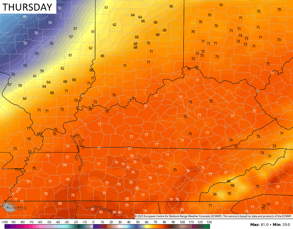
A Spring Fever ALERT is on for Wednesday and Thursday as temps surge deep into the 70s…
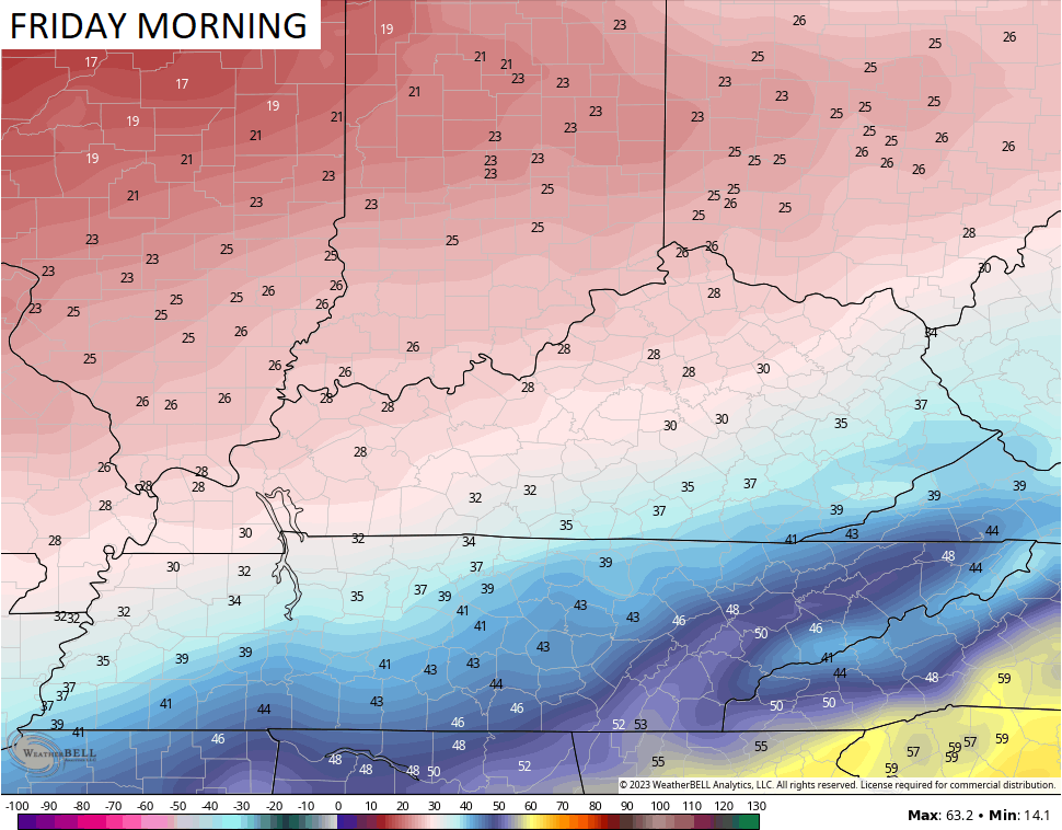
#TeamSpring is loving life until that front blows through Thursday night and knocks temps down into the 20s by Friday morning…
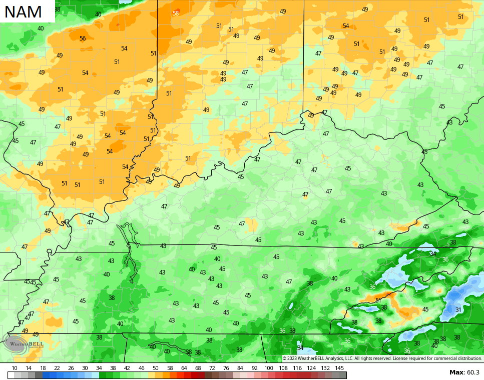
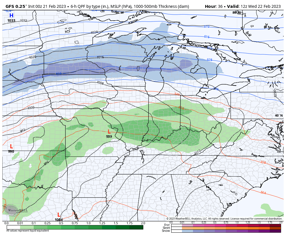
The warm temps will be accompanied by scattered showers and thunderstorms and very gusty winds. Gusty winds? This winter? No way!!
Look at the peak gusts…
This is what we get with this super-active setup with three systems likely to work through here from Wednesday/Thursday into early next week…
So, does all this mean we’ve lost all hope for some late season winter weather? Even though I am fully on board with #TeamSpring, I’m thinking March can provide us with a storm threat or two. I will go more into that over the next few days.
Enjoy your Tuesday and take care.

Thanks Chris. The Sun says Winter, but La Nina and the Southeast Ridge says Spring. I think we are not through with bouts of Winter weather until after Easter.
The one good thing about a strong Southeast Ridge is that it tends to lessen severe weather in our area. The severe weather is almost always on the north and western edge of the Ridge. I notice this morning that a cool stripe of sea surface temperatures are continuing along the entire West Coast. La Nina is weak right now, and whether it phases to ENSO / neutral is still in question. ENSO / phases are difficult to predict along with the PDO and the AMDO.
The one bad thing about a strong Southeast Ridge is that it tends to mess up our seasons. Unseasonable mild Winters are not too kind to the plant life and the overall growing season in our area due to late season frost and freezes. We need Winter when it’s Winter and Spring when it’s Spring.
I agree. I’m deep into pruning and cutting back trees, shrubs, and perennials – tasks that usually don’t start for another week or two. Those frigid days in December had a dramatic effect on many plants, but as you say, a late hard freeze may be worse. Fingers crossed for a good spring. Loving being able to work in shirt sleeves. These are beautiful days, even the cloudy ones.
I have one Catawba Rhododendron that was badly damage ( not killed ) by that severe dry, below zero Arctic air that invaded the Ohio Valley back in late December last year. If we would have had a heavy Snow cover before the Arctic air arrived, there wouldn’t have been so much damage to the plant.
Wouldn’t that be nice Schroeder to have winter during winter and spring during spring??? Has that ever happened in Kentucky weather??? It seems like we are always changing back and forth. That will be a shock to the system to go from upper 70s to the 20s the next day on Friday.
Probably won’t happen in my lifetime Crystal. The Pacific Surface Sea Temperatures are very cool along the coast due to a very long lasting negative Pacific Decadal Oscillation. As long as it’s this way our Winters will be mild in the East and cold in the West. In the Atlantic, currently the Atlantic Multidecadal Oscillation is positive( very warm. ) I’m getting concerned about the Hurricane season this Summer as my Sister and Brother in Law live on Florida’s West coast.
I grew semi – evergreen Azalea for over 50 years and when they were damaged by a late season freeze I always waited until they finished their Spring leaf growth before pruning out the dead branches. This would allow for the Summer growth to come along and set their flower buds.
Corrections : It’s the AMO and not the AMDO stands for Atlantic Mutidecadal Oscillation. Also I meant Azaleas not just Azalea.
just more rain coming to wash all the heavy chemicals down the Ohio River from Palestine. Too bad we have a president overseas when our own people are suffering horribly on the OH/PA border.
Agree with you 100% Dash!
I strongly agree.
I’m betting at best a mix next month for most of KY. Then again, we did get a blizzard the week before spring in 93…