Good evening, folks. It’s a windy day as our temps get set to surge overnight into Wednesday. This boosts our temps toward record high levels for the next few days as a few showers and storms get into the mix.
Winds are super gusty over the next couple of days and may peak close to 50mph at times.
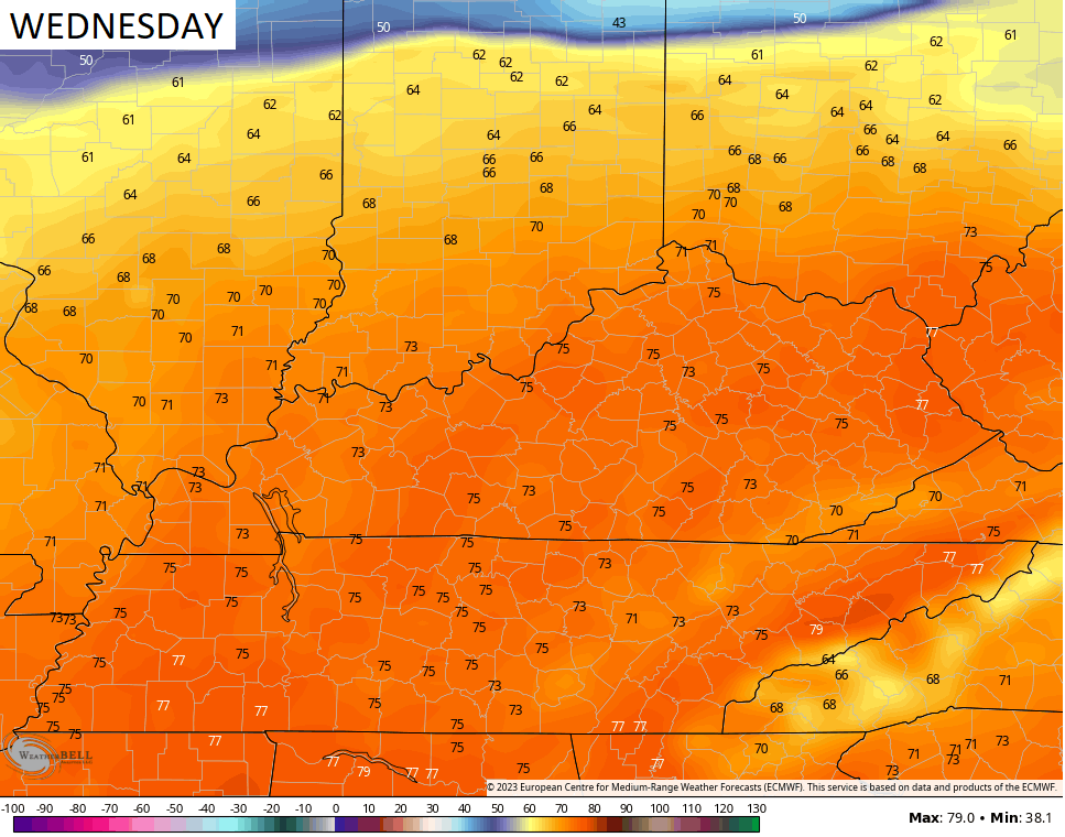
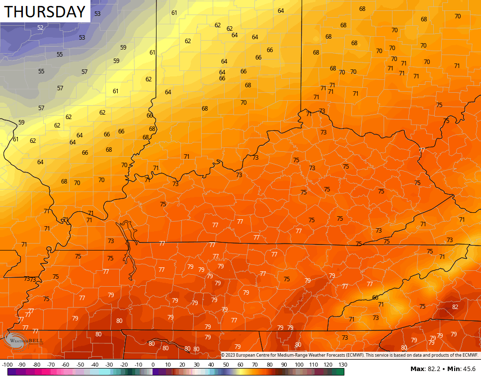
High temps reach the low and middle 70s for many, with some upper 70s possible in the south and west. Take a look at the numbers for the next few days…
A few thunderstorms will be possible from time to time, but nothing is a washout by any means.
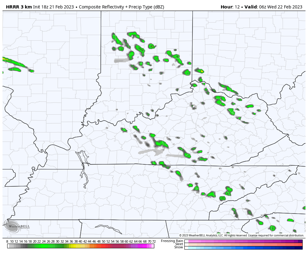
The Future Radar from the HRRR shows what I’m talking about. This animation goes from 1am Wednesday through 7am Thursday…
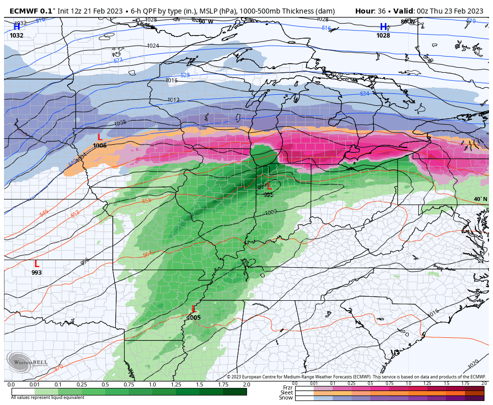
That’s quite the storm wrapping up and heading into the Great Lakes. This will bring a chillier brand of air in here for Friday and Saturday as another system brushes us with a few showers. That will be followed by another storm system early next week…
I will look farther down the weather road with my overnight update. Until then, let’s track a few showers and storms in from the southwest…

Enjoy the evening and take care.

Wouldn’t that be nice Schroeder to have winter during winter and spring during spring??? Has that ever happened in Kentucky weather??? It seems like we are always changing back and forth. That will be a shock to the system to go from upper 70s to the 20s the next day on Friday.
Yes, in the years 1976 to 1978. I explained on the previous comment section about a negative West Coast and a positive East Coast. Just learned this from NOAA’s Blog.