Good evening, folks. It’s a day straight out of April with record highs, high winds and strong storms. This springlike pattern looks to continue over the next week or so before we change it up as we head into March.
The line of strong to severe storms out of western Kentucky will likely weaken some as it moves eastward across the state this evening. I still can’t rule out some high winds from this, so we have to be mindful of that.
The Storm Prediction Center continues to highlight the west with the low-end risk for severe storms…

The weather for Thursday looks windy and warm once again. Record highs may fall one more time!
A cold front knocks the numbers way down for Friday with a shower or two in the far south. That same area has a chance for some showers on Saturday before the entire region gets in on a shower chance for Saturday night and Sunday.
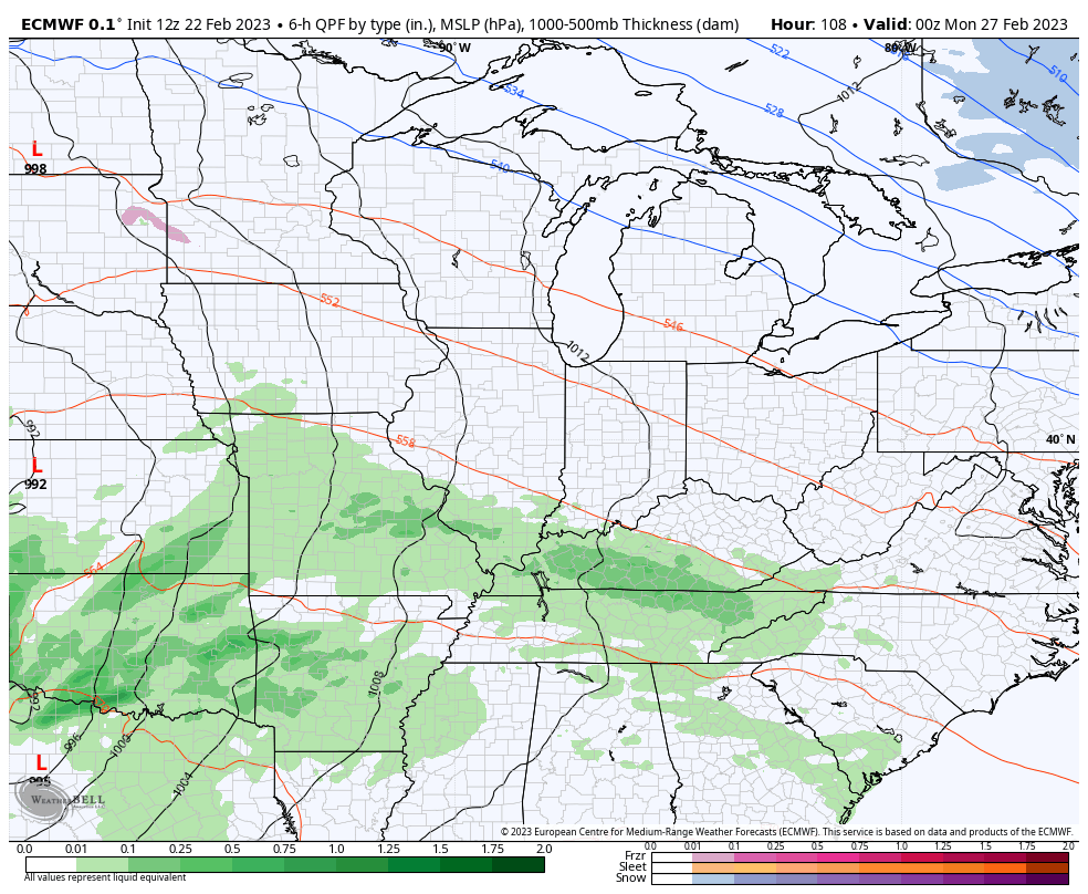
A much bigger storm system is likely to bring high winds and the threat for severe storms on Monday…
That’s got a look to it.
As we hit March, we will see the pattern starting to change. The medium range models are all focused on another big storm that has the chance to provide some winter weather as colder air gets involved…
Canadian
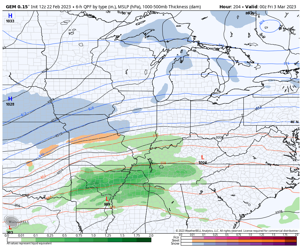
EURO
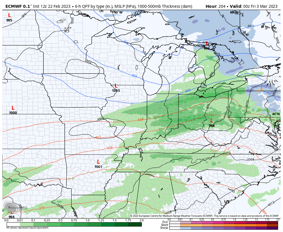
GFS
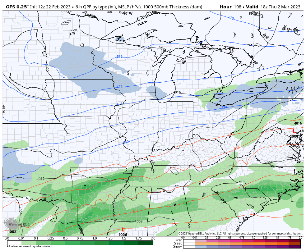
You guys know March will bring some winter weather… Right?
I will have updates later today and be on WKYT-TV for all your breaking severe weather needs. Until then, here are your Thursday storm tracking tools…

Current watches

Possible Watch Areas

Enjoy the rest of the day and take care.

I am sorry I cannot jump on the snow sled.
I like to see one decent snowfall before the spring weather becomes prevalent.
But I think we’re just snake bitten this season.
a really crappy pattern for winter lovers. Almost all the storms have taken the SAME track…. Western USA cold snowy = Eastern USA warm/rain
It’s because of a very persistent Southeast Ridge, but this weather will change sometime. Hopefully, before late March when we may enter the neutral phase of ENSO.