Good Thursday, folks. It’s another record warm day taking shape for much of the region as our spring fling in February rolls on. Temps do get closer to normal in the coming days before the focus shifts toward big storm systems again next week.
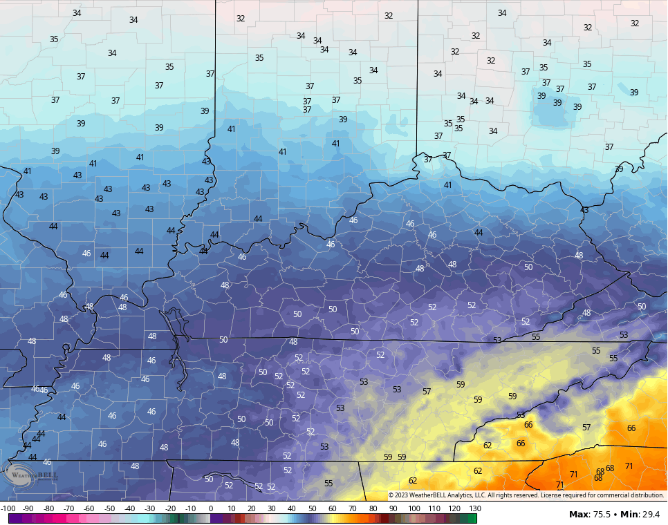
Temps today will be in the 70s for the entire region with the occasional 80 showing up in the east and southeast. Overall, you will be hard pressed to find warmer back to back February weather days on record in Kentucky. Crazy, folks!
A cold front drops in tonight and may bring a gusty shower along and ahead of it starting this evening…

Colder winds blow for Friday, but the air really can’t be called cold for this time of year.
Northern Kentucky sees temps near 40 while the south gets into the 50-55 degree range…
A shower or two will show up across southern Kentucky on Saturday with seasonable temps. A few more showers show up Saturday night and Sunday as temps slowly climb deep into the 50s.
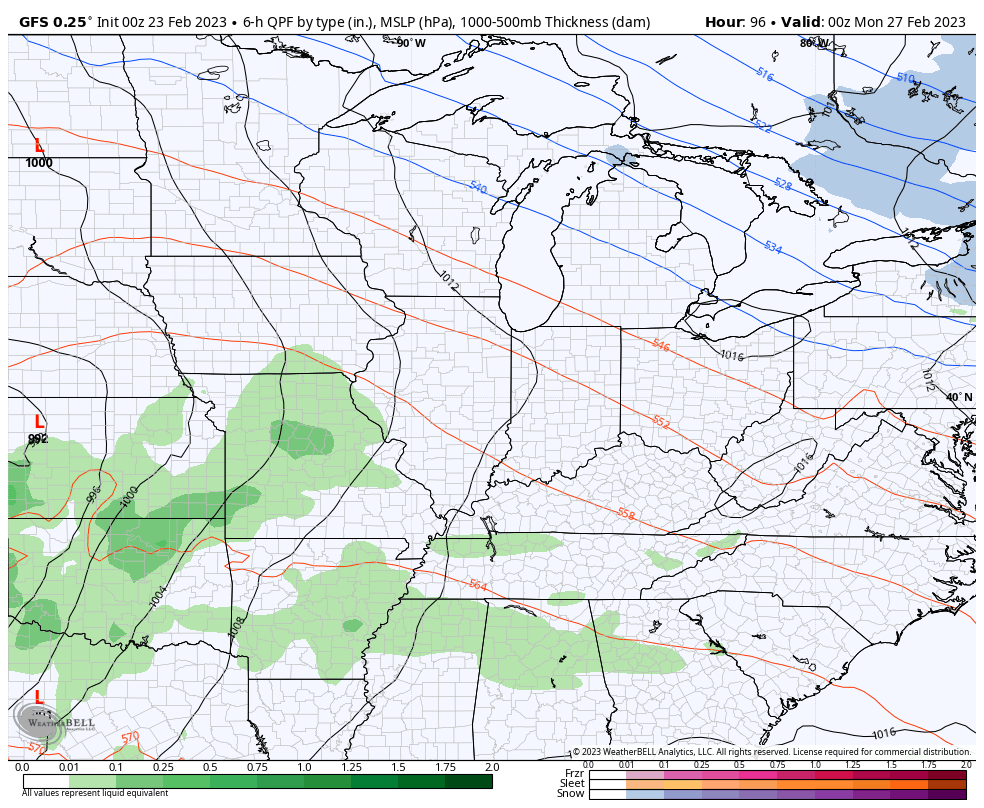
A potent storm system develops and works from the Mississippi Valley toward the Great Lakes on Monday. That looks to bring more high winds and the potential for strong to severe storms…
That’s a setup for us to keep a close eye on.
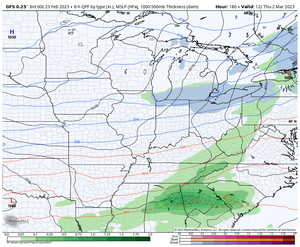
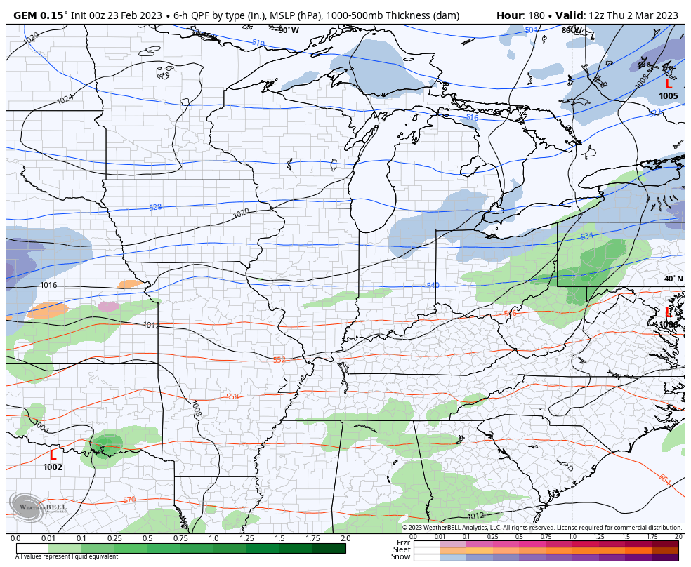
Temps stay fairly mild behind that with all signs pointing toward another big storm as we begin March later next week. This one will also need to be monitored for the potential for too much rain, strong storms, high winds and even some winter weather…
GFS
CANADIAN
I’ll have another update later today. Make it a great day and take care.

Set a new high temperature record for Bowling Green, when we hit 78°F at 1:30pm. We’ve picked up 1.20″ of rain since 6:00pm CST.
Despite the forecast for the AO, NAO and EPO to go negative in March/April, I believe that we’re unlikely to see more Winter precipitation in Warren County, aside from a few festive flurries, because of the strength of the southeastridge. The most likely outcome would be rounds of storms, some severe, but if a push of cold air is strong enough to undercut the established milder air, we’d end up with a scenario that no one wants, and that is ICE!
My thoughts exactly Joe. Glad you are continuing recovery Okay from the surgery. We had a loud thunderstorm early this morning that knocked me out of bed. We received a decent amount of rain, but I don’t know how much. Yesterday’s high temperature was 74 degrees and I expect the same today.
A record amount of rain fell for the date on Wednesday at Chicago’s O’Hare Airport with 1.20 inches of cold, heavy rain, breaking the old record of 0.95 inches set way back in 1919. 1.07 inches fell in the SW Suburbs at the NWS Forecast Office.
Meantime, the far Northern and NW Suburbs received anywhere from 0.25 inches to 0.5 inches of freezing rain/ice. With the temps several degrees above freezing this morning though, most of that has melted.
The Twin Cities in Minnesota did not receive anywhere near the amount of snow that was predicted, as only 3.8 inches fell Wednesday, bringing the two-day total to 6.9 inches. That’s a far cry from the 15-21 inches that was being predicted.
They are having a neat Winter in Minnesota and Wisconsin as one Snowstorm pops up after another. That’s the kind of Winter I wish we had here Kentucky. The only Winter that’s has come close was in South Central Indiana in 1969-70. Also in 1978 we had Snow cover from February through March.
I know one thing that those areas that are receiving lots of Snow this Winter will have a great growing season this Spring and Summer. I’m hoping we will too, but late Spring freezes are almost a sure bet here in Kentucky.
With this on going weather pattern in place makes me wonder if the Earth’s Climate has really changed. I heard from a Climatologist that the Poles have shifted and the new North Pole is Siberia.
The PDO and the AMO are not showing signs of any change. If the Climate was the way it use to be it would have made the change last year. Right now it’s a negative Pacific and a positive Atlantic and holding.
Snow is not an issue in Los Angeles County they’re expecting up to 7’ above 4000.’
The snow melt will be welcomed during the dry summer months.
I think the drought conditions in California and the Western States will be over in the coming years. Wonder what part of the Country is next. Has to be in the East.
With all the rain and lack of sustained cold air, seems the bugs, critters and foliage will be jungle like this summer.
Insects are always a problem here. Every Fall we are bombed with millions of Asian Beatles and they hibernate in my home. I spray the outside with an insecticide called DEMON W. P. with great control. During the Spring and early Summer we have Carpenter Bees. I have three traps out to control that pest. Mosquitoes in my area are not a problem. The above insects seem to be resistant to all our weather events.
Here’s an interesting article I found : https://www.climate.gov/news-features/event-tracker/disrupted-polar-vortex-brings-sudden-stratospheric-warming-february