Good evening, folks. A cold front is working through the region today and it’s bringing some seasonable air back into the region as we start the weekend. This is ahead of another active setup with, at least, two big storm systems coming next week.
This evening’s front is bringing a broken band of showers to the area and those will show up on your radars…

Temps on Friday range from 40-45 in the north to 50-55 in the south.
A few showers work in for the weekend, but this isn’t widespread or a washout by any means. Temps will be in the 40s and 50s for Saturday and closing in on 60 by Sunday.
That’s when a strong southwest wind kicks in for Monday ahead of a potent storm system. This system brings high winds and the potential for strong to severe storms as it sweeps into the region…
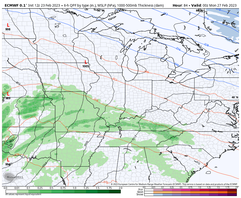
The wind gust forecast with this system is something to behold…
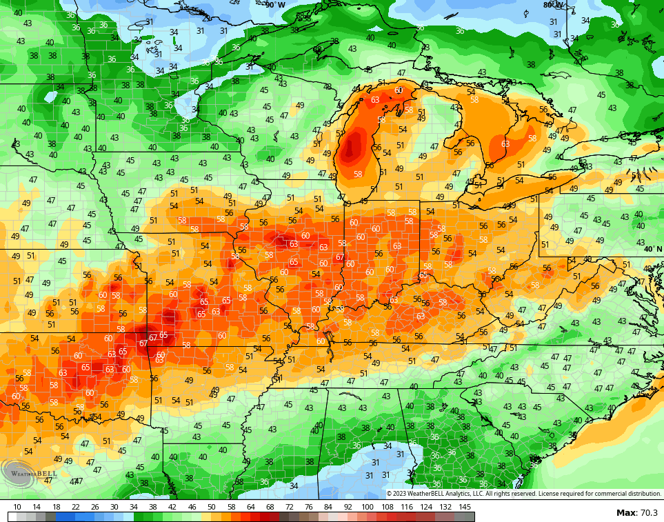
Shocker!
Mild temps continue behind that as we close the door on February and blow our way into March. There’s another big storm system likely showing up late next week into the following weekend and it can bring a bit of everything.
Much depends on the track of this storm and the models, as expected, have a lot of variances with that track.
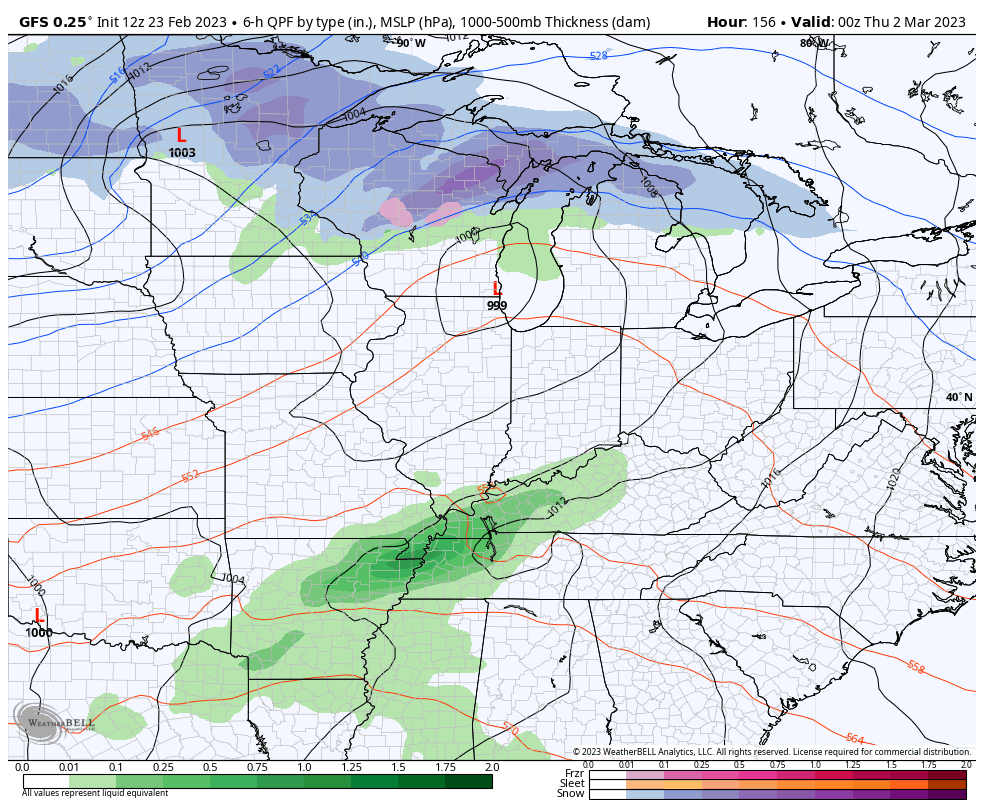
The latest GFS actually has two storms. The first brings heavy rain and storms, and the second brings snow…
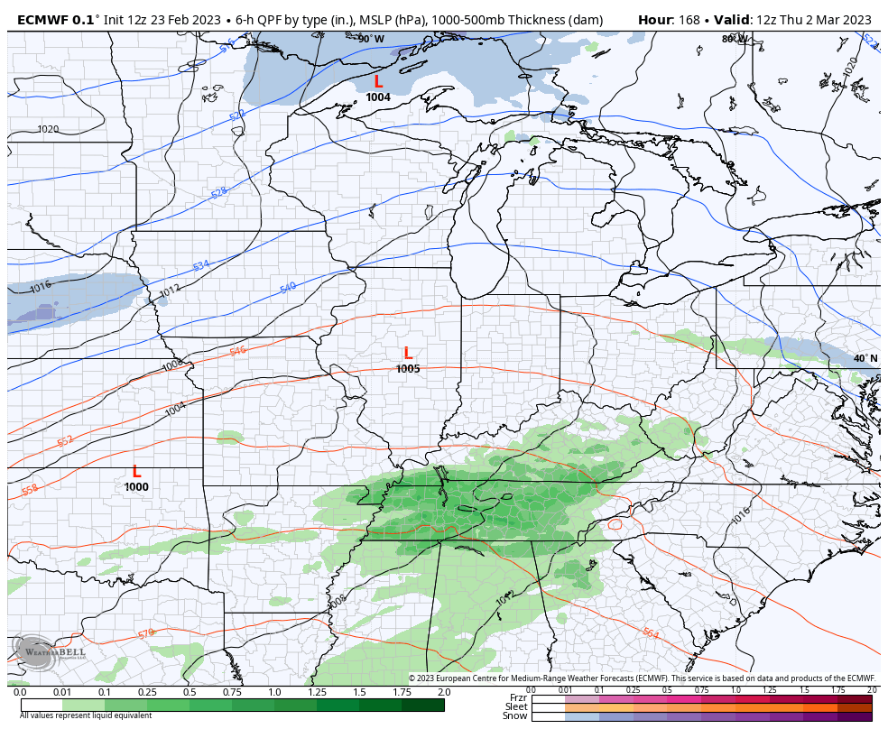
The EURO only has one storm and it’s a doozy with high wind, strong storms and heavy rain…
Enjoy the rest of the day and take care.

Here is a link for the summary of the heavy rain and freezing rain event that occurred over Northern IL on Wednesday, along with some pretty amazing photos of ice-covered trees. At the height of the storm, there were 111,000 people without power in far Northern IL, which received the brunt of the ice storm.
https://weather.gov/lot/2023feb2223