Good afternoon, everyone. It’s full steam ahead toward a big wind maker for Monday. This will bring some strong to severe storms into the mix to kick off another super-duper busy week of weather as we close February and begin March.
Let’s start with the severe threat. The Storm Prediction Center has pushed the greatest threat a little farther north and west of the area…

With or without severe storms, high winds are likely for the entire region. Gusts between 50mph and 60mph are a good bet…
Tuesday and Wednesday are very nice days with 70 degree temps for day one of March.
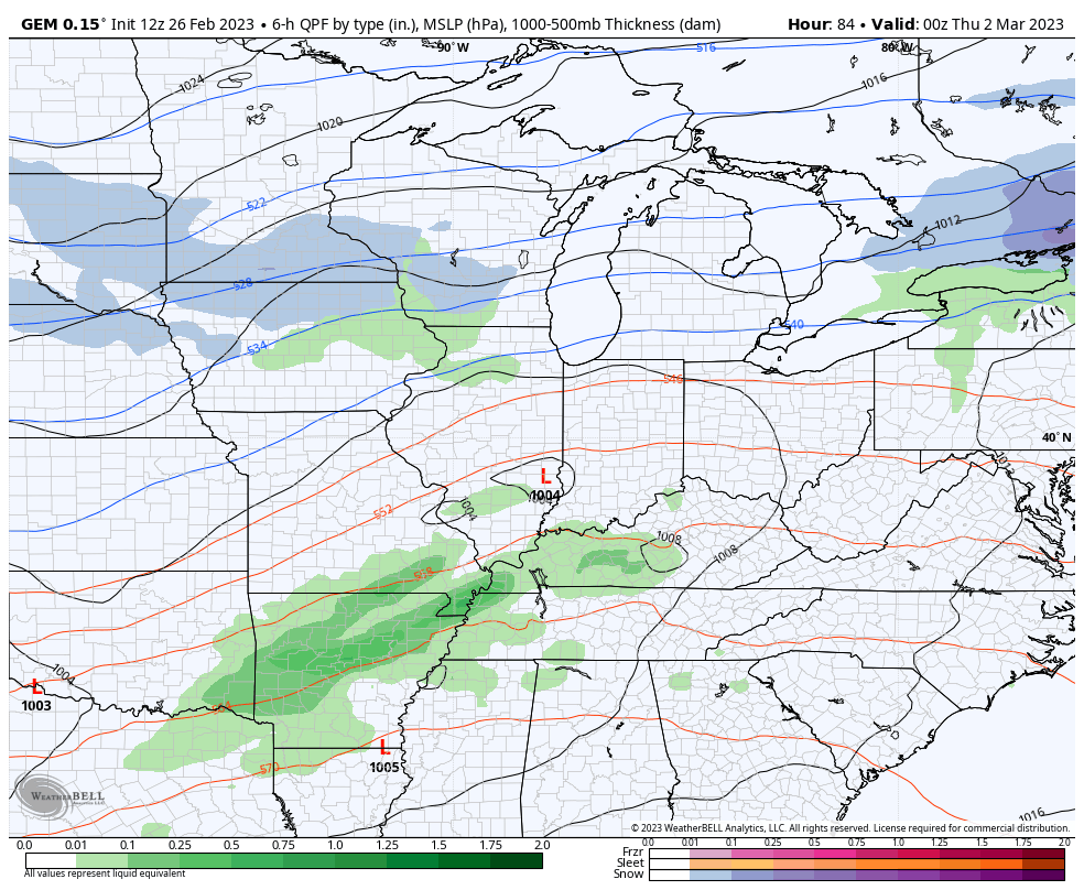
One low pressure works our way with an increase in rain and a few storms for Thursday. This paves the way for a much stronger storm to roll in behind it from the southwest on Friday.Depending on the track and intensity of this storm, it can bring anything from heavy rain, severe storms and high winds to snow.
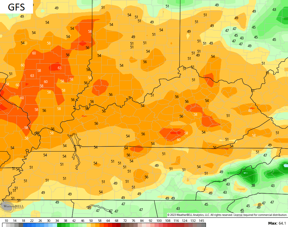
The GFS continues to be the strongest of the models, tracking this storm right on top of us…

The EURO has a similar look…

The Canadian has a flatter and farther south solution…
That’s a pretty ugly look for our region. The winter trend certainly supports the threat for severe storms, flooding rains and high winds. We will see if this changes in the coming days.
Make it a great rest of your Sunday and take care.

Thanks Chris. For once, what we have left of this Winter, I wish the center of the low pressure would track farther south so Kentucky would be in the cold and Snow section rather than the warm sector with high winds and severe weather. Since the Polar shift took place, every storm system this Winter has been to our North and West.
I know Schroeder it’s very frustrating. I read this might be a big one for some people as far as snow is concerned on eastern seaboard. It feels so close but so far away lol I guess we will end up with heavy rain but it will be interesting to watch maybe a little snow on the backside but I want to go big or go home lol⛄️
I don’t think I can take another winter with the thoughts of La Niña in it. That sounds like a good name for a country song lol♀️ Get out La Niña and take that southeast ridge with you
I have no ideal why that symbol is there meant to put lol.
Tornadoes and high winds already in Texas and Oklahoma, power outages being reported.